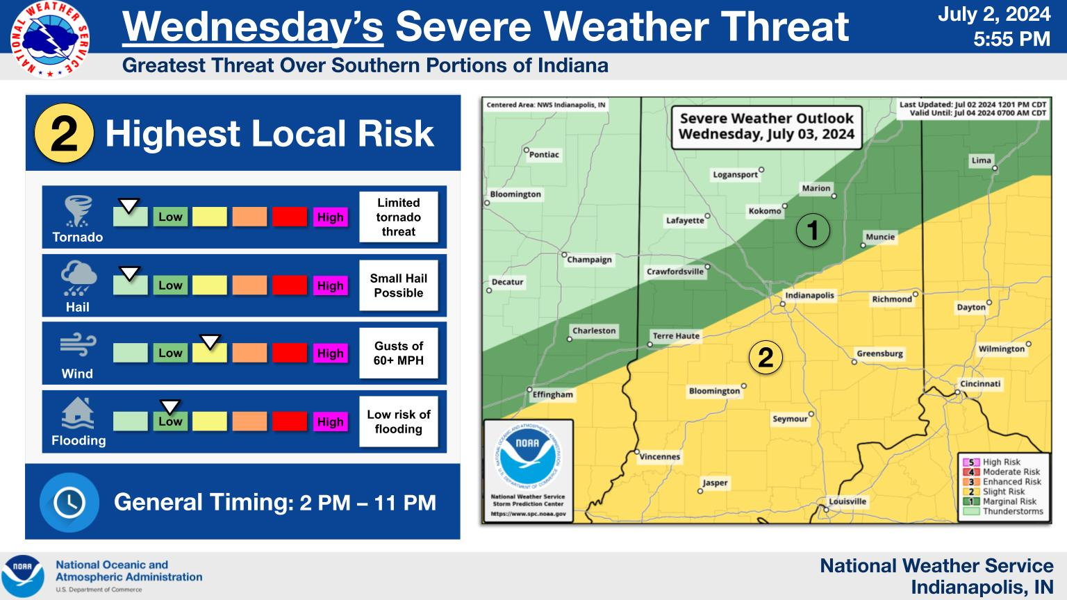
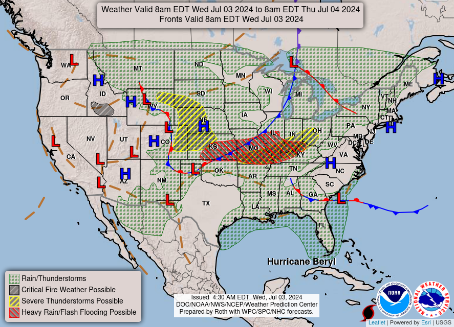
Thunderstorms will develop during the early to mid afternoon Wednesday across central Indiana, continuing into the evening as they move southeast.
Severe weather is possible with damaging winds, dangerous lightning and torrential rainfall as the primary threats.
INDIANAPOLIS 4TH OF JULY FORECAST
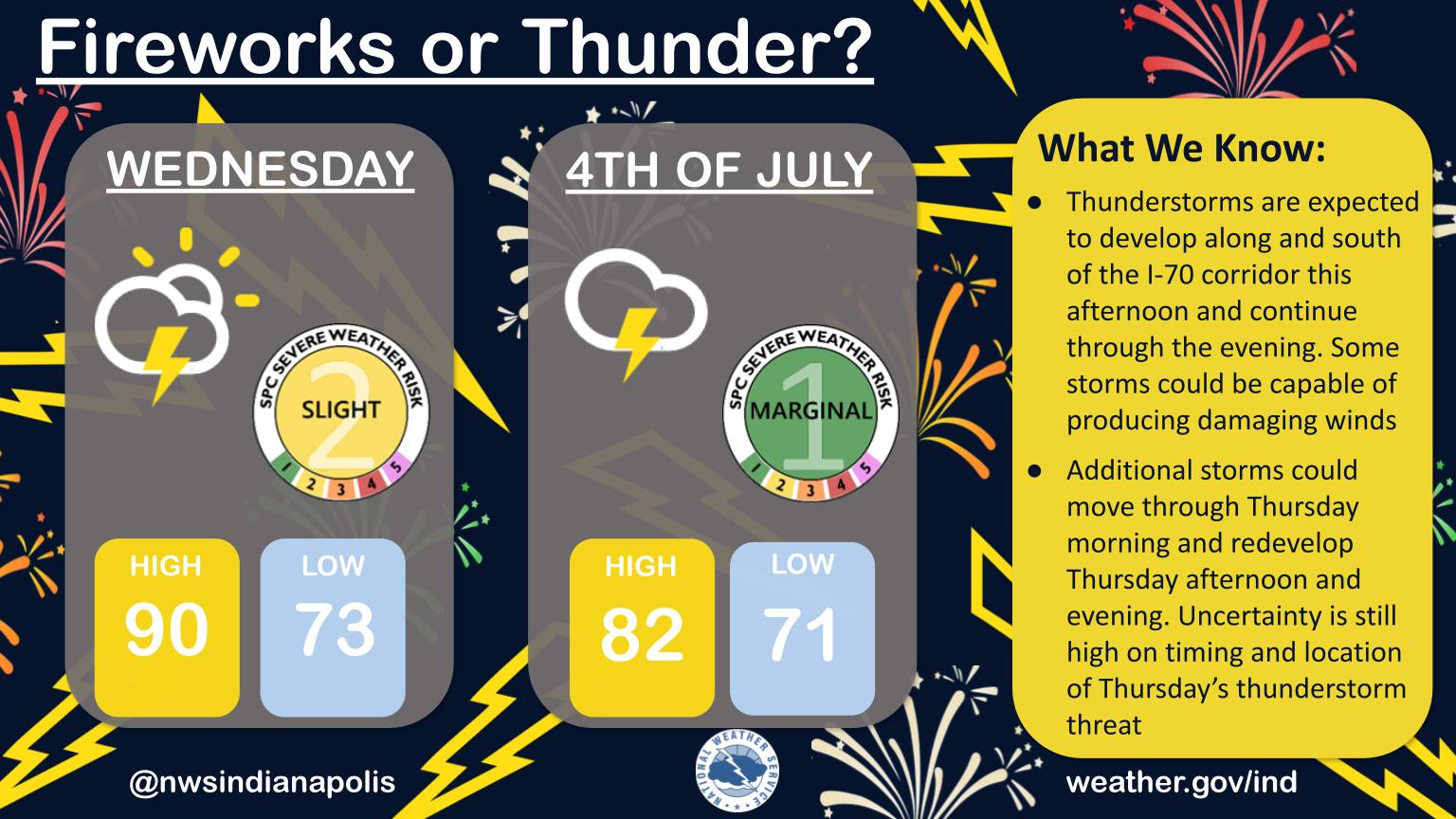
Thunderstorms are expected to develop along and south of the I-70 corridor this afternoon and continue through the evening.
Some storms could be capable of producing damaging winds.
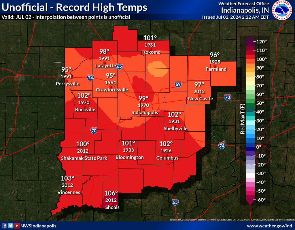
INDIANAPOLIS HISTORICAL WEATHER
INDIANAPOLIS 7-DAY EXTENDED FORECAST
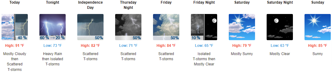
Today: Scattered showers and thunderstorms, mainly after 2pm. Mostly cloudy and hot, with a high near 91. Heat index values as high as 100. Southwest wind around 11 mph, with gusts as high as 21 mph. Chance of precipitation is 40%.
Tonight: Showers and thunderstorms likely, mainly before 8pm. Some of the storms could produce heavy rainfall. Mostly cloudy, with a low around 73. West southwest wind around 6 mph becoming light and variable after midnight. Chance of precipitation is 60%. New rainfall amounts between a quarter and half of an inch possible.
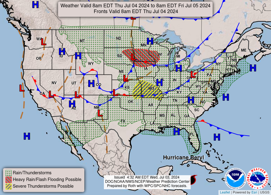
Independence Day: Scattered showers and thunderstorms. Mostly cloudy, with a high near 82. Calm wind becoming east around 6 mph in the afternoon. Chance of precipitation is 50%. New rainfall amounts between a quarter and half of an inch possible.
Thursday Night: Scattered showers and thunderstorms. Mostly cloudy, with a low around 71. East wind around 5 mph becoming calm in the evening. Chance of precipitation is 50%. New rainfall amounts between a tenth and quarter of an inch, except higher amounts possible in thunderstorms.
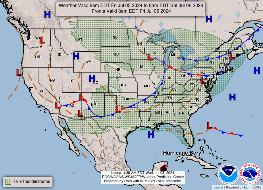
Friday: Scattered showers and thunderstorms, mainly before 2pm. Partly sunny, with a high near 84. South southwest wind 6 to 10 mph, with gusts as high as 20 mph. Chance of precipitation is 50%. New rainfall amounts between a tenth and quarter of an inch, except higher amounts possible in thunderstorms.
Friday Night: Isolated showers and thunderstorms before 8pm. Partly cloudy, with a low around 65. West wind 6 to 9 mph. Chance of precipitation is 10%.
Saturday: Mostly sunny, with a high near 79. West wind 6 to 9 mph.
Saturday Night: Mostly clear, with a low around 63. West northwest wind around 6 mph becoming calm in the evening.
Sunday: Sunny, with a high near 85. Calm wind becoming south southwest around 6 mph in the afternoon.
Sunday Night: Isolated showers after 2am. Partly cloudy, with a low around 66. South wind around 6 mph becoming calm in the evening. Chance of precipitation is 20%.
Monday: Scattered showers and thunderstorms. Mostly sunny, with a high near 84. Chance of precipitation is 40%.
Monday Night: Scattered showers and thunderstorms. Mostly cloudy, with a low around 68. Chance of precipitation is 30%.
Tuesday: Scattered showers and thunderstorms. Mostly sunny, with a high near 84. Chance of precipitation is 30%.
THE UNITED STATES OF AMERICA 3-DAY OUTLOOK
SOURCE: NWS Indianapolis.
Follow NWS Indianapolis on Twitter @NWSIndianapolis for the latest Indianapolis area weather news.