
Partly to mostly cloudy skies and isolated storms will provide a slight relief from the heat today; however temps will still reach the mid 80s to near 90 with very high humidity.
Temperatures will climb toward the mid to upper 90s by the end of the week!
NEXT 12 HOURS

NEXT 12-24 HOURS
INDIANAPOLIS DAILY CLIMATE DATA
INDIANAPOLIS 7-DAY EXTENDED FORECAST

Today: A 30 percent chance of showers and thunderstorms, mainly after 4pm. Mostly cloudy, with a high near 90. South southwest wind 7 to 13 mph, with gusts as high as 20 mph.
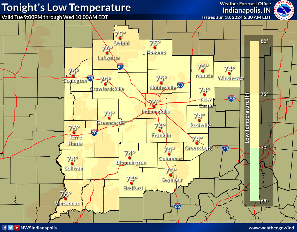
Tonight: A 30 percent chance of showers and thunderstorms, mainly before 7pm. Mostly cloudy, with a low around 76. South southwest wind 5 to 7 mph becoming calm after midnight.
Juneteenth: Isolated showers and thunderstorms after 2pm. Partly sunny and hot, with a high near 92. Calm wind becoming south southwest around 6 mph in the afternoon. Chance of precipitation is 20%.
Wednesday Night: Isolated showers and thunderstorms before 2am. Partly cloudy, with a low around 74. South wind around 5 mph becoming calm in the evening. Chance of precipitation is 20%.
Thursday: Mostly sunny and hot, with a high near 95. Light southwest wind.
Thursday Night: Partly cloudy, with a low around 74. Calm wind.
Friday: Sunny and hot, with a high near 97. Light and variable wind.
Friday Night: Mostly clear, with a low around 74. Light south southwest wind.
Saturday: Mostly sunny and hot, with a high near 96. Calm wind becoming southwest 5 to 8 mph in the afternoon.
Saturday Night: A 20 percent chance of showers and thunderstorms after 2am. Partly cloudy, with a low around 76. South southwest wind around 7 mph.
Sunday: A 40 percent chance of showers and thunderstorms. Partly sunny, with a high near 90.
Sunday Night: A 30 percent chance of showers and thunderstorms. Partly cloudy, with a low around 69.
Monday: Sunny, with a high near 87.
THE UNITED STATES OF AMERICA 3-DAY OUTLOOK


SOURCE: NWS Indianapolis.
Follow NWS Indianapolis on Twitter @NWSIndianapolis for the latest Indianapolis area weather news.