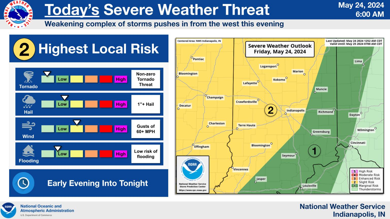
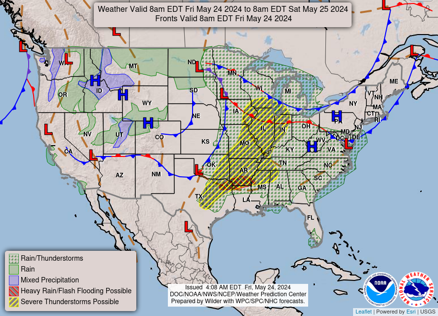
Much of central Indiana will have marginal to slight risk for severe weather this evening.
Primary threats to prepare for will be damaging wind and hail.
Some localized flooding may be possible as well.
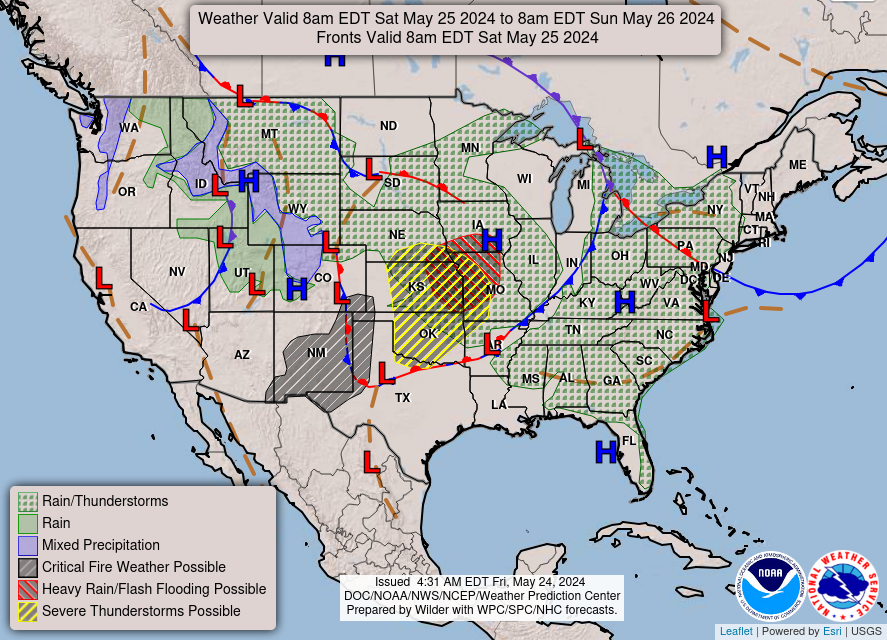
INDY 500 RACE DAY SEVERE WEATHER
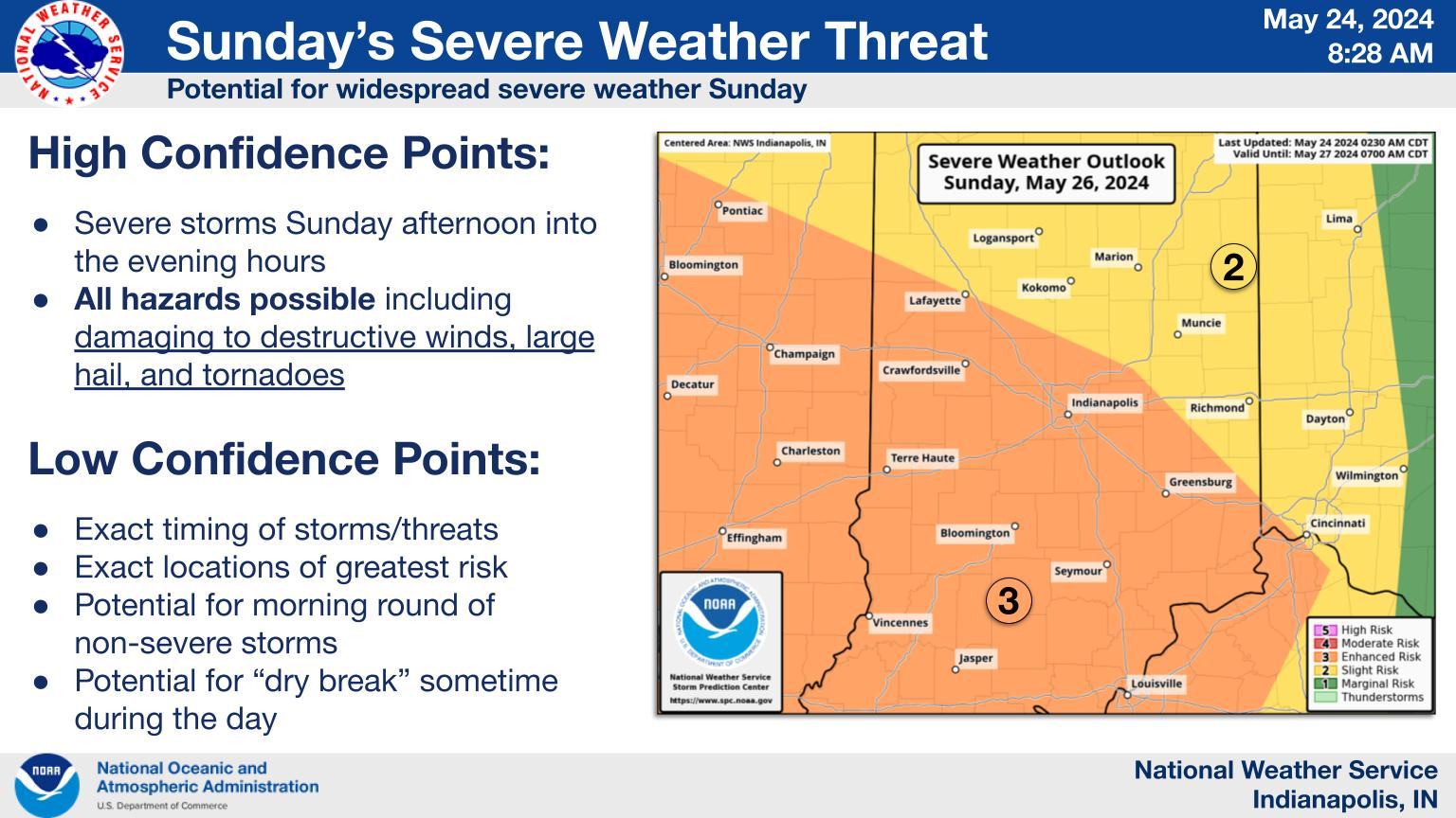
There is an enhanced risk of severe weather on Sunday. While the exact timing is still uncertain, the afternoon through evening hours appears to have the higher threat.
All hazards including damaging winds, large hail, and tornadoes are possible.
Please monitor the latest forecast through the weekend to stay updated on the threat as details become more clear.
NEXT 12-24 HOURS
INDIANAPOLIS DAILY CLIMATE DATA
INDIANAPOLIS 7-DAY EXTENDED FORECAST
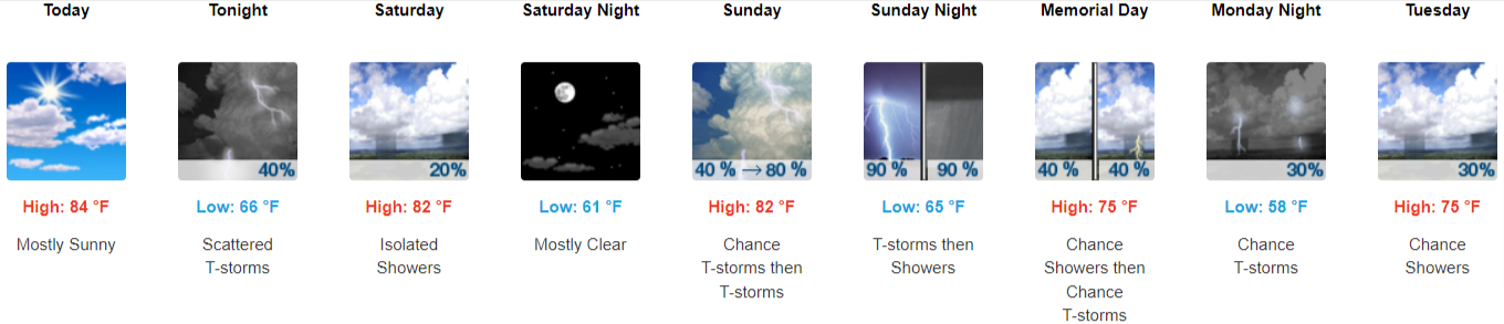
Today: Mostly sunny, with a high near 84. South southeast wind 5 to 9 mph.
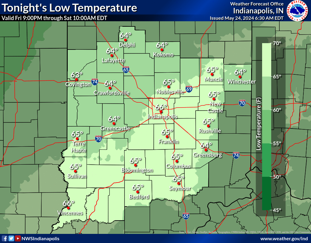
Tonight: Scattered showers and thunderstorms, mainly after 8 pm. Mostly cloudy, with a low of around 66. South wind 7 to 9 mph. The chance of precipitation is 40%.
Saturday: Isolated showers before 2 pm. Mostly cloudy, then gradually becoming sunny, with a high near 82. Southwest wind around 7 mph becoming northwest in the afternoon. The chance of precipitation is 20%.
Saturday Night: Mostly clear, with a low around 61. North wind around 5 mph becoming light and variable in the evening.
Sunday: A chance of showers before 11 am, then a chance of showers and thunderstorms between 11 am and 2 pm, then showers and possibly a thunderstorm after 2 pm. High near 82. South wind 6 to 13 mph, with gusts as high as 22 mph. The chance of precipitation is 80%. New rainfall amounts between a half and three-quarters of an inch possible.
Sunday Night: Showers and possibly a thunderstorm before 2 am, then a chance of showers and thunderstorms after 2 am. Low around 65. Southwest wind around 10 mph, with gusts as high as 21 mph. The chance of precipitation is 90%. New rainfall amounts between a half and three-quarters of an inch possible.
Memorial Day: A 40 percent chance of showers and thunderstorms. Mostly sunny, with a high near 75. West wind 10 to 14 mph, with gusts as high as 24 mph.
Monday Night: A 30 percent chance of showers and thunderstorms, mainly before 8 pm. Mostly clear, with a low around 58. West wind 6 to 10 mph, with gusts as high as 20 mph.
Tuesday: A slight chance of showers between 8 am and 2 pm, then a chance of showers and thunderstorms after 2 pm. Sunny, with a high near 75. West wind 7 to 11 mph, with gusts as high as 21 mph. The chance of precipitation is 30%.
Tuesday Night: A 30 percent chance of showers and thunderstorms before 8 pm. Mostly clear, with a low around 54. Northwest wind 5 to 9 mph.
Wednesday: Sunny, with a high near 72.
Wednesday Night: Mostly clear, with a low of around 50.
Thursday: Sunny, with a high near 76.
THE UNITED STATES OF AMERICA 3-DAY OUTLOOK
SOURCE: NWS Indianapolis.
Follow NWS Indianapolis on Twitter @NWSIndianapolis for the latest Indianapolis area weather news.