
Scattered showers continue this morning, but rain will become widespread and heavier once again by late today continuing through early Friday.
Scattered thunderstorms will also be possible, with a few stronger storms on Thursday afternoon. 1-2″ of rain is expected with locally higher amounts by Friday.
Windy conditions will develop Thursday and Friday with gusts peaking at 40 mph.
NEXT 12 HOURS

NEXT 12-24 HOURS

INDIANAPOLIS DAILY CLIMATE DATA

INDIANAPOLIS 7-DAY EXTENDED FORECAST

Today: Isolated showers before 10am, then showers likely after noon. Cloudy, with a high near 65. East wind 6 to 8 mph. Chance of precipitation is 70%. New precipitation amounts between a tenth and quarter of an inch possible.
Tonight: Showers and possibly a thunderstorm. Steady temperature around 61. East wind 9 to 11 mph, with gusts as high as 18 mph. Chance of precipitation is 100%. New rainfall amounts between three quarters and one inch possible.
Thursday: Showers and possibly a thunderstorm. Temperature rising to near 62 by 11am, then falling to around 54 during the remainder of the day. Southeast wind 14 to 16 mph becoming west in the afternoon. Winds could gust as high as 25 mph. Chance of precipitation is 100%. New rainfall amounts between a quarter and half of an inch possible.
Thursday Night: Showers likely before 8pm, then showers likely and possibly a thunderstorm between 8pm and 2am, then a chance of showers after 2am. Mostly cloudy, with a low around 45. Breezy, with a west wind 16 to 21 mph, with gusts as high as 34 mph. Chance of precipitation is 60%. New rainfall amounts of less than a tenth of an inch, except higher amounts possible in thunderstorms.
Friday: A 40 percent chance of showers, mainly before 2pm. Mostly cloudy, with a high near 59. Breezy, with a west northwest wind 18 to 24 mph, with gusts as high as 37 mph.
Friday Night: Mostly clear, with a low around 43. Breezy, with a west wind 16 to 22 mph, with gusts as high as 32 mph.
Saturday: Sunny, with a high near 69. West southwest wind 10 to 14 mph, with gusts as high as 22 mph.
Saturday Night: Partly cloudy, with a low around 56. South southwest wind 14 to 16 mph, with gusts as high as 25 mph.
Sunday: A 20 percent chance of showers and thunderstorms after 2pm. Partly sunny, with a high near 76. Breezy, with a southwest wind 17 to 20 mph, with gusts as high as 30 mph.
Sunday Night: A 20 percent chance of showers and thunderstorms. Partly cloudy, with a low around 58. Southwest wind 11 to 16 mph, with gusts as high as 24 mph.
Monday: A 20 percent chance of showers and thunderstorms. Mostly sunny, with a high near 77.
Monday Night: A 50 percent chance of showers and thunderstorms. Mostly cloudy, with a low around 59.
Tuesday: A 40 percent chance of showers and thunderstorms. Mostly cloudy, with a high near 75. Breezy.
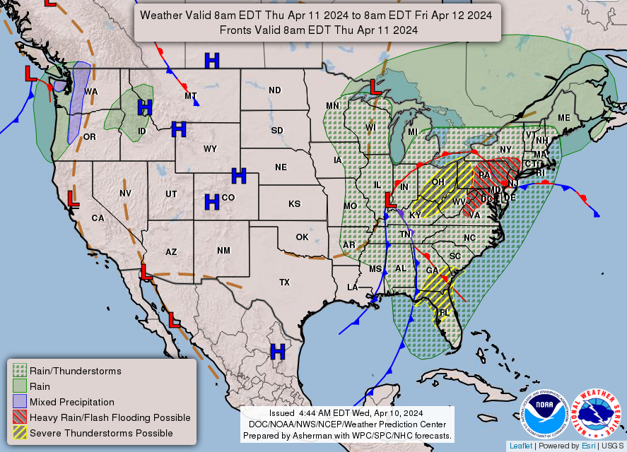
THE UNITED STATES OF AMERICA 3-DAY OUTLOOK


SOURCE: NWS Indianapolis.
Follow NWS Indianapolis on Twitter @NWSIndianapolis for the latest Indianapolis area weather news.