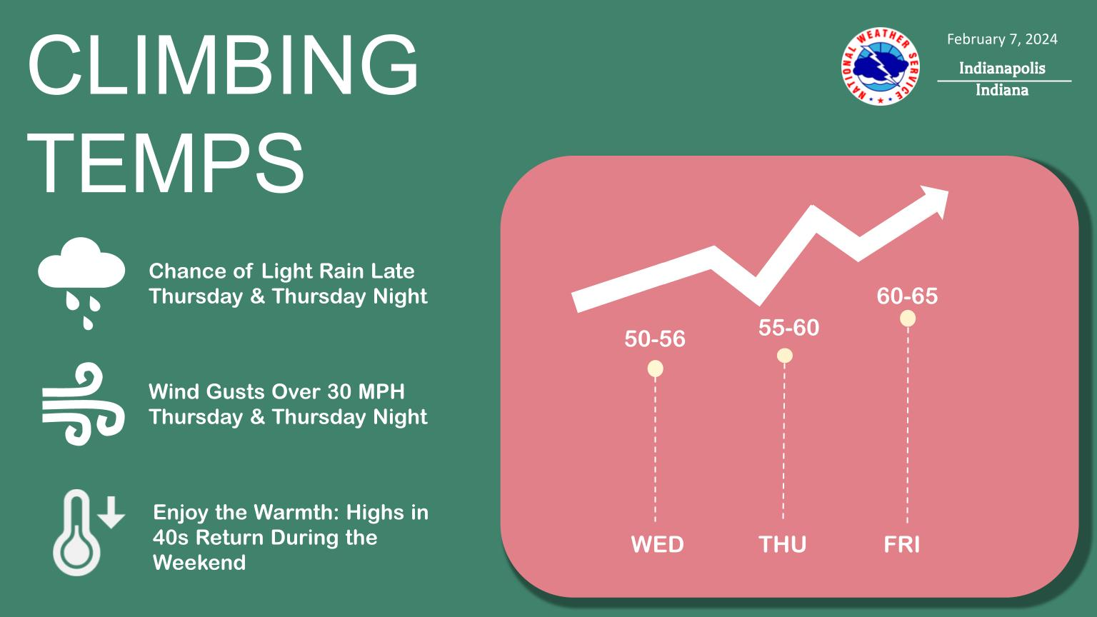
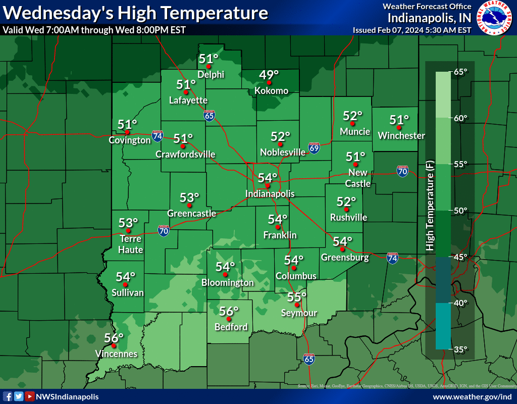
A warm up is in store to end the work week. Highs in the lower to middle 50s today will warm to the lower and middle 60s by Friday.
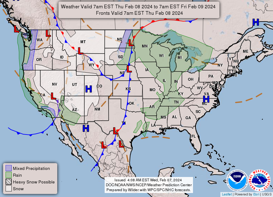
Thursday and Thursday night will see breezy conditions with wind gusts over 30 mph possible.
Chances for light rain return late Thursday and continue Thursday night.
NEXT 12 HOURS
NEXT 12-24 HOURS
INDIANAPOLIS DAILY CLIMATE DATA
INDIANAPOLIS 7-DAY EXTENDED FORECAST
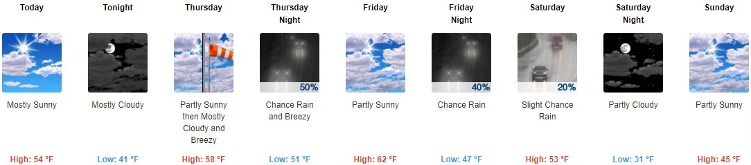
Today: Mostly sunny, with a high near 54. South southeast wind around 6 mph.
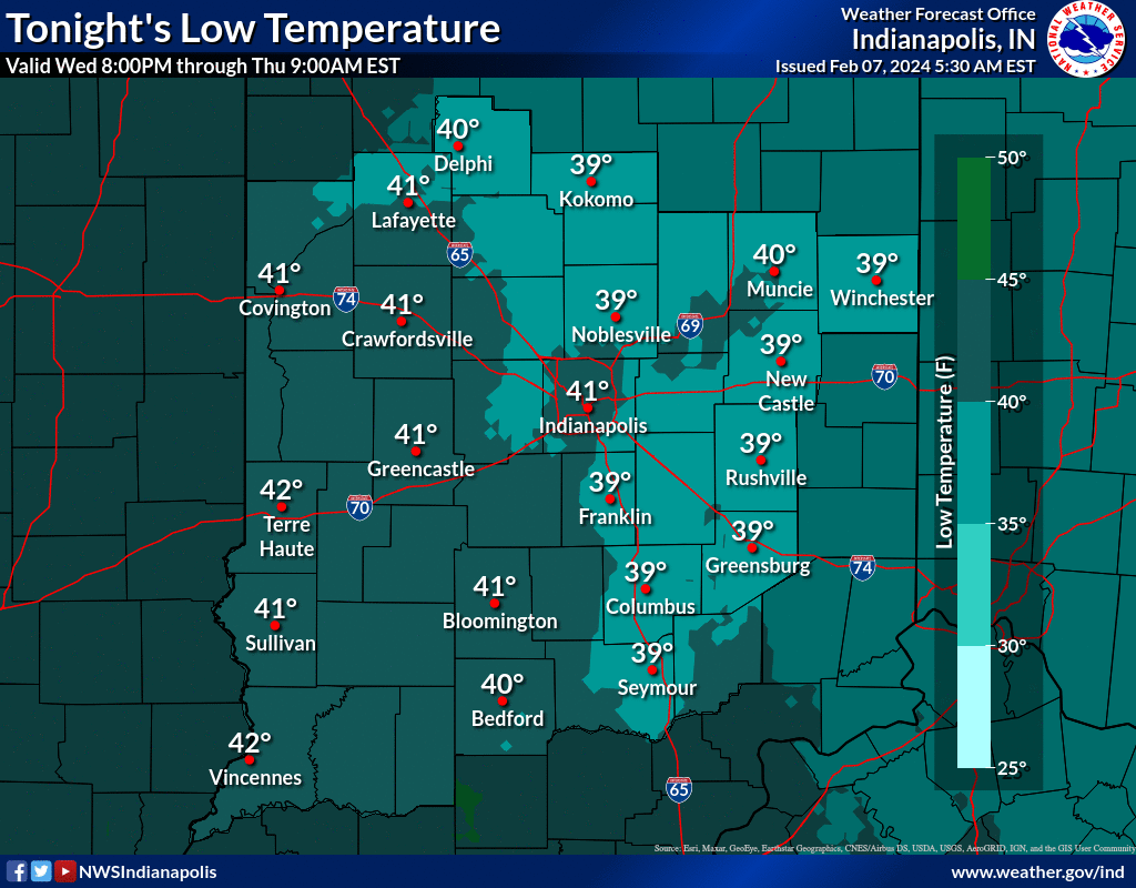
Tonight: Mostly cloudy, with a low around 41. South southeast wind 7 to 10 mph.
Thursday: Partly sunny, with a high near 58. Breezy, with a south wind 11 to 20 mph, with gusts as high as 30 mph.
Thursday Night: A 50 percent chance of rain, mainly before 1am. Mostly cloudy, with a low around 51. Breezy, with a south southwest wind 18 to 23 mph, with gusts as high as 32 mph. New precipitation amounts of less than a tenth of an inch possible.
Friday: Partly sunny, with a high near 62. South southwest wind around 17 mph, with gusts as high as 26 mph.
Friday Night: A 40 percent chance of rain. Mostly cloudy, with a low around 47. South southwest wind 14 to 18 mph, with gusts as high as 28 mph.
Saturday: A 20 percent chance of rain before 1pm. Partly sunny, with a high near 53. West northwest wind 10 to 13 mph, with gusts as high as 18 mph.
Saturday Night: Partly cloudy, with a low around 31. North northwest wind around 10 mph.
Sunday: Partly sunny, with a high near 45. North wind 7 to 9 mph.
Sunday Night: A slight chance of rain and snow after 1am. Partly cloudy, with a low around 30. North wind around 9 mph. Chance of precipitation is 20%.
Monday: A 20 percent chance of snow. Mostly sunny, with a high near 43.
Monday Night: A 20 percent chance of snow. Partly cloudy, with a low around 30.
Tuesday: Mostly sunny, with a high near 43.
THE UNITED STATES OF AMERICA 3-DAY OUTLOOK


SOURCE: NWS Indianapolis.
Follow NWS Indianapolis on Twitter @NWSIndianapolis for the latest Indianapolis area weather news.