
Patchy fog may return late tonight across north central Indiana and with the sub-freezing temperatures expected, slick spots on bridges and overpasses may occur.
Take it slow tomorrow morning whenever driving in foggier areas.
NEXT 12 HOURS
NEXT 12-24 HOURS

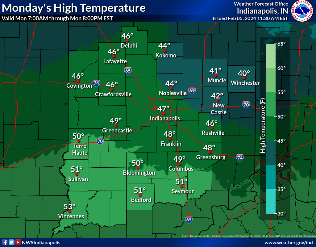
INDIANAPOLIS DAILY CLIMATE DATA
INDIANAPOLIS 7-DAY EXTENDED FORECAST
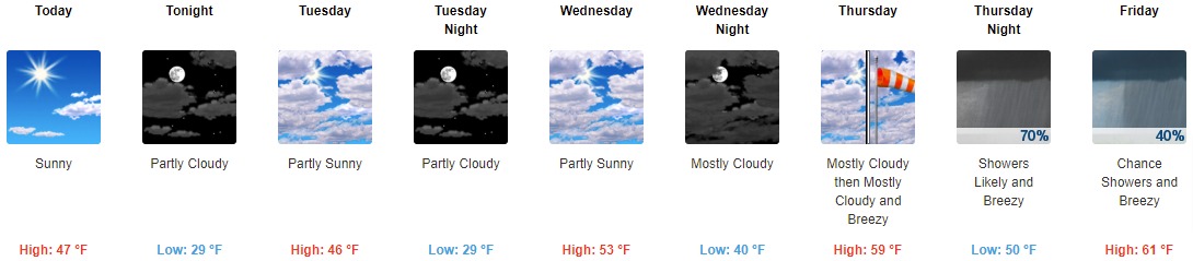
Today: Sunny, with a high near 47. North northeast wind 8 to 10 mph.
Tonight: Partly cloudy, with a low around 29. Northeast wind 7 to 9 mph.
Tuesday: Partly sunny, with a high near 46. Northeast wind around 7 mph.
Tuesday Night: Partly cloudy, with a low around 29. Northeast wind around 6 mph becoming east southeast after midnight.
Wednesday: Partly sunny, with a high near 53. South southeast wind around 7 mph.
Wednesday Night: Mostly cloudy, with a low around 40. South southeast wind 9 to 14 mph, with gusts as high as 21 mph.
Thursday: Mostly cloudy, with a high near 59. Breezy, with a south wind 14 to 22 mph, with gusts as high as 32 mph.
Thursday Night: Showers likely. Mostly cloudy, with a low around 50. Breezy, with a south wind around 22 mph, with gusts as high as 33 mph. Chance of precipitation is 70%.
Friday: A 40 percent chance of showers. Partly sunny, with a high near 61. Breezy, with a south southwest wind 18 to 21 mph, with gusts as high as 31 mph.
Friday Night: A 40 percent chance of showers. Partly cloudy, with a low around 41. West southwest wind 11 to 17 mph, with gusts as high as 26 mph.
Saturday: A 20 percent chance of showers. Mostly sunny, with a high near 54.
Saturday Night: A 20 percent chance of showers. Mostly cloudy, with a low around 37.
Sunday: A 30 percent chance of showers. Mostly cloudy, with a high near 49.
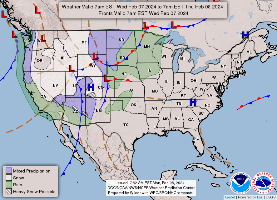
THE UNITED STATES OF AMERICA 3-DAY OUTLOOK

SOURCE: NWS Indianapolis.
Follow NWS Indianapolis on Twitter @NWSIndianapolis for the latest Indianapolis area weather news.