
Northwest winds gusting to near 40 mph combined with the cold temperatures will result in wind chill temperatures in the teens this afternoon.
NEXT 12 HOURS

NEXT 12-24 HOURS

INDIANAPOLIS DAILY CLIMATE DATA

INDIANAPOLIS 7-DAY EXTENDED FORECAST

Today: Cloudy early, then gradual clearing, with a temperature falling to around 32 by 11am. Breezy, with a west northwest wind 20 to 22 mph, with gusts as high as 38 mph.
Tonight: Clear, with a low around 23. West northwest wind 10 to 13 mph, with gusts as high as 22 mph.
Thursday: Sunny, with a high near 45. Northwest wind 6 to 8 mph becoming south southwest in the afternoon.
Thursday Night: Partly cloudy, with a low around 30. South wind 7 to 9 mph.
Friday: A slight chance of snow showers before 10am, then a slight chance of rain showers. Mostly cloudy, with a high near 48. South wind 8 to 10 mph. Chance of precipitation is 20%.
Friday Night: Mostly cloudy, with a low around 39. South wind 8 to 10 mph.
Saturday: Mostly sunny, with a high near 61. South wind 7 to 11 mph.
Saturday Night: Partly cloudy, with a low around 47. South southeast wind 10 to 13 mph, with gusts as high as 20 mph.
Sunday: Mostly sunny, with a high near 69. South wind 10 to 15 mph, with gusts as high as 23 mph.
Sunday Night: Partly cloudy, with a low around 55. South southeast wind around 15 mph, with gusts as high as 22 mph.
Monday: A 40 percent chance of showers. Partly sunny, with a high near 69.
Monday Night: A 50 percent chance of showers. Mostly cloudy, with a low around 44.
Tuesday: A 30 percent chance of showers. Partly sunny, with a high near 58.
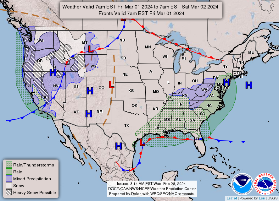
THE UNITED STATES OF AMERICA 3-DAY OUTLOOK


SOURCE: NWS Indianapolis.
Follow NWS Indianapolis on Twitter @NWSIndianapolis for the latest Indianapolis area weather news.