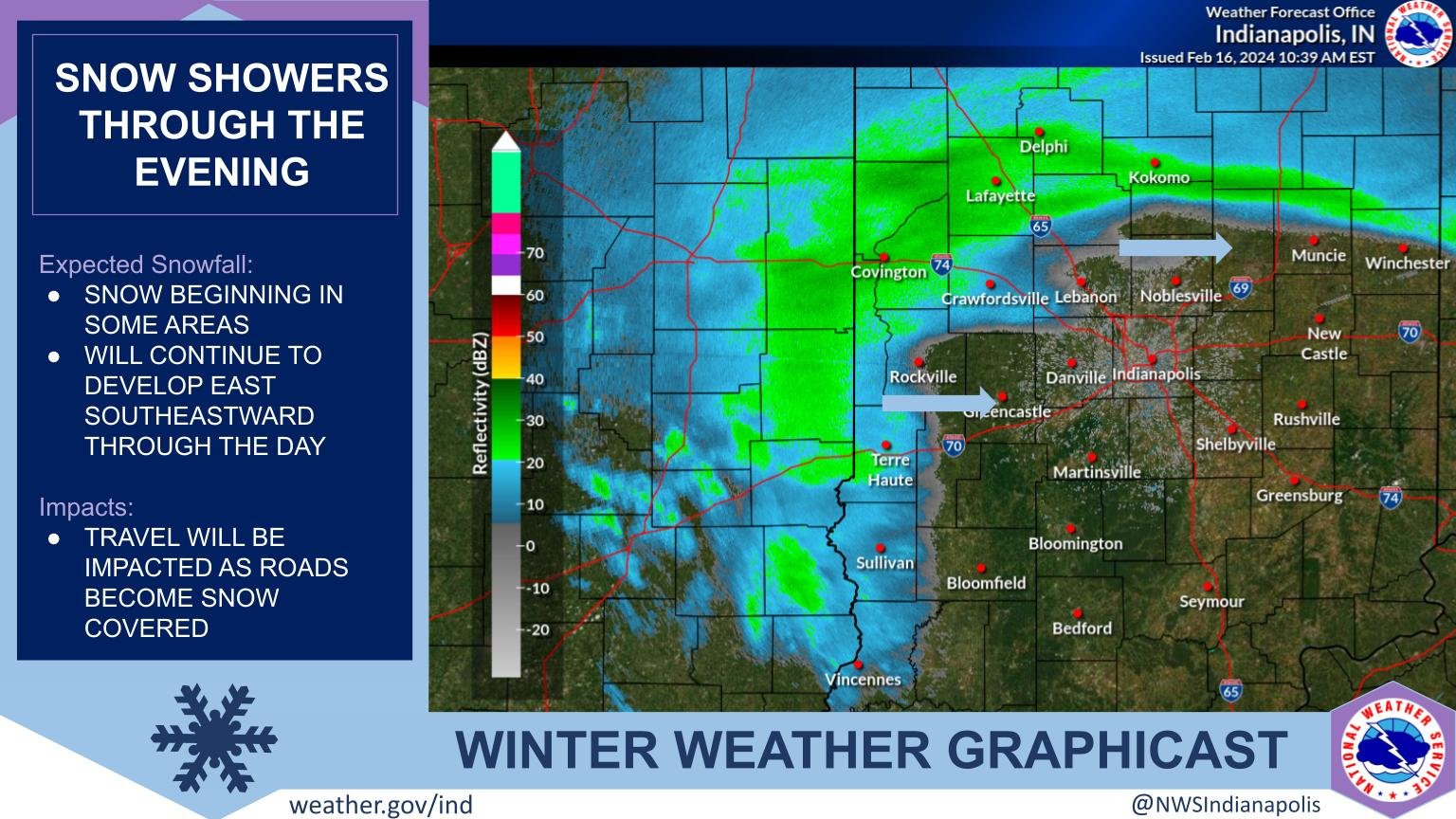
Snow is on the way! Snow arrives later this morning and continues into the afternoon.
The snow may be heavy at times, limiting visibility and leading to hazardous travel.
Additionally, very cold wind chills are possible by Saturday morning with values as low as 0 degrees.
WINTER WEATHER ADVISORY

…WINTER WEATHER ADVISORY IN EFFECT FROM 10 AM THIS MORNING TO 9 PM EST THIS EVENING…
WHAT…Snow expected. Total snow accumulations of 2 to 4 inches.
WHERE…Portions of central, east central, north central, south central, southeast, southwest and west central Indiana.
WHEN…From 10 AM this morning to 9 PM EST this evening.
IMPACTS…Plan on slippery road conditions. The hazardous conditions will impact the evening commute.
ADDITIONAL DETAILS…Isolated snow amounts to 5 inches are possible.
Snow will develop late this morning…becoming widespread from midday through the early evening. Accumulations of two to four inches are expected…with locally higher amounts from heavier snow bands that organize.
Including the counties of Carroll County, Warren County, Tippecanoe County, Clinton County, Howard County, Fountain County, Montgomery County, Boone County, Tipton County, Hamilton County, Madison County, Delaware County, Randolph County, Vermillion County, Parke County, Putnam County, Hendricks County, Marion County, Hancock County, Henry County, Vigo County, Clay County, Owen County, Morgan County, Johnson County, Shelby County, Rush County, Sullivan County, Greene County, Monroe County, Brown County, Bartholomew County, Decatur County, Knox County, Daviess County, Martin County, Lawrence County, Jackson County and Jennings County.
Including the cities of Delphi, Flora, Williamsport, West Lebanon, Lafayette, West Lafayette, Frankfort, Kokomo, Attica, Covington, Veedersburg, Crawfordsville, Lebanon, Zionsville, Tipton, Fishers, Carmel, Noblesville, Anderson, Muncie, Winchester, Union City, Farmland, Parker City, Clinton, Fairview Park, Rockville, Montezuma, Rosedale, Greencastle, Plainfield, Brownsburg, Danville, Indianapolis, Greenfield, New Castle, Terre Haute, Brazil, Spencer, Gosport, Martinsville, Mooresville, Greenwood, Franklin, Shelbyville, Rushville, Sullivan, Carlisle, Shelburn, Farmersburg, Linton, Bloomfield, Jasonville, Worthington, Bloomington, Nashville, Columbus, Greensburg, Vincennes, Washington, Loogootee, Shoals, Bedford, Mitchell, Seymour, and North Vernon.
NEXT 12-24 HOURS

INDIANAPOLIS DAILY CLIMATE DATA

INDIANAPOLIS 7-DAY EXTENDED FORECAST

Today: Snow, mainly after 11am. The snow could be heavy at times. High near 33. North northeast wind around 7 mph. Chance of precipitation is 100%. Total daytime snow accumulation of 2 to 4 inches possible.
Tonight: A 30 percent chance of snow before 7pm. Cloudy during the early evening, then gradual clearing, with a low around 16. Northwest wind 6 to 9 mph, with gusts as high as 18 mph.
Saturday: Sunny, with a high near 27. Northwest wind around 11 mph, with gusts as high as 18 mph.
Saturday Night: Clear, with a low around 21. West southwest wind 10 to 18 mph, with gusts as high as 28 mph.
Sunday: Sunny, with a high near 42. West southwest wind 15 to 17 mph, with gusts as high as 25 mph.
Sunday Night: Mostly clear, with a low around 23. West southwest wind 6 to 13 mph, with gusts as high as 20 mph.
Washington’s Birthday: Sunny, with a high near 49. South southwest wind 6 to 10 mph.
Monday Night: Partly cloudy, with a low around 31. South wind around 9 mph.
Tuesday: Mostly sunny, with a high near 52. South wind 9 to 11 mph.
Tuesday Night: Partly cloudy, with a low around 36. South wind around 9 mph.
Wednesday: Mostly sunny, with a high near 59.
Wednesday Night: A 40 percent chance of showers. Mostly cloudy, with a low around 44.
Thursday: A 40 percent chance of showers. Mostly cloudy, with a high near 56.
THE UNITED STATES OF AMERICA 3-DAY OUTLOOK


SOURCE: NWS Indianapolis.
Follow NWS Indianapolis on Twitter @NWSIndianapolis for the latest Indianapolis area weather news.