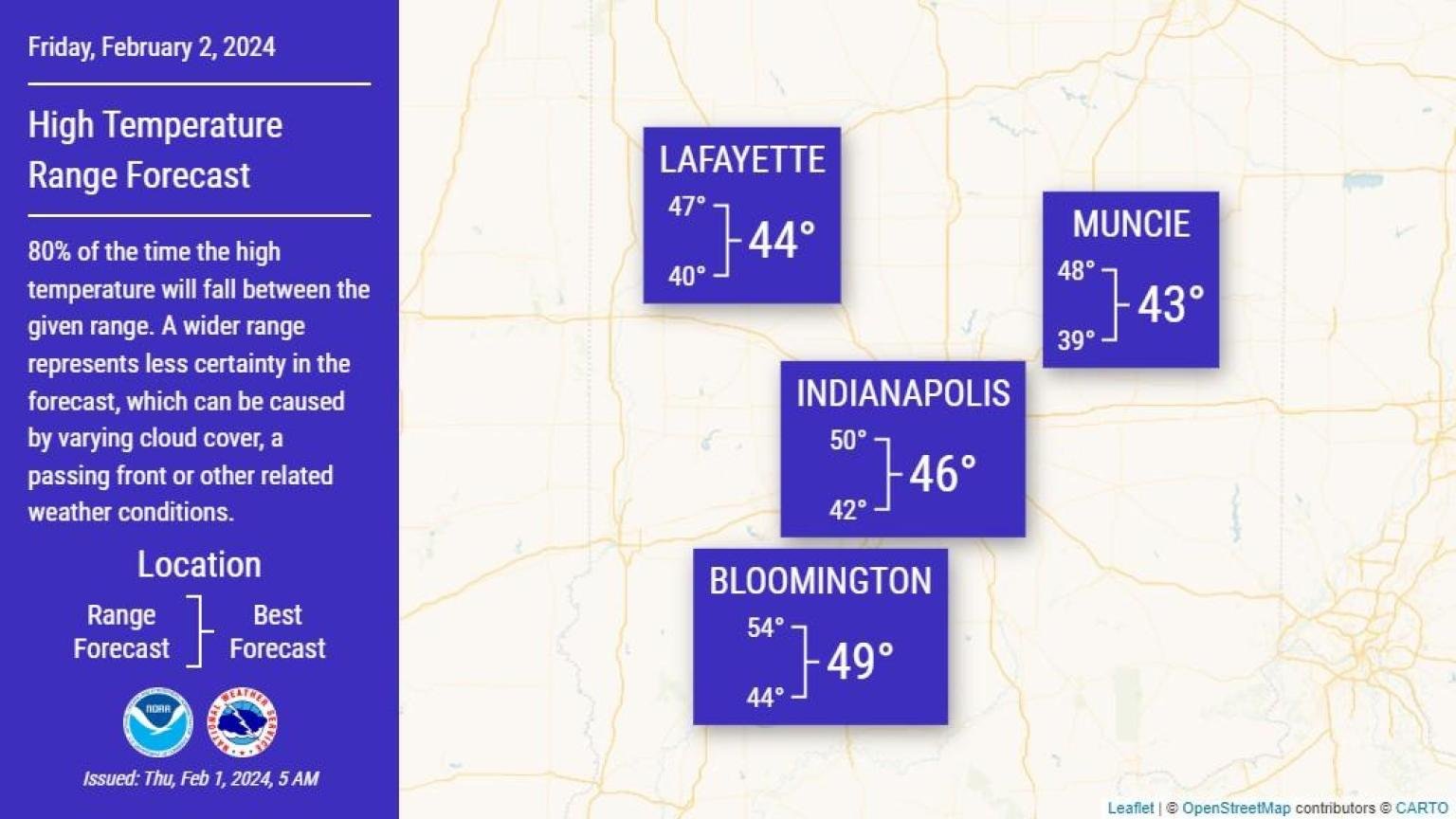
There is growing confidence that a cold front will shift across much of central Indiana early Friday, with a period of clouds into the afternoon before skies clear.
There remains some uncertainty in how this will impact temperatures but expect highs largely in the 40s.
If the cloud cover should hang longer, then temperatures will likely be cooler.
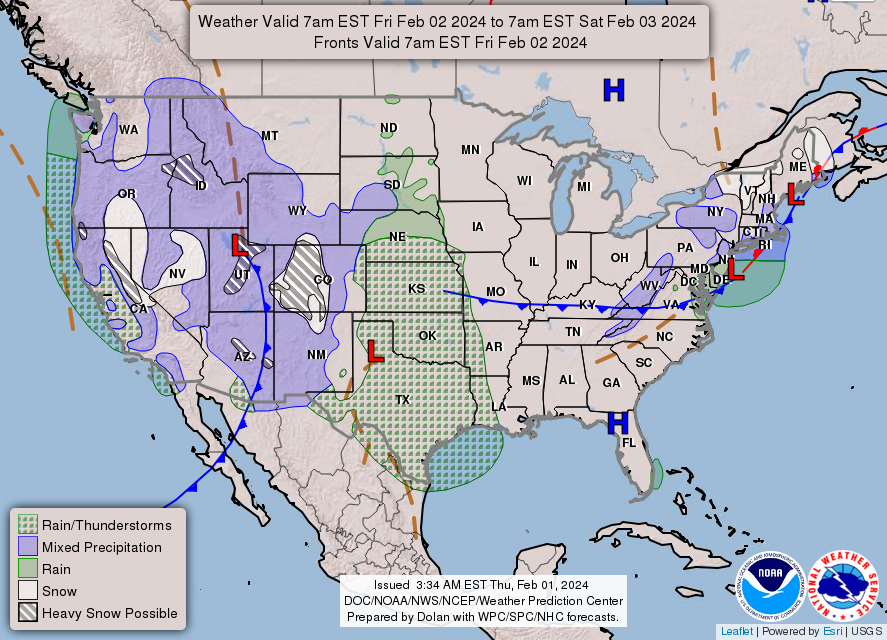
NEXT 12 HOURS

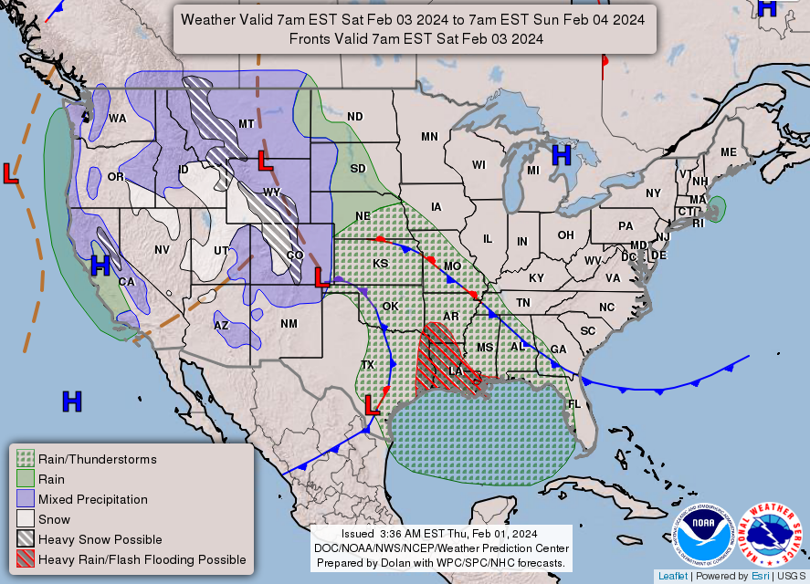
NEXT 12-24 HOURS

INDIANAPOLIS DAILY CLIMATE DATA
INDIANAPOLIS 7-DAY EXTENDED FORECAST
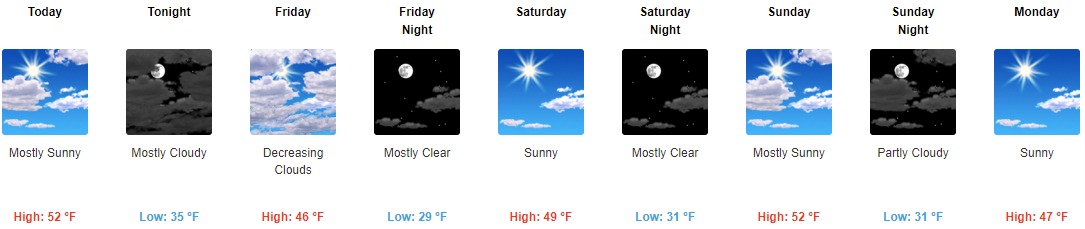
Tonight: Increasing clouds, with a low around 35. West wind 6 to 9 mph becoming north after midnight.
Friday: Mostly cloudy, with a high near 41. East northeast wind 8 to 10 mph.
Friday Night: Partly cloudy, with a low around 29. East wind 7 to 9 mph.
Saturday: Sunny, with a high near 48. East wind 7 to 9 mph.
Saturday Night: Clear, with a low around 30. East wind around 9 mph.
Sunday: Sunny, with a high near 51. East wind 8 to 11 mph.
Sunday Night: Partly cloudy, with a low around 30. Northeast wind 11 to 14 mph, with gusts as high as 23 mph.
Monday: Sunny, with a high near 48. Northeast wind 11 to 13 mph, with gusts as high as 18 mph.
Monday Night: Mostly clear, with a low around 28. Northeast wind 8 to 13 mph, with gusts as high as 20 mph.
Tuesday: Mostly sunny, with a high near 46. Northeast wind 7 to 9 mph.
Tuesday Night: Mostly clear, with a low around 28.
Wednesday: Mostly sunny, with a high near 50.
Wednesday Night: Mostly cloudy, with a low around 35.
Thursday: Partly sunny, with a high near 53.
THE UNITED STATES OF AMERICA 3-DAY OUTLOOK
SOURCE: NWS Indianapolis.
Follow NWS Indianapolis on Twitter @NWSIndianapolis for the latest Indianapolis area weather news.