
Precipitation is set to move in tonight which will start off as snow or a rain/snow mix for much of the forecast area.
A winter weather advisory is out for counties north of I-70 which could see 1 to 3 inches of snow tonight.
This may make Tuesday morning travel difficult.
SNOWFALL TONIGHT
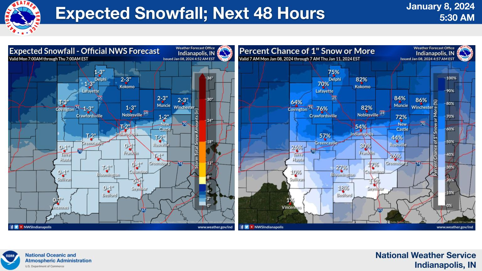
Snow is possible tonight and again Tuesday night into Wednesday.
Highest snowfall amounts will be possible north of I-70 tonight where up to 3 inches of snow will be possible before rain takes over tomorrow morning.
NEXT 12-24 HOURS

INDIANAPOLIS DAILY CLIMATE DATA

INDIANAPOLIS 7-DAY EXTENDED FORECAST

Today: Cloudy, with a high near 40. East southeast wind 11 to 14 mph, with gusts as high as 21 mph.
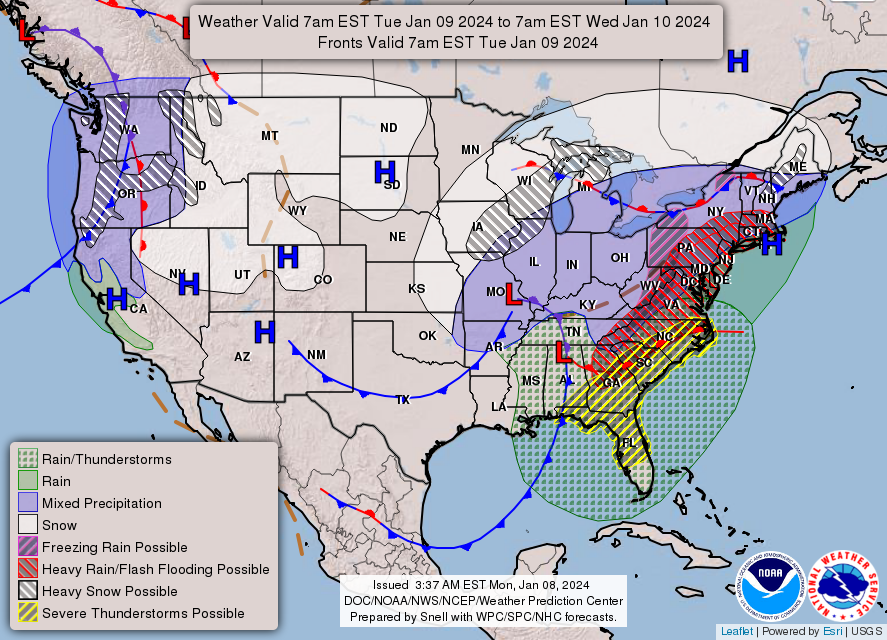
Tonight: Rain, possibly mixed with snow, mainly after 11pm. Low around 32. East wind 10 to 15 mph, with gusts as high as 28 mph. Chance of precipitation is 100%. New snow accumulation of less than a half inch possible.
Tuesday: Rain. High near 47. Breezy, with an east southeast wind 16 to 20 mph becoming south southwest in the afternoon. Winds could gust as high as 30 mph. Chance of precipitation is 100%. New precipitation amounts between a half and three quarters of an inch possible.
Tuesday Night: Rain before 10pm, then rain and snow. Low around 31. Breezy, with a southwest wind 18 to 26 mph, with gusts as high as 39 mph. Chance of precipitation is 100%. New precipitation amounts between a tenth and quarter of an inch possible.
Wednesday: Mostly cloudy, with a high near 35. Breezy, with a west wind 17 to 22 mph, with gusts as high as 33 mph.
Wednesday Night: A 20 percent chance of snow after 1am. Partly cloudy, with a low around 30. Breezy, with a south southwest wind 14 to 24 mph, with gusts as high as 36 mph.
Thursday: A slight chance of rain and snow before 1pm. Partly sunny, with a high near 40. Breezy, with a southwest wind 11 to 20 mph, with gusts as high as 30 mph. Chance of precipitation is 20%.
Thursday Night: A chance of rain before 1am, then a chance of rain and snow. Mostly cloudy, with a low around 32. Southeast wind 10 to 14 mph, with gusts as high as 20 mph. Chance of precipitation is 50%.
Friday: Rain likely before 1pm, then rain, possibly mixed with snow. High near 40. East southeast wind 14 to 18 mph, with gusts as high as 28 mph. Chance of precipitation is 80%.
Friday Night: Rain and snow, mainly before 1am. Low around 23. Breezy, with an east wind 22 to 29 mph becoming west after midnight. Winds could gust as high as 41 mph. Chance of precipitation is 80%.
Saturday: A 30 percent chance of snow. Mostly cloudy, with a high near 28. Breezy.
Saturday Night: A 20 percent chance of snow. Mostly cloudy, with a low around 11. Breezy.
Sunday: A 20 percent chance of snow. Mostly cloudy, with a high near 22.
THE UNITED STATES OF AMERICA 3-DAY OUTLOOK


SOURCE: NWS Indianapolis.
Follow NWS Indianapolis on Twitter @NWSIndianapolis for the latest Indianapolis area weather news.