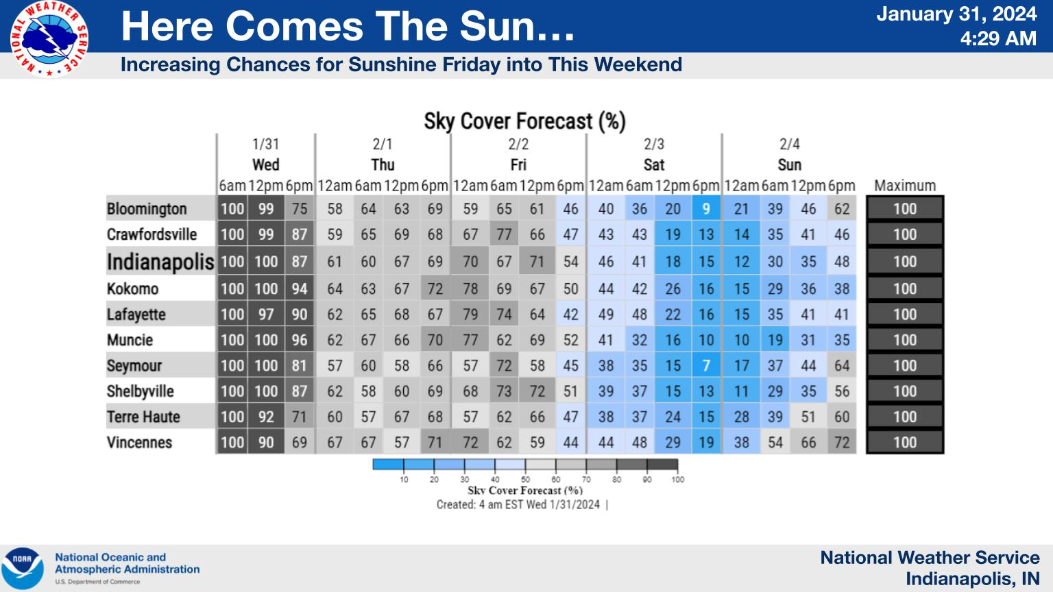
It’s been 9 to 10 days since most of central Indiana last saw the sun.
Cloudy skies will linger today but hang tight as a few peaks of sun are expected Thursday with increasing sunshine later Friday into the weekend.
NEXT 12 HOURS
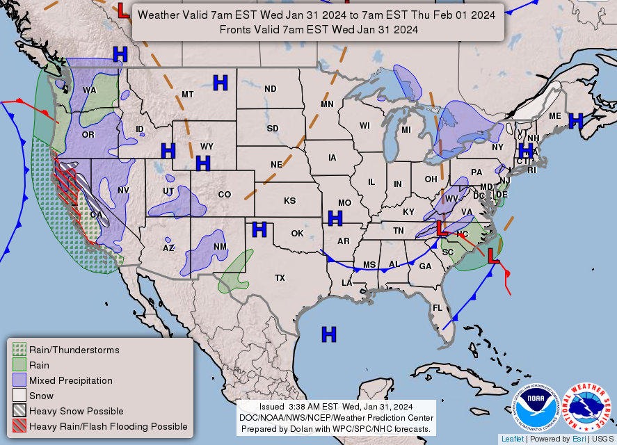
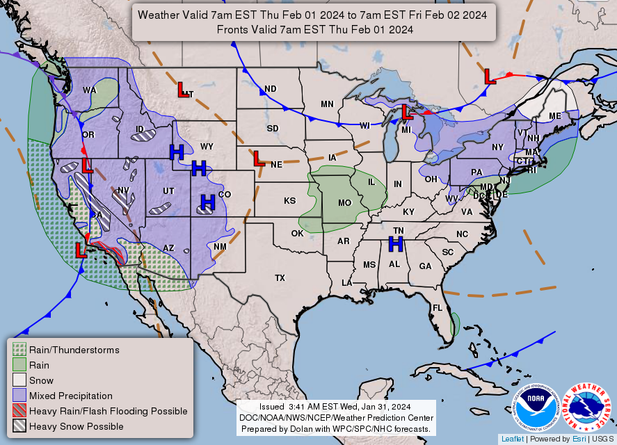
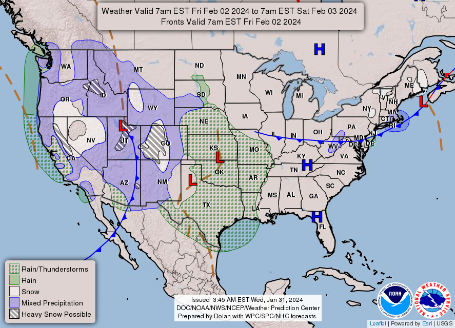
NEXT 12-24 HOURS
INDIANAPOLIS DAILY CLIMATE DATA
INDIANAPOLIS 7-DAY EXTENDED FORECAST
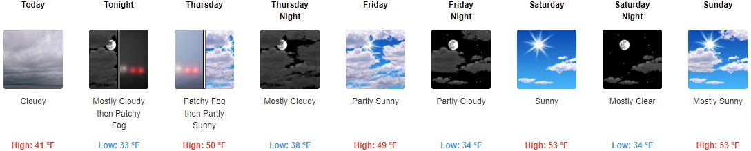
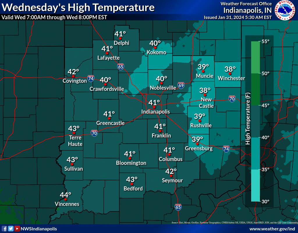
Today: Cloudy, with a high near 41. Light and variable wind becoming west 5 to 8 mph in the morning.
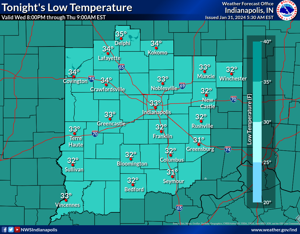
Tonight: Patchy fog after 3am. Otherwise, mostly cloudy, with a low around 33. Southwest wind 7 to 10 mph, with gusts as high as 18 mph.
Thursday: Patchy fog before 7am. Otherwise, partly sunny, with a high near 50. Southwest wind around 10 mph, with gusts as high as 18 mph.
Thursday Night: Mostly cloudy, with a low around 38. Southwest wind 5 to 7 mph becoming calm.
Friday: Partly sunny, with a high near 49. East northeast wind 7 to 9 mph.
Friday Night: Partly cloudy, with a low around 34. East wind around 8 mph.
Saturday: Sunny, with a high near 53. East wind around 8 mph.
Saturday Night: Mostly clear, with a low around 34. East wind around 8 mph.
Sunday: Mostly sunny, with a high near 53. East northeast wind 8 to 10 mph.
Sunday Night: Partly cloudy, with a low around 33. Northeast wind 11 to 13 mph.
Monday: Mostly sunny, with a high near 48.
Monday Night: Partly cloudy, with a low around 29.
Tuesday: Sunny, with a high near 48.
THE UNITED STATES OF AMERICA 3-DAY OUTLOOK
SOURCE: NWS Indianapolis.
Follow NWS Indianapolis on Twitter @NWSIndianapolis for the latest Indianapolis area weather news.