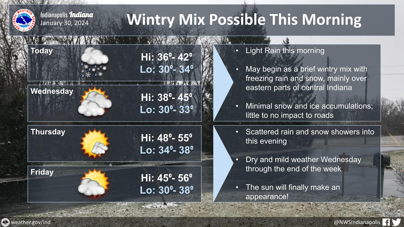
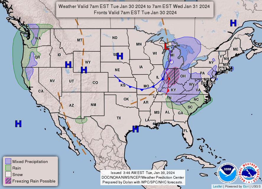
Light rain will move into central Indiana early this morning, possibly beginning as a brief wintry mix with freezing rain and snow.
Any snow and/or ice accumulations will be very light and have little to no impact on roads across the area this morning.
Scattered rain and snow showers will linger through this evening before ending.
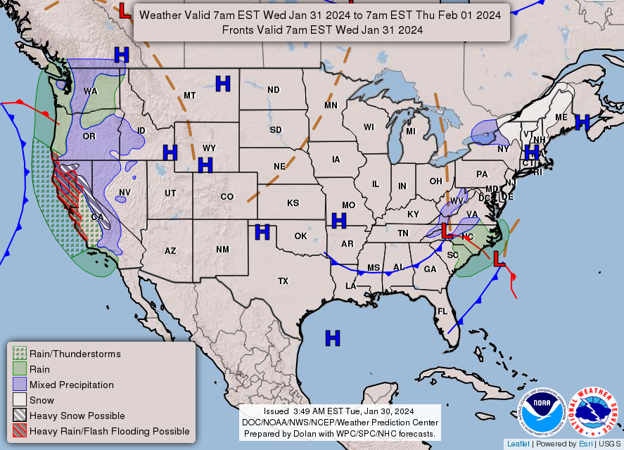
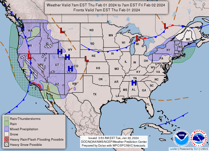
An extended period of dry and mild weather is then expected Wednesday into this weekend.
NEXT 12 HOURS
NEXT 12-24 HOURS

INDIANAPOLIS DAILY CLIMATE DATA
INDIANAPOLIS 7-DAY EXTENDED FORECAST
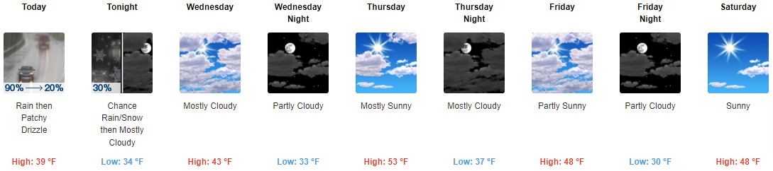
Today: Rain, mainly before noon, then patchy drizzle after 1pm. High near 39. South wind 9 to 13 mph becoming west northwest in the afternoon. Winds could gust as high as 18 mph. Chance of precipitation is 90%. New precipitation amounts of less than a tenth of an inch possible.
Tonight: A chance of rain, possibly mixing with snow after 9pm, then gradually ending. Cloudy, with a low around 34. Northwest wind 8 to 10 mph. Chance of precipitation is 30%.
Wednesday: Mostly cloudy, with a high near 43. Northwest wind around 7 mph becoming west southwest in the afternoon.
Wednesday Night: Partly cloudy, with a low around 33. Southwest wind 7 to 9 mph.
Thursday: Mostly sunny, with a high near 53. Southwest wind 8 to 10 mph.
Thursday Night: Mostly cloudy, with a low around 37. Southwest wind around 6 mph becoming calm in the evening.
Friday: Partly sunny, with a high near 48. Northeast wind 7 to 10 mph.
Friday Night: Partly cloudy, with a low around 30. East northeast wind around 9 mph.
Saturday: Sunny, with a high near 48. East wind 9 to 14 mph, with gusts as high as 21 mph.
Saturday Night: Mostly clear, with a low around 30. East northeast wind 11 to 14 mph, with gusts as high as 22 mph.
Sunday: Mostly sunny, with a high near 48.
Sunday Night: Partly cloudy, with a low around 29.
Monday: Mostly sunny, with a high near 45.
THE UNITED STATES OF AMERICA 3-DAY OUTLOOK
SOURCE: NWS Indianapolis.
Follow NWS Indianapolis on Twitter @NWSIndianapolis for the latest Indianapolis area weather news.