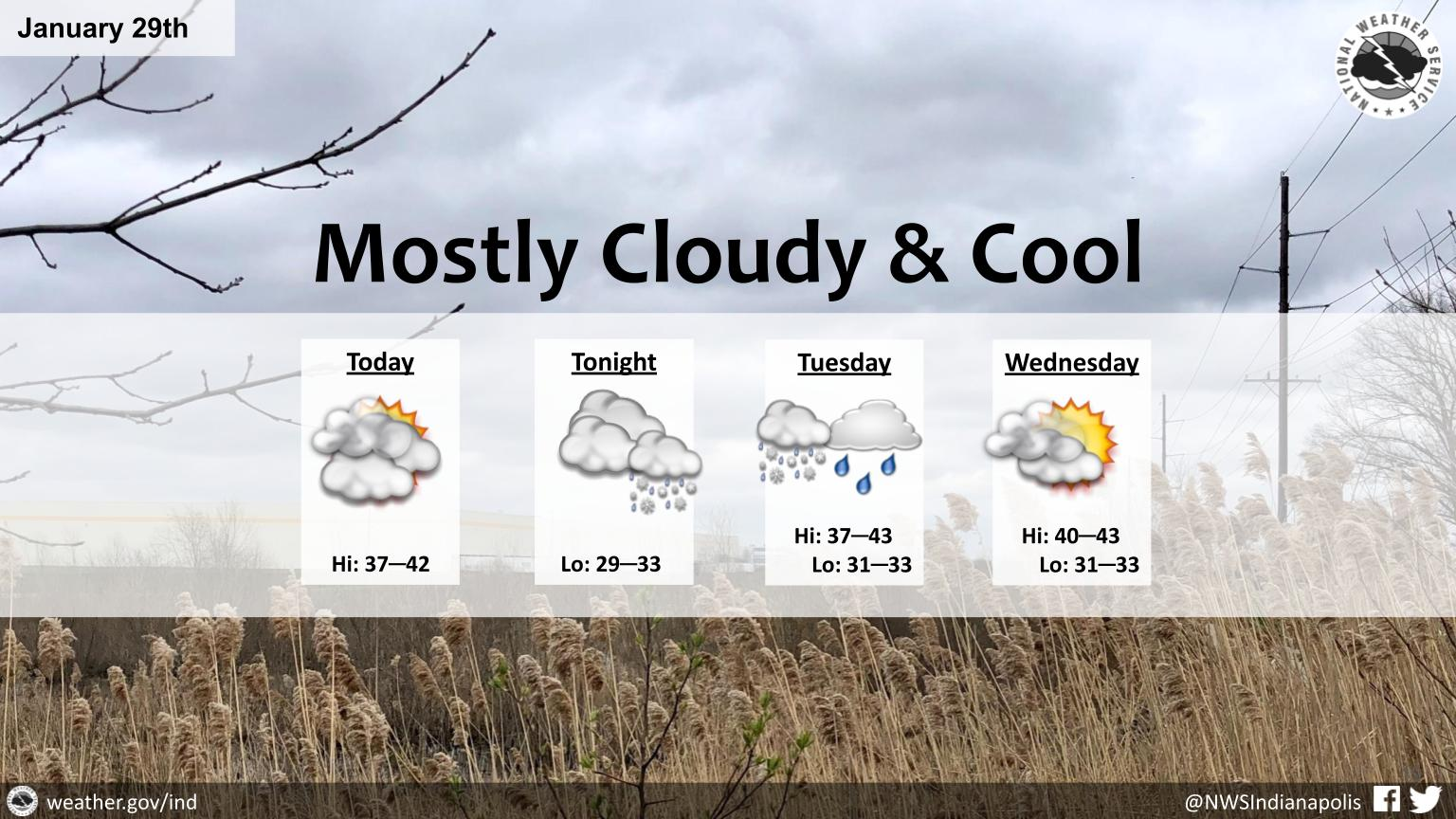
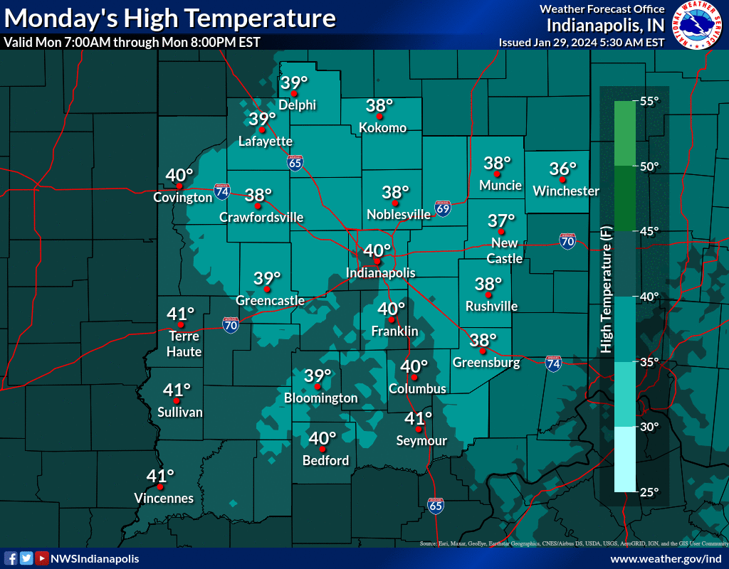
Considerable cloudiness and seasonably cool conditions today as the region enters a drier period.
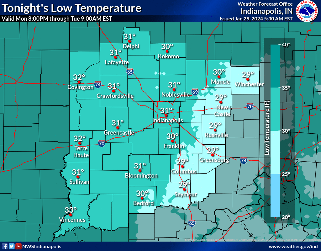
Expect several hours of light rain and/or snow late tonight into Tuesday, which may cause minor impacts early Tuesday, especially east of Indianapolis.
Decreasing clouds are expected Wednesday.
NEXT 12 HOURS
NEXT 12-24 HOURS
INDIANAPOLIS DAILY CLIMATE DATA

INDIANAPOLIS 7-DAY EXTENDED FORECAST

Today: Cloudy, with a high near 39. West southwest wind 5 to 7 mph.
Tonight: A slight chance of rain and snow between 4am and 5am, then a slight chance of snow after 5am. Mostly cloudy, with a low around 31. South southwest wind 7 to 10 mph. Chance of precipitation is 20%.
Tuesday: A chance of rain and snow before 10am, then a chance of rain. Cloudy, with a high near 40. South wind 9 to 13 mph becoming west in the afternoon. Winds could gust as high as 18 mph. Chance of precipitation is 50%. New precipitation amounts of less than a tenth of an inch possible.
Tuesday Night: Mostly cloudy, with a low around 33. Northwest wind around 9 mph.
Wednesday: Mostly cloudy, with a high near 42. North northwest wind around 8 mph.
Wednesday Night: Partly cloudy, with a low around 33. Southwest wind 8 to 14 mph, with gusts as high as 22 mph.
Thursday: Mostly sunny, with a high near 50. Southwest wind around 15 mph, with gusts as high as 23 mph.
Thursday Night: Mostly cloudy, with a low around 32. West wind 10 to 14 mph becoming north northwest after midnight. Winds could gust as high as 21 mph.
Friday: Mostly sunny, with a high near 43. North wind around 11 mph.
Friday Night: Mostly clear, with a low around 26. North northeast wind around 10 mph.
Saturday: Sunny, with a high near 42.
Saturday Night: Mostly clear, with a low around 25.
Sunday: Sunny, with a high near 41.
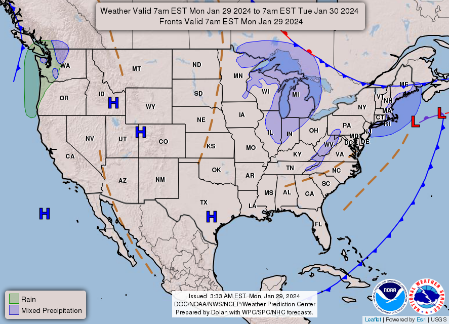
THE UNITED STATES OF AMERICA 3-DAY OUTLOOK


SOURCE: NWS Indianapolis.
Follow NWS Indianapolis on Twitter @NWSIndianapolis for the latest Indianapolis area weather news.