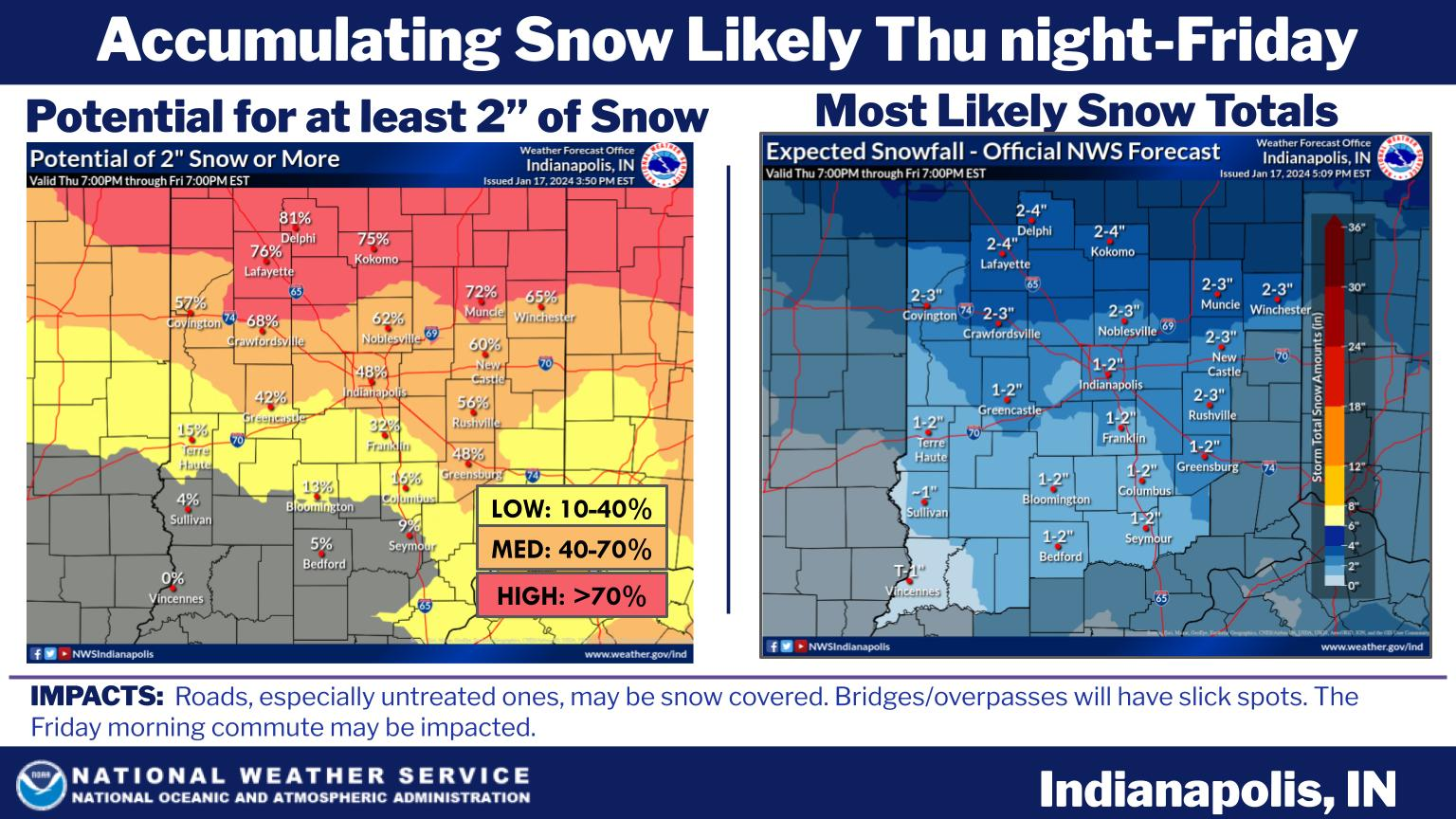
Snow will return on Thursday.
Several rounds of now are possible on Thursday night and again on Friday.
Light Accumulations are expected. Look for cold and dry weather today.
INDIANAPOLIS 7-DAY EXTENDED FORECAST

Today
Mostly sunny, with a high near 24. Wind chill values as low as -8. Southwest wind 14 to 17 mph, with gusts as high as 28 mph.
Tonight
Mostly cloudy, with a low around 19. Southwest wind around 10 mph, with gusts as high as 21 mph.
Thursday
A 40 percent chance of snow after 8am. Cloudy, with a high near 28. South southwest wind 7 to 10 mph.
Thursday Night
Snow, mainly after 2am. Low around 17. North wind 5 to 9 mph. Chance of precipitation is 80%.
Friday
Snow before 8am, then a chance of snow showers, mainly between 8am and 2pm. High near 21. West northwest wind 11 to 16 mph, with gusts as high as 24 mph. Chance of precipitation is 80%.
Friday Night
A 20 percent chance of snow showers before 2am. Mostly cloudy, with a low around 4. West northwest wind 15 to 17 mph, with gusts as high as 26 mph.
Saturday
Mostly sunny, with a high near 16. West northwest wind around 14 mph, with gusts as high as 20 mph.
Saturday Night
Mostly clear, with a low around 4. West northwest wind 6 to 11 mph, with gusts as high as 18 mph.
Sunday
Mostly sunny, with a high near 23. South wind 5 to 9 mph.
Sunday Night
Mostly cloudy, with a low around 19. South southeast wind 10 to 14 mph, with gusts as high as 20 mph.
Monday
A 20 percent chance of showers. Mostly cloudy, with a high near 35.
Monday Night
A 50 percent chance of showers. Cloudy, with a low around 32.
Tuesday
Showers likely. Cloudy, with a high near 41. Chance of precipitation is 70%.
SOURCE: NWS Indianapolis.
Follow NWS Indianapolis on Twitter @NWSIndianapolis for the latest Indianapolis area weather news.