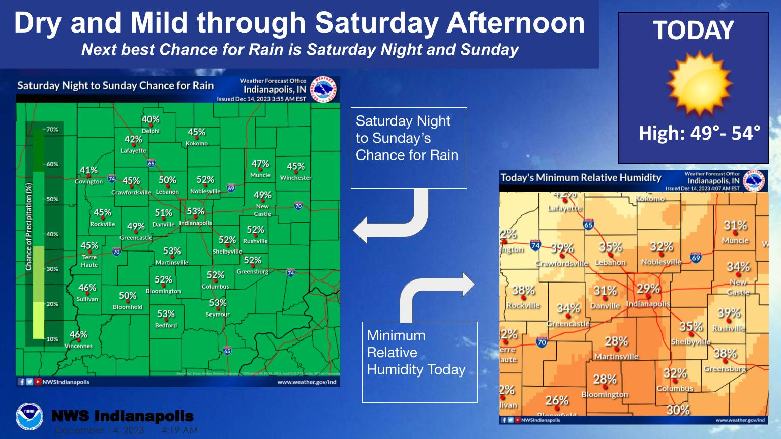
Expect dry and mild conditions through Saturday Afternoon with highs in the upper 40s and lower 50s today.
Relative Humidity will fall to about 25%-35% this afternoon.
There is near a 50% chance for rain on Saturday night into Sunday.
NEXT 12 HOURS

NEXT 12-24 HOURS

INDIANAPOLIS HISTORICAL CLIMATE DATA

INDIANAPOLIS 7-DAY EXTENDED FORECAST

Today: Sunny, with a high near 51. Calm wind becoming south southwest around 5 mph.
Tonight: Clear, with a low around 29. South wind 3 to 5 mph.
Friday: Sunny, with a high near 53. South southeast wind 3 to 7 mph.
Friday Night: Increasing clouds, with a low around 35. Southeast wind around 6 mph.
Saturday: Mostly cloudy, with a high near 50. Southeast wind around 8 mph.
Saturday Night: A 50 percent chance of showers after 8pm. Cloudy, with a low around 41. South southeast wind around 10 mph. New precipitation amounts between a tenth and quarter of an inch possible.
Sunday: A 50 percent chance of showers before 2pm. Mostly cloudy, with a high near 47. South wind around 10 mph becoming north northeast in the afternoon.
Sunday Night: Mostly cloudy, with a low around 37. North wind 10 to 15 mph, with gusts as high as 22 mph.
Monday: Partly sunny, with a high near 42. Breezy, with a north northwest wind 16 to 21 mph, with gusts as high as 32 mph.
Monday Night: Mostly clear, with a low around 24. Blustery, with a north wind 14 to 20 mph, with gusts as high as 30 mph.
Tuesday: Sunny, with a high near 41.
Tuesday Night: Partly cloudy, with a low around 27.
Wednesday: Mostly sunny, with a high near 46.
THE UNITED STATES OF AMERICA 3-DAY OUTLOOK


SOURCE: NWS Indianapolis.
Follow NWS Indianapolis on Twitter @NWSIndianapolis for the latest Indianapolis area weather news.