
Morning wind chills will fall to near 0 in spots this morning with highs today running 15 to 20 degrees below normal. Bundle up before heading out today!
INDIANAPOLIS DAILY CLIMATE DATA

INDIANAPOLIS 7-DAY EXTENDED FORECAST

Today: Scattered flurries before 11am. Sunny, with a high near 28. West northwest wind 9 to 11 mph.
Tonight: Mostly clear, with a low around 20. South southwest wind 7 to 13 mph, with gusts as high as 18 mph.
Wednesday: Sunny, with a high near 45. West southwest wind 13 to 17 mph, with gusts as high as 25 mph.
Wednesday Night: Partly cloudy, with a low around 31. South southwest wind around 10 mph.
Thursday: A 50 percent chance of rain after 1pm. Partly sunny, with a high near 51. South southwest wind 11 to 18 mph, with gusts as high as 29 mph. New precipitation amounts of less than a tenth of an inch possible.
Thursday Night: Rain. Low around 40. South southwest wind 11 to 18 mph, with gusts as high as 29 mph. Chance of precipitation is 90%. New precipitation amounts between a quarter and half of an inch possible.
Friday: Rain, mainly before 1pm. High near 46. Southeast wind around 11 mph becoming north northeast in the afternoon. Chance of precipitation is 90%.
Friday Night: A 20 percent chance of rain before 1am. Mostly cloudy, with a low around 36. North northeast wind around 10 mph.
Saturday: Mostly cloudy, with a high near 48. East wind around 9 mph.
Saturday Night: A 30 percent chance of rain after 1am. Mostly cloudy, with a low around 40. East southeast wind around 8 mph.
Sunday: A 30 percent chance of rain. Mostly cloudy, with a high near 56.
Sunday Night: A 30 percent chance of rain. Mostly cloudy, with a low around 40.
Monday: A 30 percent chance of rain. Mostly cloudy, with a high near 48.
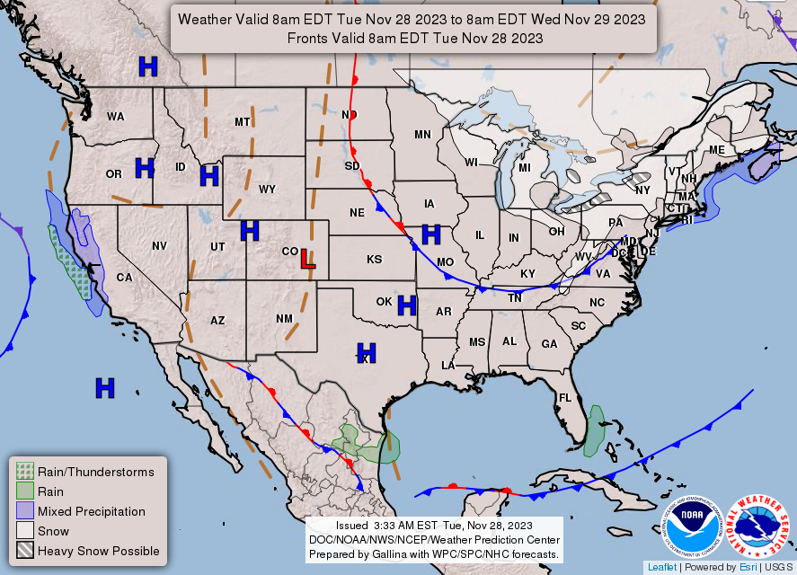
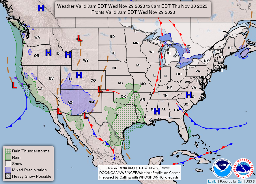
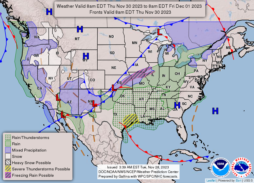
THE UNITED STATES OF AMERICA 3-DAY OUTLOOK
SOURCE: NWS Indianapolis.
Follow NWS Indianapolis on Twitter @NWSIndianapolis for the latest Indianapolis area weather news.