Dry weather with pleasant fall temperatures are in store for the next few days.
Relative humidity’s will also be low, so take precautions with any open flames as they could easily spread.
INDIANA BURN BANS IN EFFECT
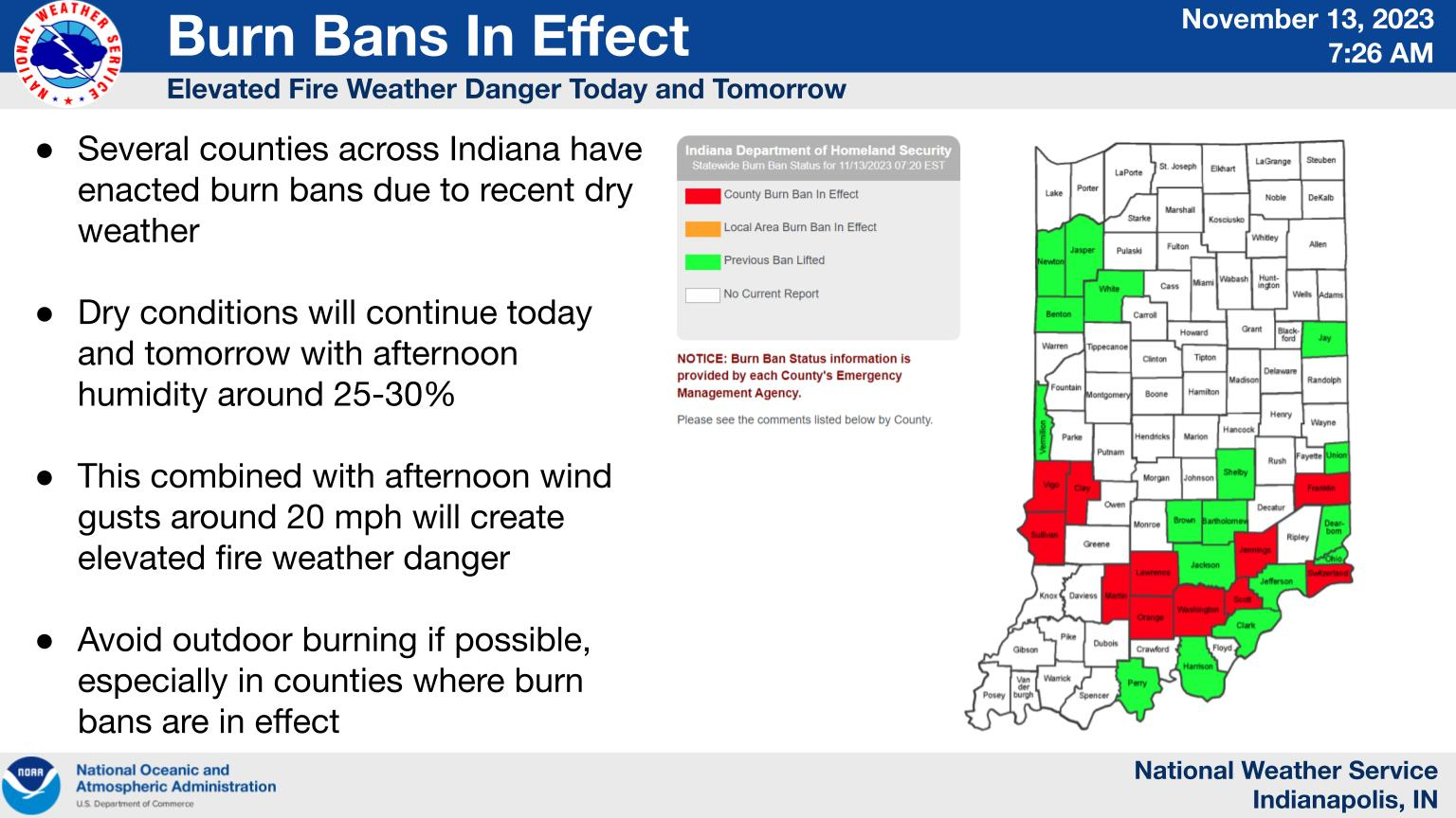
With the recent dry weather several counties have enacted burn bans, especially across southern Indiana.
Low relative humidity and wind gusts to 20 mph will create elevated fire weather danger with outdoor burning discouraged even outside of counties with burn bans.
Visit https://www.in.gov/dhs/burnban/ for more information
INDIANAPOLIS DAILY CLIMATE DATA
INDIANAPOLIS 7-DAY EXTENDED FORECAST
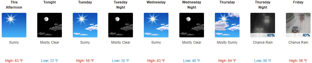
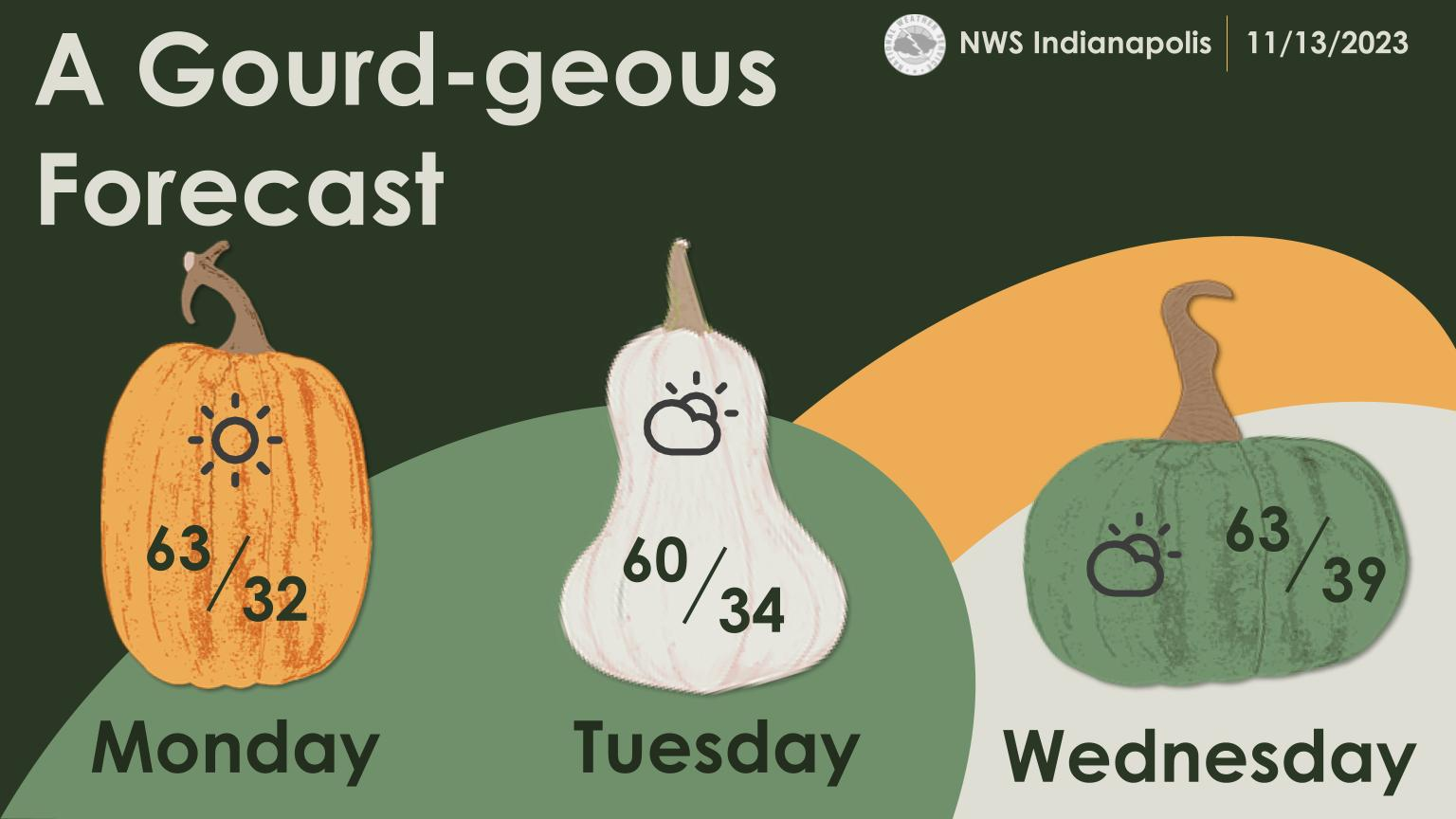
This Afternoon: Sunny, with a high near 63. Northwest wind 9 to 11 mph, with gusts as high as 18 mph.
Tonight: Mostly clear, with a low around 33. West northwest wind 5 to 7 mph becoming northeast after midnight.
Tuesday: Sunny, with a high near 59. Calm wind becoming south southeast 5 to 7 mph in the morning.
Tuesday Night: Mostly clear, with a low around 35. Southeast wind 6 to 9 mph.
Wednesday: Sunny, with a high near 63. Southwest wind 7 to 10 mph.
Wednesday Night: Mostly clear, with a low around 40. South southwest wind 7 to 9 mph.
Thursday: Mostly sunny, with a high near 64. South wind 7 to 13 mph, with gusts as high as 18 mph.
Thursday Night: A 40 percent chance of rain, mainly after 1am. Mostly cloudy, with a low around 50. South southwest wind around 15 mph, with gusts as high as 22 mph.
Friday: A 40 percent chance of rain. Partly sunny, with a high near 58. Southwest wind around 15 mph becoming northwest in the afternoon. Winds could gust as high as 22 mph.
Friday Night: A 20 percent chance of rain before 1am. Mostly clear, with a low around 35. North northwest wind 8 to 11 mph, with gusts as high as 18 mph.
Saturday: Sunny, with a high near 54.
Saturday Night: Mostly clear, with a low around 34.
Sunday: Sunny, with a high near 54.
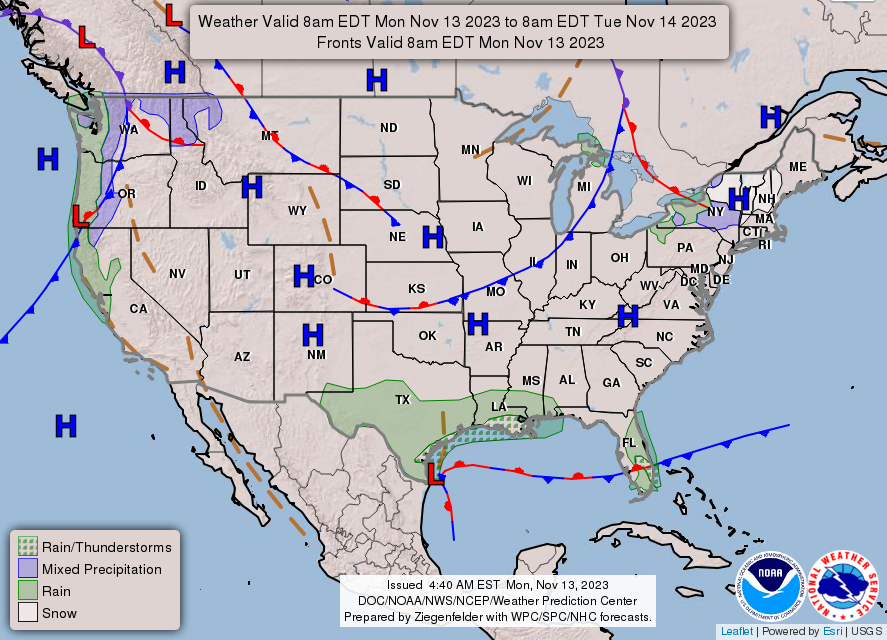
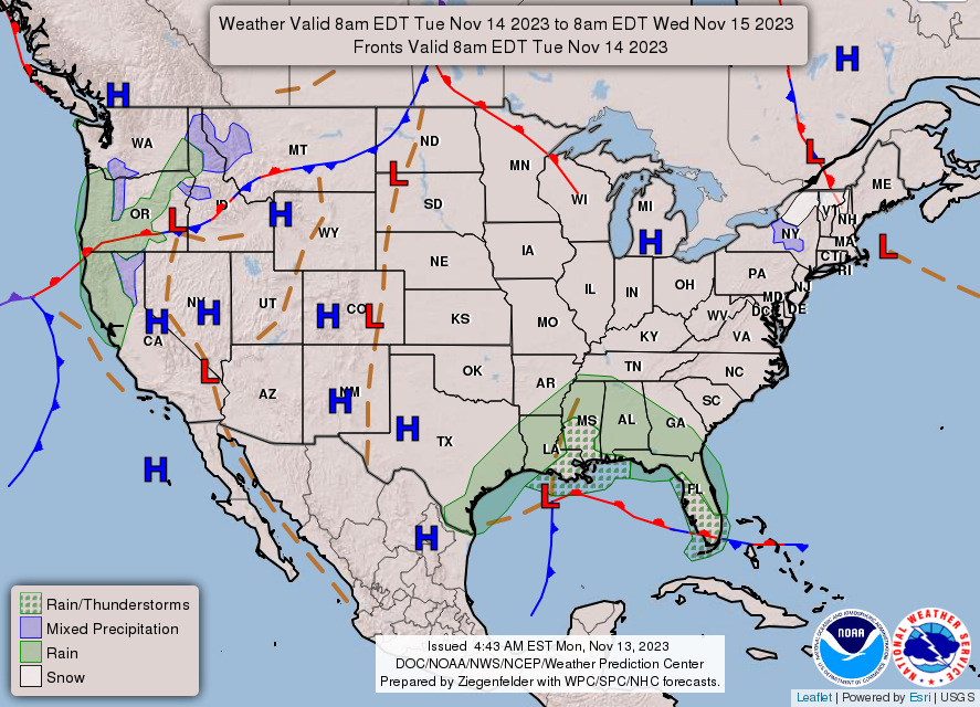
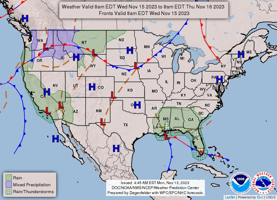
THE UNITED STATES OF AMERICA 3-DAY OUTLOOK
SOURCE: NWS Indianapolis.
Follow NWS Indianapolis on Twitter @NWSIndianapolis for the latest Indianapolis area weather news.