
Dry and warm weather will continue through mid week, before an approaching low pressure system and cold front brings showers and isolated thunderstorms to the area.
Rain will be possible from Wednesday night into Friday, with chances highest Thursday into Thursday evening.
Temperatures will turn sharply cooler toward late week.
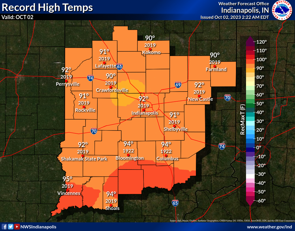
INDIANAPOLIS DAILY CLIMATE DATA
INDIANAPOLIS RADAR OUTAGE
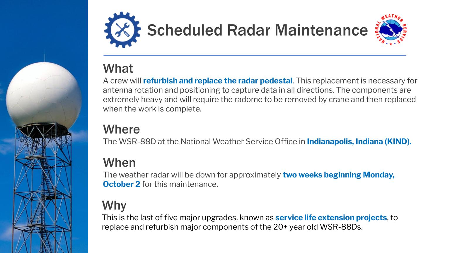
Beginning Monday, October 2nd, the WSR-88D KIND radar will be down for vital maintenance that will help prolong the life of the radar.
This outage will last up to 2 weeks.
For more information, visit weather.gov/ind/radarpedestalreplacement.
INDIANAPOLIS 7-DAY EXTENDED FORECAST
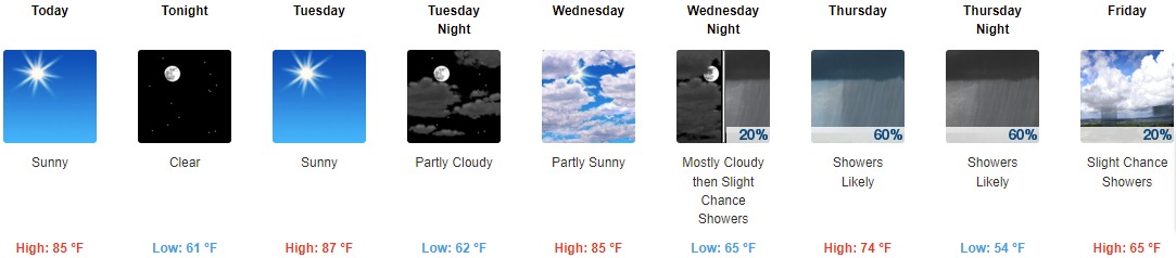
Today: Sunny, with a high near 85. Southeast wind 3 to 6 mph.
Tonight: Clear, with a low around 61. Light east southeast wind.
Tuesday: Sunny, with a high near 87. Calm wind becoming south southeast 5 to 7 mph in the morning.
Tuesday Night: Partly cloudy, with a low around 62. South southeast wind around 7 mph.
Wednesday: Partly sunny, with a high near 85. South southwest wind 6 to 11 mph.
Wednesday Night: A 20 percent chance of showers after 2am. Mostly cloudy, with a low around 65.
Thursday: A chance of showers, then showers likely and possibly a thunderstorm after 2pm. Cloudy, with a high near 74. Chance of precipitation is 60%.
Thursday Night: Showers likely and possibly a thunderstorm before 8pm, then a chance of showers and thunderstorms between 8pm and 2am, then a chance of showers after 2am. Mostly cloudy, with a low around 54. Chance of precipitation is 60%.
Friday: A 20 percent chance of showers. Mostly sunny, with a high near 65.
Friday Night: Partly cloudy, with a low around 43.
Saturday: Sunny, with a high near 58.
Saturday Night: Mostly clear, with a low around 40.
Sunday: Mostly sunny, with a high near 62.
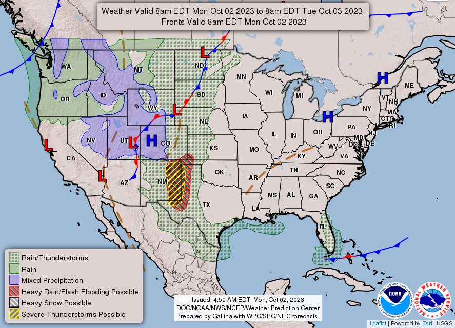
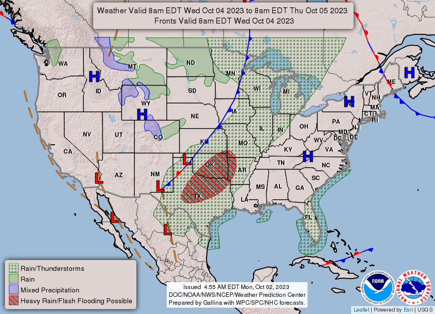
THE UNITED STATES OF AMERICA 3-DAY OUTLOOK

SOURCE: NWS Indianapolis.
Follow NWS Indianapolis on Twitter @NWSIndianapolis for the latest Indianapolis area weather news.