
A cold front will move east across central Indiana late today and tonight.
The front will interact with warm, moist and unstable air and trigger scattered thunderstorms.
A few could produce marginally severe wind damage from 2-10 pm.

An area of thunderstorms with brief heavy rain, occasional cloud to ground lightning and gusty winds will continue to move northeast and move into Warren, Vermillion, Tippecanoe and Parke counties through 7:30 AM.
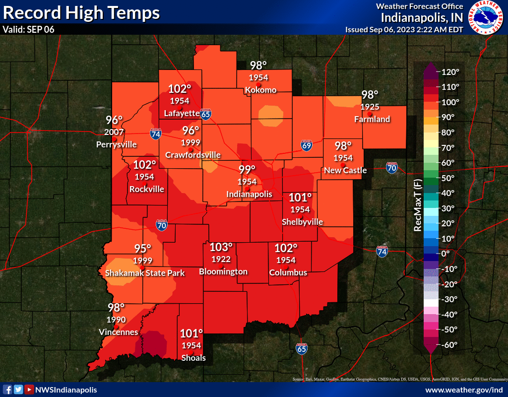
INDIANAPOLIS DAILY CLIMATE DATA
INDIANAPOLIS 7-DAY EXTENDED FORECAST
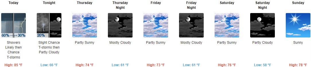
Today: A chance of showers and thunderstorms before 10am, then showers likely and possibly a thunderstorm between 10am and 11am, then a chance of showers and thunderstorms after 11am. Mostly cloudy, with a high near 85. South southwest wind 9 to 13 mph, with gusts as high as 21 mph. Chance of precipitation is 60%. New rainfall amounts between a tenth and quarter of an inch, except higher amounts possible in thunderstorms.
Tonight: A 20 percent chance of showers and thunderstorms before 9pm. Partly cloudy, with a low around 66. West wind 6 to 11 mph, with gusts as high as 18 mph.
Thursday: Partly sunny, with a high near 74. West northwest wind 6 to 9 mph.
Thursday Night: Mostly cloudy, with a low around 61. North wind 6 to 8 mph.
Friday: Partly sunny, with a high near 73. North northwest wind around 7 mph.
Friday Night: Mostly cloudy, with a low around 61.
Saturday: Partly sunny, with a high near 76.
Saturday Night: Partly cloudy, with a low around 58.
Sunday: Sunny, with a high near 78.
Sunday Night: Mostly clear, with a low around 58.
Monday: Mostly sunny, with a high near 80.
Monday Night: A 20 percent chance of showers. Mostly cloudy, with a low around 61.
Tuesday: A 30 percent chance of showers. Partly sunny, with a high near 76.
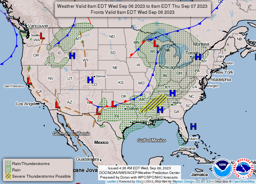
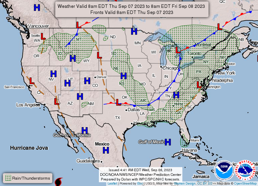
THE UNITED STATES OF AMERICA 3-DAY OUTLOOK

SOURCE: NWS Indianapolis.
Follow NWS Indianapolis on Twitter @NWSIndianapolis for the latest Indianapolis area weather news.