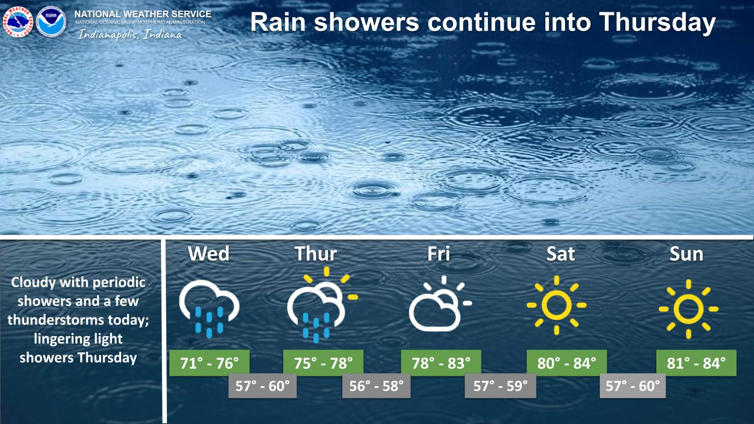
A rainy pattern will continue into Thursday, although there will be breaks between rain showers.
Most locations will receive at least some rainfall.
Showers will diminish during the day Thursday.
High temperatures will be in the 70s today and Thursday, and warming into the 80s this weekend.
INDIANAPOLIS DAILY CLIMATE DATA
INDIANAPOLIS 7-DAY EXTENDED FORECAST
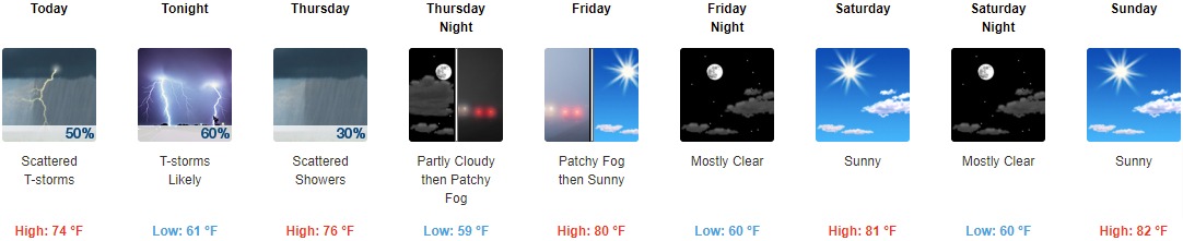
Today: Scattered showers and thunderstorms. Mostly cloudy, with a high near 74. Southeast wind 5 to 7 mph. Chance of precipitation is 50%. New rainfall amounts between a tenth and quarter of an inch, except higher amounts possible in thunderstorms.
Tonight: Showers and thunderstorms likely, mainly before 11pm. Mostly cloudy, with a low around 61. East southeast wind around 7 mph. Chance of precipitation is 60%. New rainfall amounts between a tenth and quarter of an inch, except higher amounts possible in thunderstorms.
Thursday: Scattered showers and thunderstorms before 8am, then scattered showers between 8am and 2pm. Partly sunny, with a high near 76. Light and variable wind becoming southwest around 6 mph in the morning. Chance of precipitation is 30%.
Thursday Night: Patchy fog after 3am. Otherwise, partly cloudy, with a low around 59. Northwest wind around 6 mph becoming light and variable after midnight.
Friday: Patchy fog before 9am. Otherwise, mostly sunny, with a high near 80. East wind 3 to 5 mph.
Friday Night: Mostly clear, with a low around 60.
Saturday: Sunny, with a high near 81.
Saturday Night: Mostly clear, with a low around 60.
Sunday: Sunny, with a high near 82.
Sunday Night: Mostly clear, with a low around 60.
Monday: Sunny, with a high near 83.
Monday Night: Mostly clear, with a low around 58.
Tuesday: Sunny, with a high near 83.
THE UNITED STATES OF AMERICA 3-DAY OUTLOOK


SOURCE: NWS Indianapolis.
Follow NWS Indianapolis on Twitter @NWSIndianapolis for the latest Indianapolis area weather news.