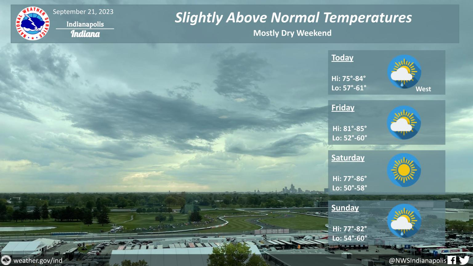
Expect some rain today in far western central Indiana, otherwise the rest of the area will be dry through much of the weekend with temperatures on the warm side.
The next chance of rain could start as early as Sunday afternoon.
INDIANAPOLIS DAILY CLIMATE DATA
INDIANAPOLIS 7-DAY EXTENDED FORECAST

Today: Mostly cloudy, with a high near 82. South southeast wind around 7 mph.
Tonight: Partly cloudy, with a low around 62. East southeast wind around 6 mph.
Friday: Sunny, with a high near 84. East southeast wind around 7 mph.
Friday Night: Mostly clear, with a low around 60. East wind around 8 mph.
Saturday: Sunny, with a high near 82. East wind around 7 mph.
Saturday Night: Mostly clear, with a low around 56.
Sunday: A 20 percent chance of showers after 2pm. Mostly sunny, with a high near 80.
Sunday Night: A 30 percent chance of showers, mainly after 8pm. Mostly cloudy, with a low around 60.
Monday: A 30 percent chance of showers, mainly after 2pm. Partly sunny, with a high near 77.
Monday Night: A 30 percent chance of showers, mainly before 2am. Mostly cloudy, with a low around 59.
Tuesday: A 30 percent chance of showers. Partly sunny, with a high near 73.
Tuesday Night: A 30 percent chance of showers. Mostly cloudy, with a low around 58.
Wednesday: A 40 percent chance of showers. Partly sunny, with a high near 72.
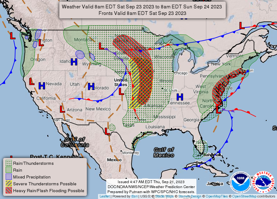
THE UNITED STATES OF AMERICA 3-DAY OUTLOOK
SOURCE: NWS Indianapolis.
Follow NWS Indianapolis on Twitter @NWSIndianapolis for the latest Indianapolis area weather news.