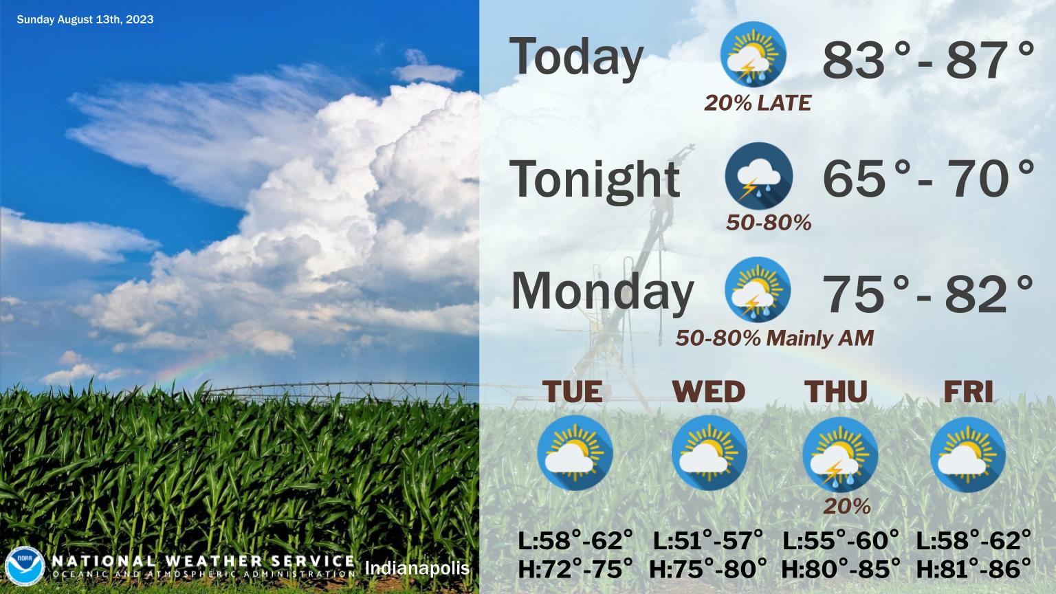
Today will be mostly dry and warm with just a slight chance of an afternoon thunderstorm over primarily western Indiana.
Chances for storms increase tonight into Monday morning.
Locally heavy rain is possible along with a strong thunderstorm. Milder weather expected through mid week.
INDIANAPOLIS DAILY CLIMATE DATA
INDIANAPOLIS 7-DAY EXTENDED FORECAST
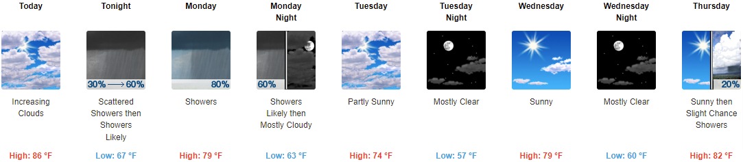
Today: Increasing clouds, with a high near 86. Calm wind becoming west 5 to 7 mph in the morning.
Tonight: Scattered showers, then showers likely and possibly a thunderstorm after 2am. Cloudy, with a low around 67. East northeast wind 6 to 8 mph. Chance of precipitation is 60%. New rainfall amounts of less than a tenth of an inch, except higher amounts possible in thunderstorms.
Monday: Showers and possibly a thunderstorm. High near 79. Southeast wind 8 to 11 mph becoming southwest in the afternoon. Chance of precipitation is 80%. New rainfall amounts between a quarter and half of an inch possible.
Monday Night: Showers likely before 8pm. Mostly cloudy, with a low around 63. West wind 11 to 15 mph, with gusts as high as 22 mph. Chance of precipitation is 60%. New precipitation amounts of less than a tenth of an inch possible.
Tuesday: Partly sunny, with a high near 74. North wind 10 to 13 mph, with gusts as high as 18 mph.
Tuesday Night: Mostly clear, with a low around 57.
Wednesday: Sunny, with a high near 79.
Wednesday Night: Mostly clear, with a low around 60.
Thursday: A 20 percent chance of showers after 2pm. Sunny, with a high near 82.
Thursday Night: A 10 percent chance of showers before 8pm. Mostly clear, with a low around 63.
Friday: Sunny, with a high near 84.
Friday Night: Mostly clear, with a low around 64.
Saturday: Sunny, with a high near 87.
THE UNITED STATES OF AMERICA 3-DAY OUTLOOK


SOURCE: NWS Indianapolis.
Follow NWS Indianapolis on Twitter @NWSIndianapolis for the latest Indianapolis area weather news.