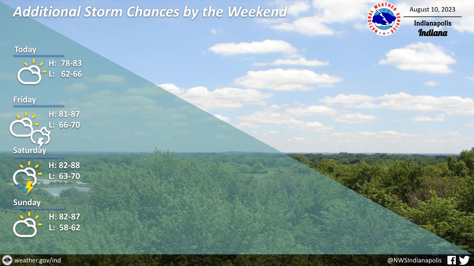
Dry weather will return today with skies gradually becoming partly cloudy after some morning fog.
Chances for showers and storms will return as early as Friday evening continuing into Saturday.
INDIANAPOLIS DAILY CLIMATE DATA
INDIANAPOLIS 7-DAY EXTENDED FORECAST
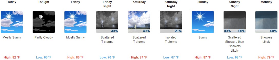
Today: Mostly sunny, with a high near 82. West northwest wind 5 to 10 mph.
Tonight: Partly cloudy, with a low around 66. West wind around 6 mph becoming light and variable.
Friday: Mostly sunny, with a high near 86. Southwest wind 5 to 9 mph.
Friday Night: Scattered showers and thunderstorms. Increasing clouds, with a low around 70. South southwest wind 6 to 8 mph. Chance of precipitation is 40%.
Saturday: Scattered showers and thunderstorms. Mostly sunny, with a high near 87. Southwest wind 8 to 10 mph. Chance of precipitation is 40%.
Saturday Night: Isolated showers and thunderstorms before 2am. Mostly clear, with a low around 67. Chance of precipitation is 20%.
Sunday: Sunny, with a high near 87.
Sunday Night: Scattered showers, then showers likely and possibly a thunderstorm after 2am. Mostly cloudy, with a low around 68. Chance of precipitation is 60%.
Monday: Showers likely and possibly a thunderstorm before 2pm, then scattered showers and thunderstorms after 2pm. Partly sunny, with a high near 79. Chance of precipitation is 60%.
Monday Night: Scattered showers and thunderstorms before 8pm. Mostly clear, with a low around 63. Chance of precipitation is 30%.
Tuesday: Mostly sunny, with a high near 78.
Tuesday Night: Mostly clear, with a low around 59.
Wednesday: Sunny, with a high near 82.
THE UNITED STATES OF AMERICA 3-DAY OUTLOOK


SOURCE: NWS Indianapolis.
Follow NWS Indianapolis on Twitter @NWSIndianapolis for the latest Indianapolis area weather news.