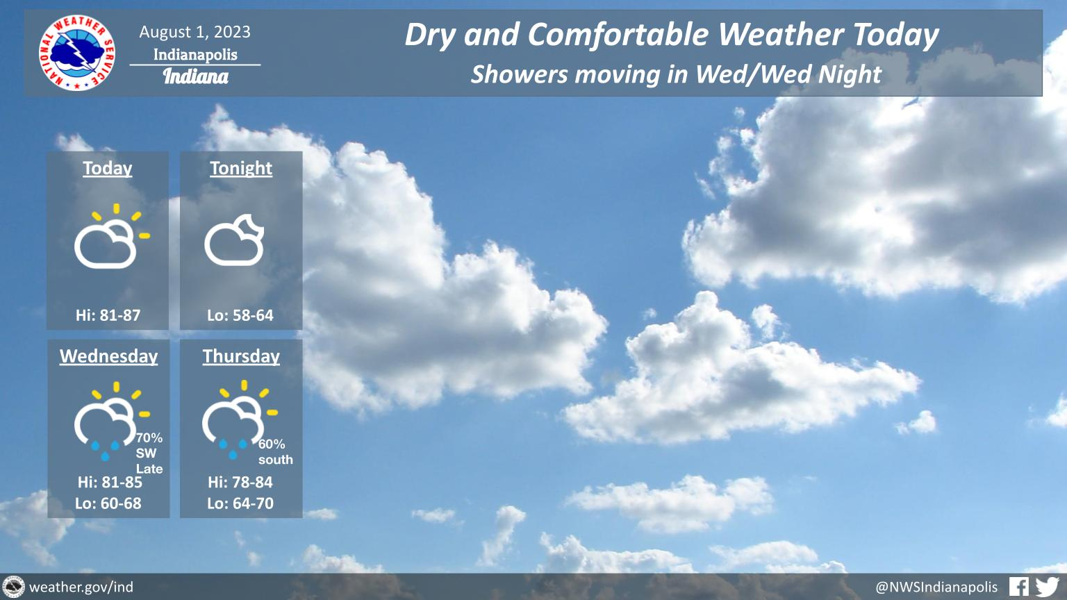
Today will see partly sunny skies, seasonable temperatures with afternoon highs in the 80s and comfortable humidity levels.
INDIANAPOLIS DAILY CLIMATE DATA
INDIANAPOLIS 7-DAY EXTENDED FORECAST
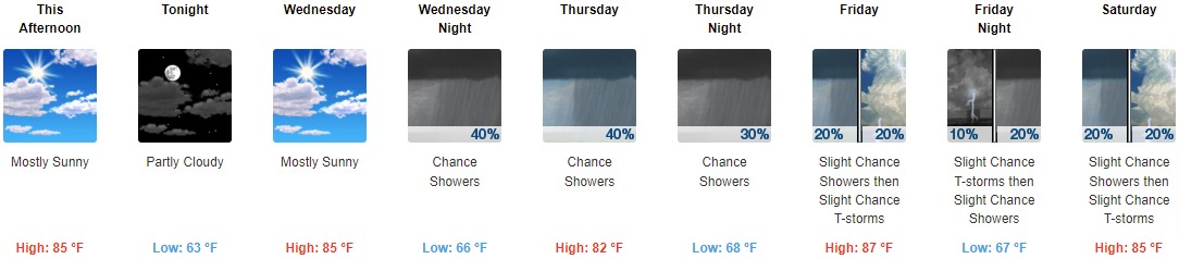
This Afternoon: Mostly sunny, with a high near 85. Southeast wind around 6 mph.
Tonight: Partly cloudy, with a low around 63. East wind 3 to 6 mph.
Wednesday: Mostly sunny, with a high near 85. South wind 6 to 9 mph.
Wednesday Night: A 40 percent chance of showers, mainly after 2am. Mostly cloudy, with a low around 66. South wind around 7 mph.
Thursday: A chance of showers, with thunderstorms also possible after 2pm. Partly sunny, with a high near 82. South southwest wind 7 to 9 mph. Chance of precipitation is 40%.
Thursday Night: A chance of showers and thunderstorms. Mostly cloudy, with a low around 68. Chance of precipitation is 30%.
Friday: A slight chance of showers, with thunderstorms also possible after 2pm. Partly sunny, with a high near 87. Chance of precipitation is 20%.
Friday Night: A slight chance of thunderstorms before 8pm, then a slight chance of showers after 2am. Partly cloudy, with a low around 67. Chance of precipitation is 20%.
Saturday: A slight chance of showers, with thunderstorms also possible after 2pm. Partly sunny, with a high near 85. Chance of precipitation is 20%.
Saturday Night: A chance of showers and thunderstorms before 8pm, then a chance of showers between 8pm and 2am, then a chance of showers and thunderstorms after 2am. Partly cloudy, with a low around 67. Chance of precipitation is 30%.
Sunday: A 40 percent chance of showers and thunderstorms. Partly sunny, with a high near 84.
Sunday Night: A 30 percent chance of showers and thunderstorms. Partly cloudy, with a low around 66.
Monday: A 40 percent chance of showers and thunderstorms. Mostly sunny, with a high near 85.
THE UNITED STATES OF AMERICA 3-DAY OUTLOOK


SOURCE: NWS Indianapolis.
Follow NWS Indianapolis on Twitter @NWSIndianapolis for the latest Indianapolis area weather news.