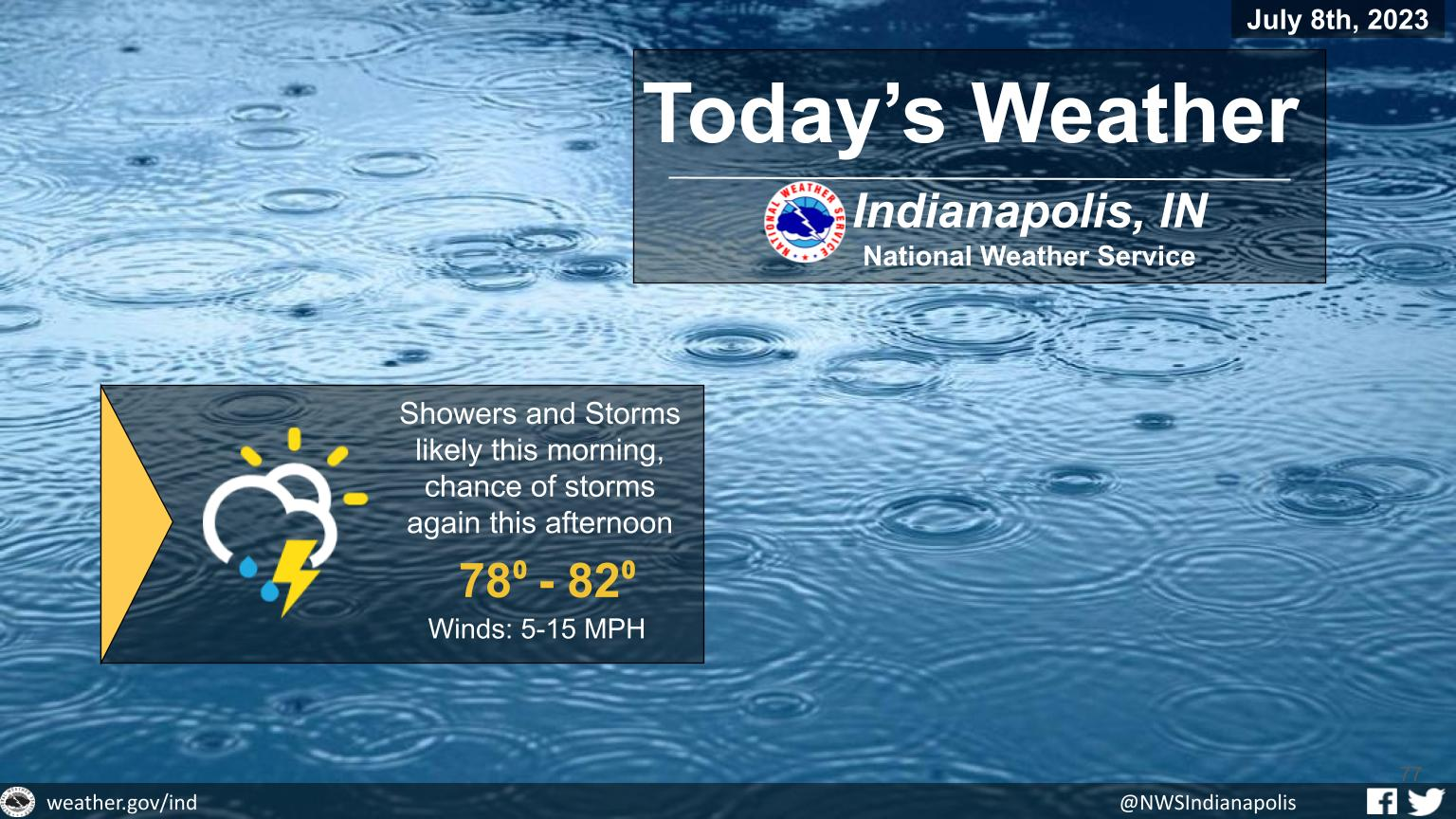
Rain with embedded thunderstorms is currently moving across Indiana.
Locally heavy rainfall is possible at times this morning, before the storms begin to dissipate.
A second round of storms is possible later this afternoon, a few of which could be strong to severe.
INDIANAPOLIS 7-DAY EXTENDED FORECAST
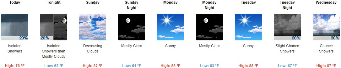
Today: Isolated showers before 1pm, then isolated showers after 5pm. Mostly cloudy, with a high near 76. South wind 6 to 10 mph becoming west in the afternoon. Chance of precipitation is 20%.
Tonight: Isolated showers before 11pm. Mostly cloudy, with a low around 62. North northwest wind around 8 mph. Chance of precipitation is 20%.
Sunday: Mostly cloudy, then gradually becoming sunny, with a high near 82. North wind 7 to 10 mph.
Sunday Night: Mostly clear, with a low around 61. North northwest wind 3 to 8 mph.
Monday: Sunny, with a high near 85. West wind 3 to 6 mph.
Monday Night: Mostly clear, with a low around 63.
Tuesday: Sunny, with a high near 88.
Tuesday Night: A 20 percent chance of showers before 2am. Partly cloudy, with a low around 67.
Wednesday: A slight chance of showers between 8am and 2pm, then a chance of showers and thunderstorms after 2pm. Mostly sunny, with a high near 87. Chance of precipitation is 30%.
Wednesday Night: A chance of showers and thunderstorms. Mostly cloudy, with a low around 69. Chance of precipitation is 50%.
Thursday: A 50 percent chance of showers and thunderstorms. Partly sunny, with a high near 83.
Thursday Night: A 30 percent chance of showers and thunderstorms. Partly cloudy, with a low around 66.
Friday: A 40 percent chance of showers and thunderstorms. Partly sunny, with a high near 85.
THE UNITED STATES OF AMERICA 3-DAY OUTLOOK


SOURCE: NWS Indianapolis.
Follow NWS Indianapolis on Twitter @NWSIndianapolis for the latest Indianapolis area weather news.