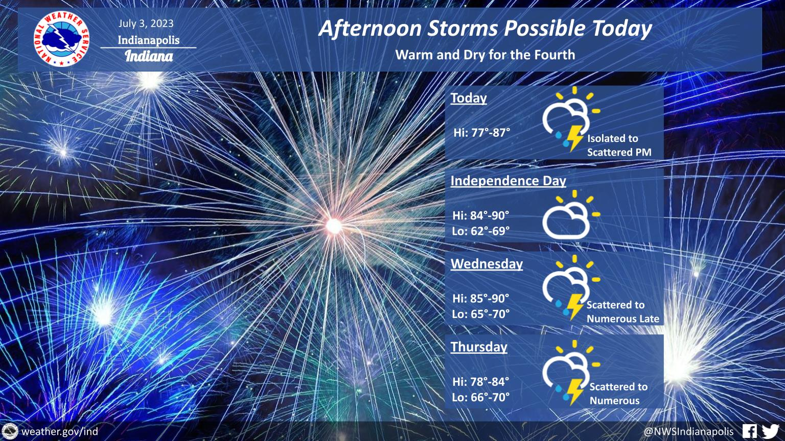
Isolated to scattered afternoon thunderstorms are possible today, but dry weather is expected from tonight through early Wednesday, including for the Fourth.
Storm chances return Wednesday afternoon onward, with an isolated severe threat possible Wednesday afternoon and night.
INDIANAPOLIS 7-DAY EXTENDED FORECAST
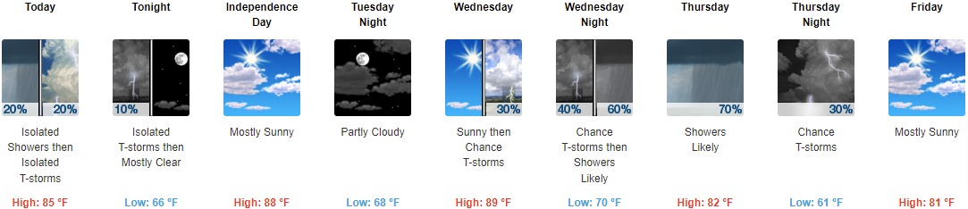
Today: Isolated showers between 10am and 2pm, then isolated showers and thunderstorms after 2pm. Partly sunny, with a high near 85. Northwest wind 7 to 10 mph. Chance of precipitation is 20%.
Tonight: Isolated thunderstorms before 7pm. Mostly cloudy, then gradually becoming clear, with a low around 66. Northwest wind 5 to 8 mph becoming calm in the evening. Chance of precipitation is 10%.
Independence Day: Mostly sunny, with a high near 88. Calm wind becoming west 5 to 7 mph in the morning.
Tuesday Night: Partly cloudy, with a low around 68. South wind 3 to 6 mph.
Wednesday: A 30 percent chance of showers and thunderstorms after 2pm. Sunny, with a high near 89. South southwest wind 6 to 9 mph.
Wednesday Night: A chance of showers and thunderstorms, then showers likely and possibly a thunderstorm after 2am. Mostly cloudy, with a low around 70. Chance of precipitation is 60%. New rainfall amounts between a quarter and half of an inch possible.
Thursday: Showers likely and possibly a thunderstorm. Mostly cloudy, with a high near 82. Chance of precipitation is 70%.
Thursday Night: A 30 percent chance of showers and thunderstorms, mainly before 8pm. Mostly cloudy, with a low around 61.
Friday: Mostly sunny, with a high near 81.
Friday Night: Partly cloudy, with a low around 60.
Saturday: Mostly sunny, with a high near 82.
Saturday Night: A 30 percent chance of showers and thunderstorms. Mostly cloudy, with a low around 63.
Sunday: A 40 percent chance of showers and thunderstorms. Partly sunny, with a high near 83.
THE UNITED STATES OF AMERICA 3-DAY OUTLOOK


SOURCE: NWS Indianapolis.
Follow NWS Indianapolis on Twitter @NWSIndianapolis for the latest Indianapolis area weather news.