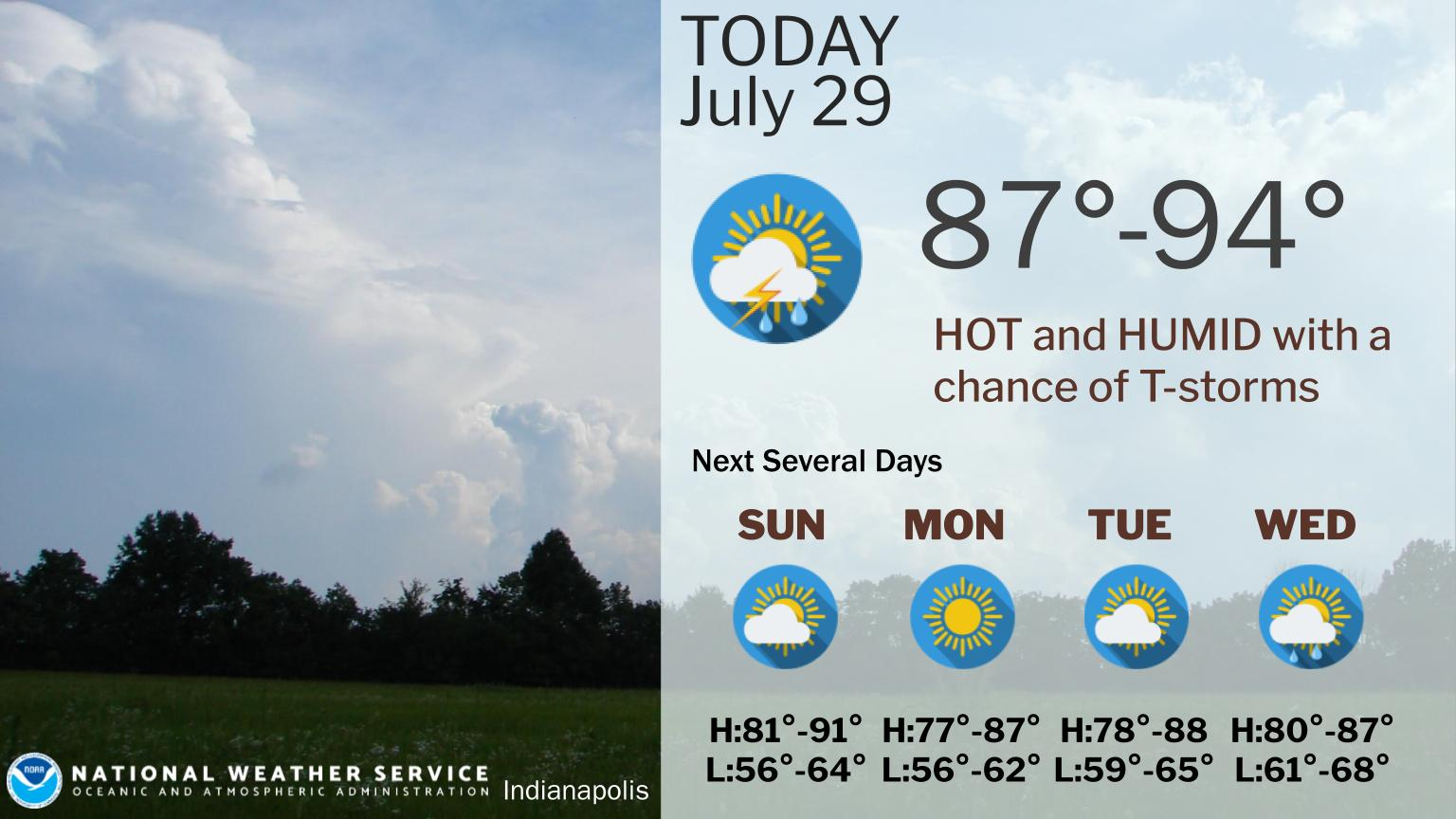
It will be HOT AND HUMID yet again today.
Afternoon temperatures will be in the upper 80s in northern Indiana and mid 90s in southwestern Indiana.
Heat Indices mid 90s in northern Indiana to around 105 in southwestern Indiana.
Chance of morning and evening storms, especially south, where a few could be strong or severe this afternoon.
Damaging winds and large hail are possible along with heavy rain and lightning.
CENTRAL INDIANA RECORDS
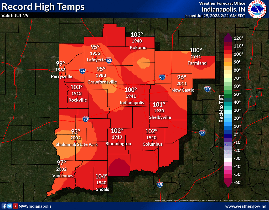
Don’t trust legacy media weather reporting as fact without looking into it yourself. Here are the actual record high and lows for the day. Note the dates.
INDIANAPOLIS 7-DAY EXTENDED FORECAST
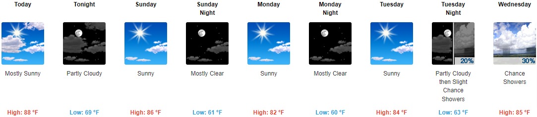
Today: Mostly sunny, with a high near 88. Northwest wind around 10 mph.
Tonight: Partly cloudy, with a low around 69. North wind 7 to 9 mph.
Sunday: Sunny, with a high near 86. North wind 6 to 9 mph.
Sunday Night: Mostly clear, with a low around 61. North wind 9 to 13 mph, with gusts as high as 18 mph.
Monday: Sunny, with a high near 82. North northeast wind around 8 mph.
Monday Night: Mostly clear, with a low around 60.
Tuesday: Sunny, with a high near 84.
Tuesday Night: A 20 percent chance of showers after 2am. Partly cloudy, with a low around 63.
Wednesday: A 30 percent chance of showers, mainly after 8am. Mostly sunny, with a high near 85.
Wednesday Night: A 40 percent chance of showers. Mostly cloudy, with a low around 66.
Thursday: A 30 percent chance of showers and thunderstorms. Partly sunny, with a high near 87.
Thursday Night: A 40 percent chance of showers and thunderstorms. Mostly cloudy, with a low around 70.
Friday: A 30 percent chance of showers and thunderstorms. Partly sunny, with a high near 87.
THE UNITED STATES OF AMERICA 3-DAY OUTLOOK


SOURCE: NWS Indianapolis.
Follow NWS Indianapolis on Twitter @NWSIndianapolis for the latest Indianapolis area weather news.