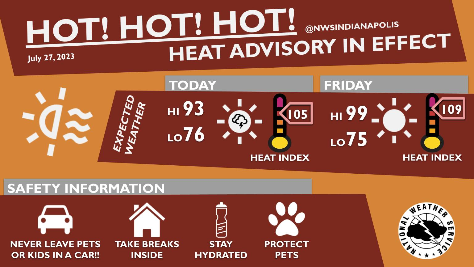
Hot! Hot! Hot! Heat indices are expected to rise above 100 the next few days, meaning that it is going to be very uncomfortable outside during the afternoon hours.
An isolated thunderstorm may fire in South Central Indiana later today.
Check out weather.gov/safety/heat for more heat safety tips, and stay cool these next few days!
INDIANAPOLIS 7-DAY EXTENDED FORECAST
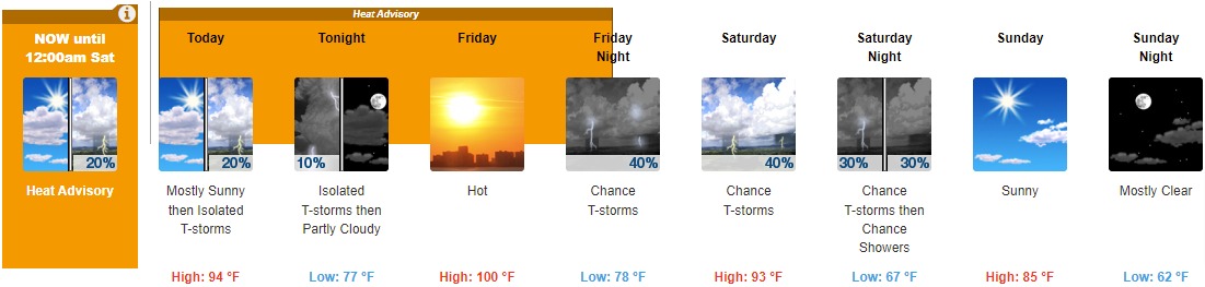
Today: Isolated showers and thunderstorms after 3pm. Mostly sunny and hot, with a high near 94. Heat index values as high as 104. Southwest wind around 8 mph. Chance of precipitation is 20%.
Tonight: Isolated showers and thunderstorms before 8pm. Partly cloudy, with a low around 77. South wind around 6 mph. Chance of precipitation is 10%.
Friday: Mostly sunny and hot, with a high near 100. Heat index values as high as 109. South southwest wind 7 to 10 mph.
Friday Night: A 40 percent chance of showers and thunderstorms. Partly cloudy, with a low around 78. Southwest wind 10 to 16 mph, with gusts as high as 25 mph.
Saturday: A 40 percent chance of showers and thunderstorms, mainly after 2pm. Mostly sunny and hot, with a high near 93. West southwest wind around 10 mph.
Saturday Night: A 30 percent chance of showers and thunderstorms before 2am. Partly cloudy, with a low around 67.
Sunday: Sunny, with a high near 85.
Sunday Night: Mostly clear, with a low around 62.
Monday: Sunny, with a high near 85.
Monday Night: Mostly clear, with a low around 64.
Tuesday: Mostly sunny, with a high near 88.
Tuesday Night: A 20 percent chance of showers. Partly cloudy, with a low around 67.
Wednesday: A 20 percent chance of showers and thunderstorms. Mostly sunny, with a high near 90.
THE UNITED STATES OF AMERICA 3-DAY OUTLOOK


SOURCE: NWS Indianapolis.
Follow NWS Indianapolis on Twitter @NWSIndianapolis for the latest Indianapolis area weather news.