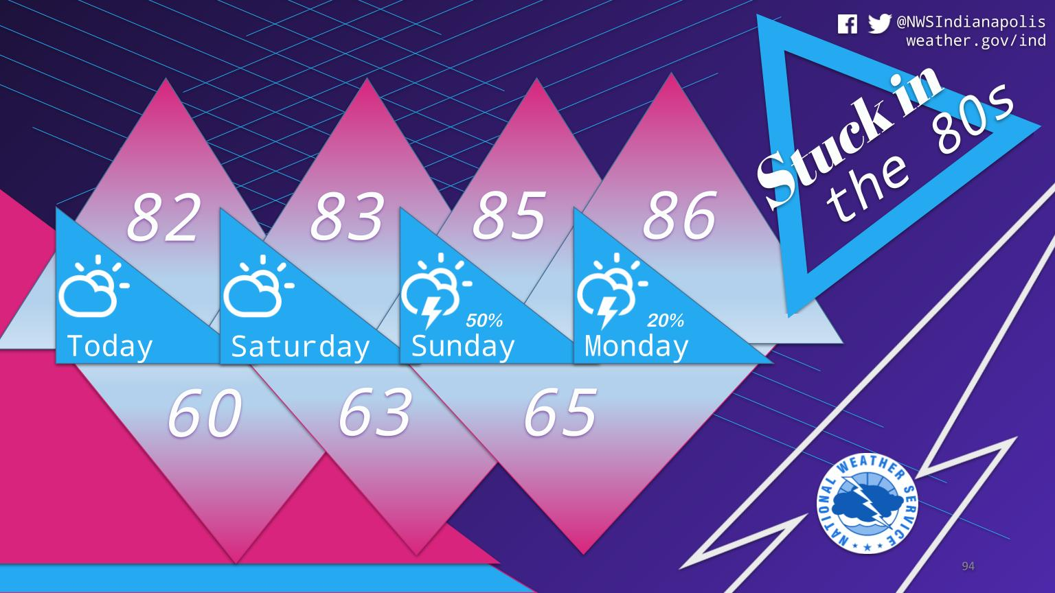
The next several days will be quite comfortable for late July with highs in the low to mid 80s and lower humidity levels.
Mainly dry conditions expected today and tomorrow, then the chances for scattered storms increase on Sunday.
INDIANAPOLIS 7-DAY EXTENDED FORECAST
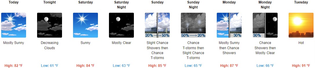
Today: Mostly sunny, with a high near 82. North northwest wind around 9 mph.
Tonight: Mostly cloudy, then gradually becoming clear, with a low around 61. North wind 5 to 8 mph.
Saturday: Sunny, with a high near 84. Calm wind becoming west around 6 mph in the morning.
Saturday Night: Mostly clear, with a low around 63. Northwest wind around 6 mph becoming light and variable after midnight.
Sunday: A slight chance of showers, then a chance of showers and thunderstorms after noon. Mostly sunny, with a high near 85. South southwest wind 5 to 8 mph. Chance of precipitation is 50%. New rainfall amounts of less than a tenth of an inch, except higher amounts possible in thunderstorms.
Sunday Night: A 50 percent chance of showers and thunderstorms, mainly before 9pm. Partly cloudy, with a low around 65. New rainfall amounts of less than a tenth of an inch, except higher amounts possible in thunderstorms.
Monday: A 30 percent chance of showers and thunderstorms after 3pm. Mostly sunny, with a high near 87.
Monday Night: A 30 percent chance of showers and thunderstorms before 9pm. Mostly clear, with a low around 66.
Tuesday: Mostly sunny and hot, with a high near 91.
Tuesday Night: Partly cloudy, with a low around 69.
Wednesday: Mostly sunny and hot, with a high near 92.
Wednesday Night: A 20 percent chance of showers and thunderstorms. Partly cloudy, with a low around 72.
Thursday: A 20 percent chance of showers and thunderstorms. Mostly sunny and hot, with a high near 94.
THE UNITED STATES OF AMERICA 3-DAY OUTLOOK


SOURCE: NWS Indianapolis.
Follow NWS Indianapolis on Twitter @NWSIndianapolis for the latest Indianapolis area weather news.