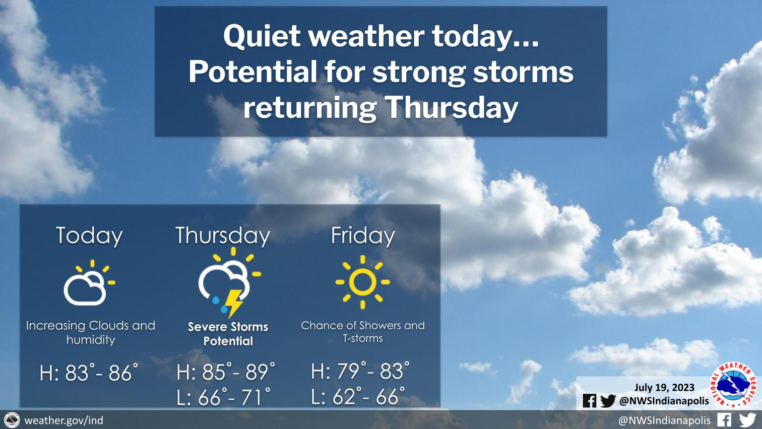
Partly sunny for most of today north of Indy Metro, otherwise increasing clouds further south.
Humidity will be on an increase today with temperatures rising into the middle to upper 80s.
The next chance for precipitation will be Thursday, with some storms possibly becoming severe during the midday and afternoon hours for portions of Central Indiana.
INDIANAPOLIS 7-DAY EXTENDED FORECAST
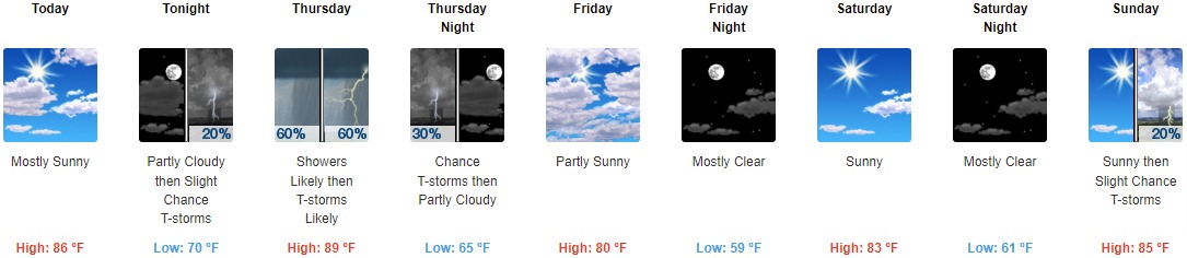
Today: Mostly sunny, with a high near 86. Northeast wind around 6 mph becoming south in the afternoon.
Tonight: A 20 percent chance of showers and thunderstorms after 3am. Partly cloudy, with a low around 70. North northwest wind around 6 mph becoming south southeast after midnight.
Thursday: Showers and thunderstorms likely, mainly before 5pm. Cloudy, with a high near 89. South wind 7 to 11 mph becoming west in the afternoon. Chance of precipitation is 60%. New rainfall amounts of less than a tenth of an inch, except higher amounts possible in thunderstorms.
Thursday Night: A 30 percent chance of showers and thunderstorms before 11pm. Mostly cloudy, then gradually becoming mostly clear, with a low around 65. West northwest wind 7 to 10 mph.
Friday: Partly sunny, with a high near 80. North northwest wind 8 to 10 mph.
Friday Night: Mostly clear, with a low around 59.
Saturday: Sunny, with a high near 83.
Saturday Night: Mostly clear, with a low around 61.
Sunday: A 20 percent chance of showers and thunderstorms after 2pm. Sunny, with a high near 85.
Sunday Night: A 20 percent chance of showers and thunderstorms. Partly cloudy, with a low around 65.
Monday: A 30 percent chance of showers and thunderstorms. Mostly sunny, with a high near 86.
Monday Night: A 30 percent chance of showers and thunderstorms. Partly cloudy, with a low around 66.
Tuesday: A 20 percent chance of showers and thunderstorms. Mostly sunny, with a high near 89.
THE UNITED STATES OF AMERICA 3-DAY OUTLOOK


SOURCE: NWS Indianapolis.
Follow NWS Indianapolis on Twitter @NWSIndianapolis for the latest Indianapolis area weather news.