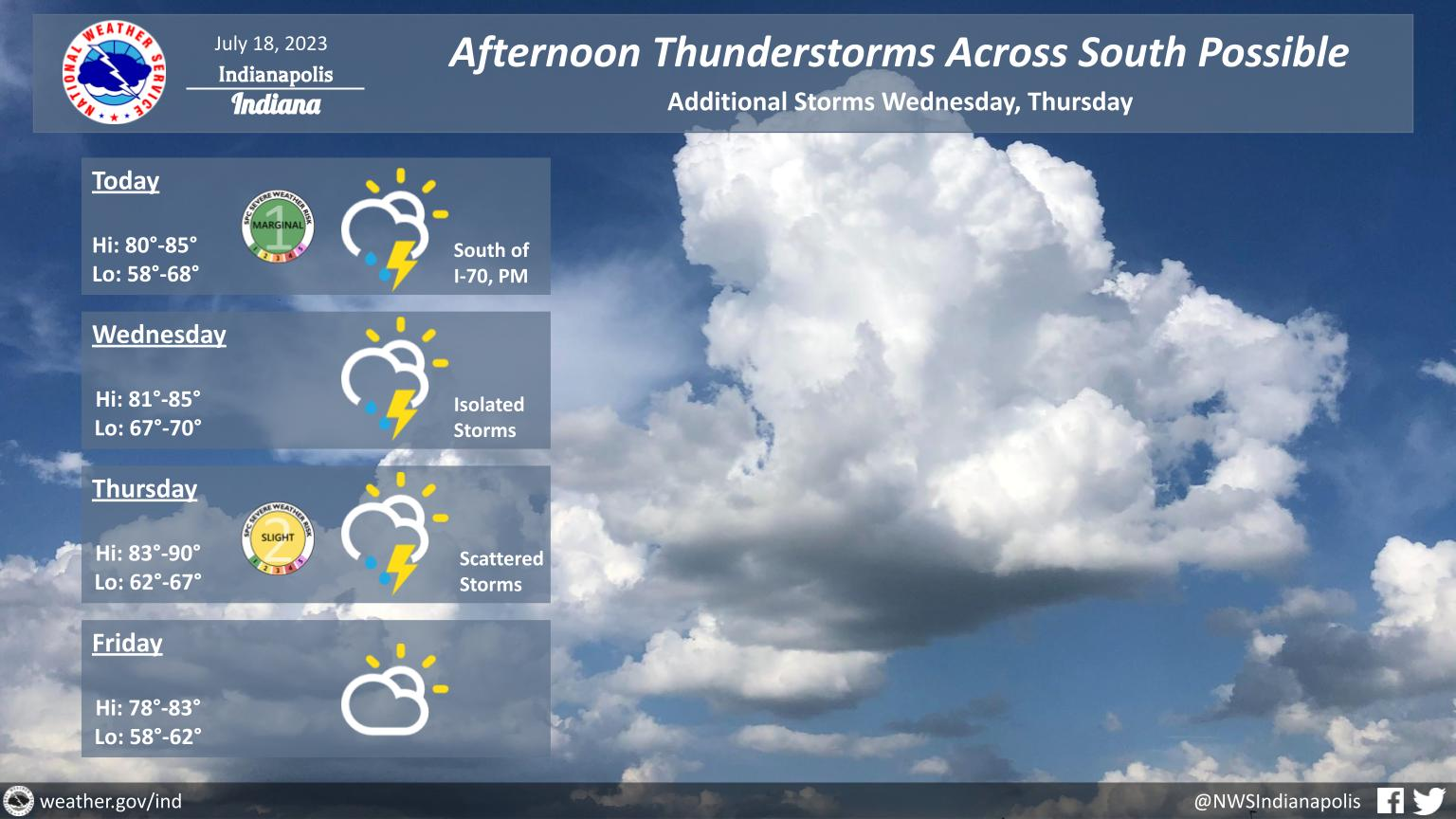
Thunderstorm chances continue over the next few days with a slight cool down coming Friday.
Storms today should stay to the south of I-70 with some potentially becoming strong to severe.
Thursday will again have the potential for storms to be severe.
Damaging winds, hail, and localized flooding will all be possible within stronger storms.
INDIANAPOLIS 7-DAY EXTENDED FORECAST
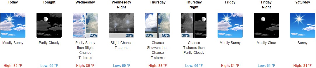
Today: Mostly sunny, with a high near 83. West wind 5 to 8 mph.
Tonight: Partly cloudy, with a low around 65. North wind around 6 mph becoming east northeast after midnight.
Wednesday: A 20 percent chance of showers and thunderstorms after 2pm. Partly sunny, with a high near 85. East northeast wind 5 to 7 mph becoming southeast in the afternoon.
Wednesday Night: A 20 percent chance of showers and thunderstorms. Partly cloudy, with a low around 69. South southeast wind 3 to 6 mph.
Thursday: A 50 percent chance of showers and thunderstorms. Partly sunny, with a high near 88. South wind 5 to 11 mph becoming west in the afternoon. New rainfall amounts of less than a tenth of an inch, except higher amounts possible in thunderstorms.
Thursday Night: A chance of thunderstorms before 8pm. Partly cloudy, with a low around 66. Chance of precipitation is 30%.
Friday: Mostly sunny, with a high near 81.
Friday Night: Mostly clear, with a low around 61.
Saturday: Sunny, with a high near 81.
Saturday Night: Mostly clear, with a low around 61.
Sunday: Sunny, with a high near 84.
Sunday Night: Partly cloudy, with a low around 64.
Monday: A 20 percent chance of showers and thunderstorms. Mostly sunny, with a high near 85.
THE UNITED STATES OF AMERICA 3-DAY OUTLOOK


SOURCE: NWS Indianapolis.
Follow NWS Indianapolis on Twitter @NWSIndianapolis for the latest Indianapolis area weather news.