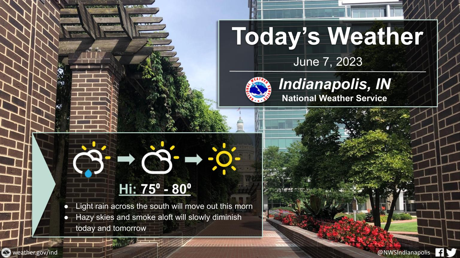
Light rain will come to an end by midday and skies will mostly clear out by late in the day.
Hazy and smoky conditions aloft will continue but will be dissipating through tomorrow as winds shift direction.
INDIANAPOLIS 7-DAY EXTENDED FORECAST
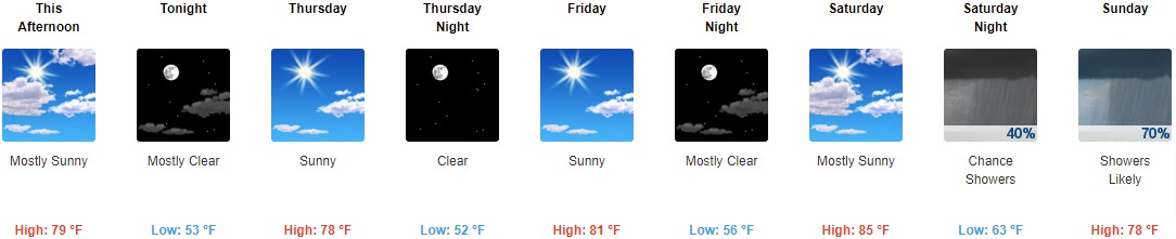
This Afternoon: Mostly sunny, with a high near 79. North northeast wind 7 to 9 mph.
Tonight: Mostly clear, with a low around 53. North wind 7 to 9 mph.
Thursday: Sunny, with a high near 78. East northeast wind around 9 mph.
Thursday Night: Clear, with a low around 52. North wind 8 to 10 mph.
Friday: Sunny, with a high near 81. North northwest wind around 8 mph.
Friday Night: Mostly clear, with a low around 56.
Saturday: Mostly sunny, with a high near 85.
Saturday Night: A 40 percent chance of showers, mainly after 2am. Mostly cloudy, with a low around 63.
Sunday: Showers likely, mainly after 8am. Mostly cloudy, with a high near 78. Chance of precipitation is 70%.
Sunday Night: A chance of showers and thunderstorms. Mostly cloudy, with a low around 56. Chance of precipitation is 40%.
Monday: A 40 percent chance of showers. Mostly sunny, with a high near 76.
Monday Night: A 30 percent chance of showers. Partly cloudy, with a low around 56.
Tuesday: A 30 percent chance of showers. Sunny, with a high near 81.
THE UNITED STATES OF AMERICA 3-DAY OUTLOOK


SOURCE: NWS Indianapolis.
Follow NWS Indianapolis on Twitter @NWSIndianapolis for the latest Indianapolis area weather news.