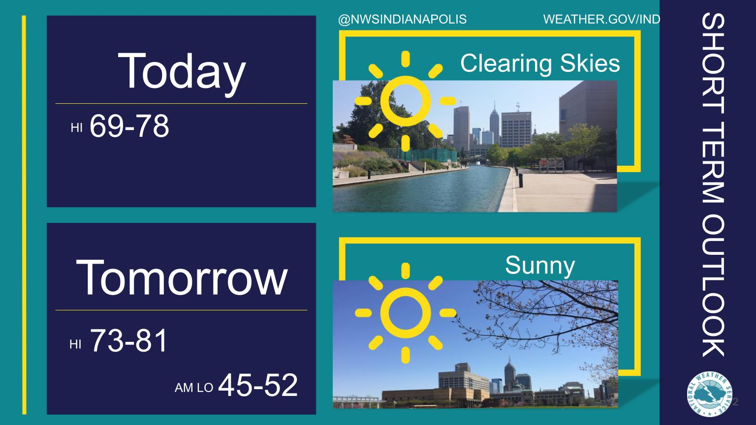
After skies clear this morning, expect sunny skies and highs in the upper 60s to upper 70s.
Wednesday will start cool, with lows in the mid 40s to low 50s, followed by a very pleasant day with highs in the low 70s to around 80 across central Indiana.
INDIANAPOLIS 7-DAY EXTENDED FORECAST
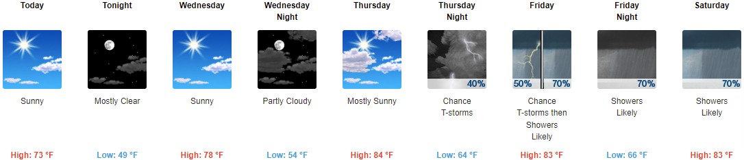
Today: Sunny, with a high near 73. Northeast wind around 10 mph.
Tonight: Mostly clear, with a low around 49. Northeast wind around 7 mph.
Wednesday: Sunny, with a high near 78. East southeast wind 7 to 9 mph.
Wednesday Night: Partly cloudy, with a low around 54. East southeast wind 6 to 8 mph.
Thursday: Mostly sunny, with a high near 84. South southeast wind 8 to 10 mph.
Thursday Night: A 40 percent chance of showers and thunderstorms, mainly after 2am. Mostly cloudy, with a low around 64.
Friday: A chance of showers and thunderstorms, then showers likely and possibly a thunderstorm after 2pm. Mostly cloudy, with a high near 83. Chance of precipitation is 70%.
Friday Night: Showers likely and possibly a thunderstorm before 2am, then a chance of showers and thunderstorms after 2am. Mostly cloudy, with a low around 66. Chance of precipitation is 70%.
Saturday: A chance of showers and thunderstorms before 8am, then showers likely between 8am and 2pm, then showers likely and possibly a thunderstorm after 2pm. Mostly cloudy, with a high near 83. Chance of precipitation is 70%.
Saturday Night: A chance of showers and thunderstorms. Mostly cloudy, with a low around 64. Chance of precipitation is 50%.
Sunday: Showers likely and possibly a thunderstorm. Mostly cloudy, with a high near 78. Chance of precipitation is 60%.
Sunday Night: Showers likely and possibly a thunderstorm. Mostly cloudy, with a low around 52. Chance of precipitation is 60%.
Monday: A 10 percent chance of showers. Partly sunny, with a high near 70.
THE UNITED STATES OF AMERICA 3-DAY OUTLOOK


SOURCE: NWS Indianapolis.
Follow NWS Indianapolis on Twitter @NWSIndianapolis for the latest Indianapolis area weather news.