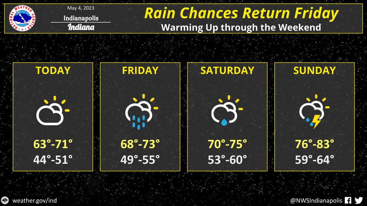
Look for partly to mostly sunny skies today, with highs in the lower 60s to around 70.
Clouds will increase some tonight with lows in the middle 40s to around 50.
Rain chances return to areas mainly along and south of I-74 Friday afternoon and night.
Highs on Friday will be in the upper 60s to lower 70s.
Rain chances and warmer temperatures will continue for the weekend.
INDIANAPOLIS 7-DAY EXTENDED FORECAST
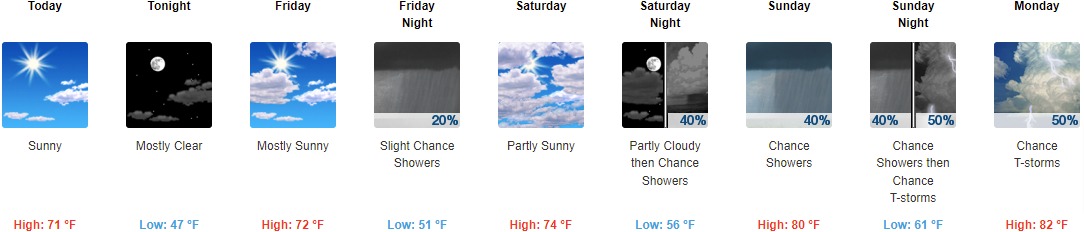
Today: Sunny, with a high near 71. Calm wind becoming west northwest around 6 mph in the afternoon.
Tonight: Mostly clear, with a low around 47. Southeast wind 3 to 8 mph.
Friday: Mostly sunny, with a high near 72. South southeast wind 9 to 11 mph.
Friday Night: A 20 percent chance of showers. Mostly cloudy, with a low around 51. South southeast wind around 9 mph.
Saturday: Partly sunny, with a high near 74. Southeast wind 10 to 13 mph, with gusts as high as 21 mph.
Saturday Night: A 40 percent chance of showers and thunderstorms after 2am. Partly cloudy, with a low around 56.
Sunday: A 40 percent chance of showers and thunderstorms. Partly sunny, with a high near 80.
Sunday Night: A 50 percent chance of showers and thunderstorms. Mostly cloudy, with a low around 61.
Monday: A 50 percent chance of showers and thunderstorms. Partly sunny, with a high near 82.
Monday Night: A chance of showers and thunderstorms. Mostly cloudy, with a low around 61. Chance of precipitation is 50%.
Tuesday: A 50 percent chance of showers and thunderstorms. Partly sunny, with a high near 81.
Tuesday Night: A 40 percent chance of showers and thunderstorms. Partly cloudy, with a low around 58.
Wednesday: A 30 percent chance of showers. Mostly sunny, with a high near 78.
THE UNITED STATES OF AMERICA 3-DAY OUTLOOK


SOURCE: NWS Indianapolis.
Follow NWS Indianapolis on Twitter @NWSIndianapolis for the latest Indianapolis area weather news.