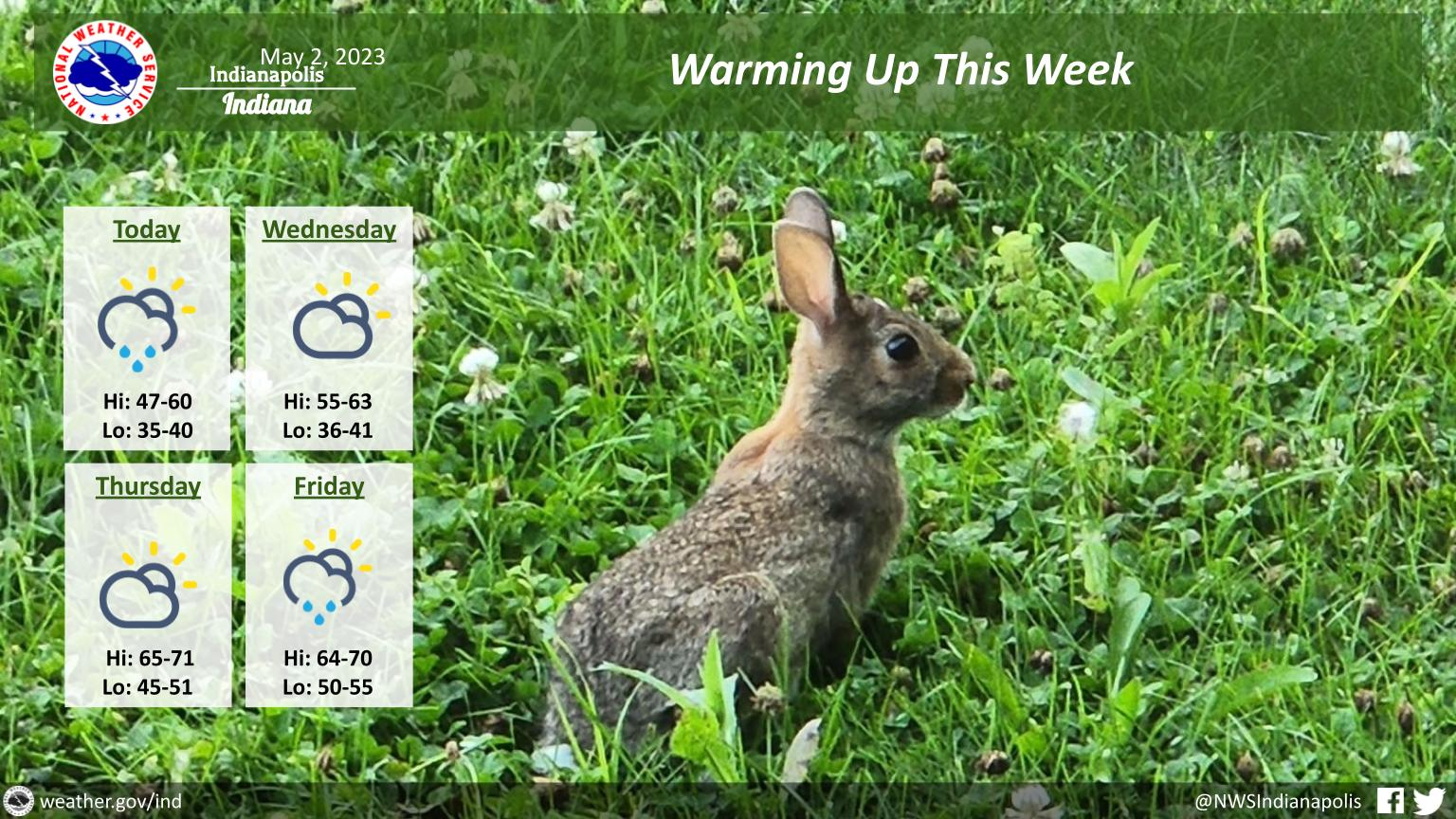
Look for a few showers to continue today into this evening under partly to mostly cloudy skies.
High temperatures will range from the upper 40s northeast to around 60 southwest.
Lows tonight will generally be in the 30s.
Wednesday and Thursday will be dry and warmer, but rain chances return on Friday.
INDIANAPOLIS 7-DAY EXTENDED FORECAST
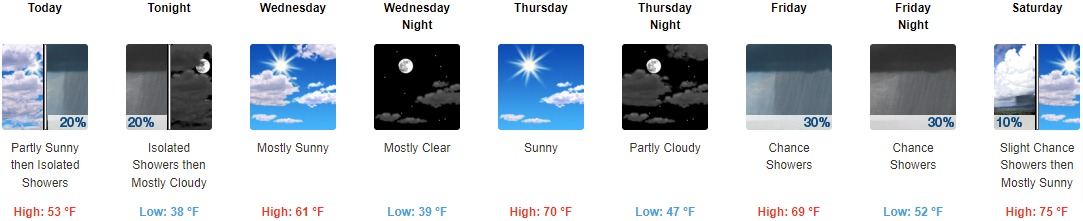
Today: Isolated showers between 1pm and 2pm. Mostly cloudy, with a high near 53. West northwest wind around 18 mph, with gusts as high as 29 mph. Chance of precipitation is 20%.
Tonight: Isolated showers before 11pm. Mostly cloudy, with a low around 38. Northwest wind 14 to 16 mph, with gusts as high as 24 mph. Chance of precipitation is 20%.
Wednesday: Mostly sunny, with a high near 61. Northwest wind around 14 mph, with gusts as high as 23 mph.
Wednesday Night: Mostly clear, with a low around 39. North northwest wind 5 to 10 mph.
Thursday: Sunny, with a high near 70. West wind 3 to 7 mph.
Thursday Night: Partly cloudy, with a low around 47.
Friday: A 30 percent chance of showers, mainly after 2pm. Mostly cloudy, with a high near 69.
Friday Night: A 30 percent chance of showers, mainly before 2am. Mostly cloudy, with a low around 52.
Saturday: A 10 percent chance of showers before 8am. Mostly sunny, with a high near 75.
Saturday Night: Partly cloudy, with a low around 55.
Sunday: A 30 percent chance of showers and thunderstorms. Mostly sunny, with a high near 80.
Sunday Night: A 30 percent chance of showers and thunderstorms. Partly cloudy, with a low around 59.
Monday: A 40 percent chance of showers and thunderstorms. Partly sunny, with a high near 83.
THE UNITED STATES OF AMERICA 3-DAY OUTLOOK


SOURCE: NWS Indianapolis.
Follow NWS Indianapolis on Twitter @NWSIndianapolis for the latest Indianapolis area weather news.