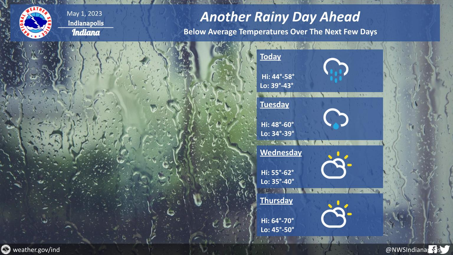
Expect scattered showers through the morning with more widespread rain later today, mainly across the NE half of central Indiana.
Light showers may linger into Tuesday, but sunshine will return midweek!
Temperatures will be below normal over the next few days.
INDIANAPOLIS 7-DAY EXTENDED FORECAST
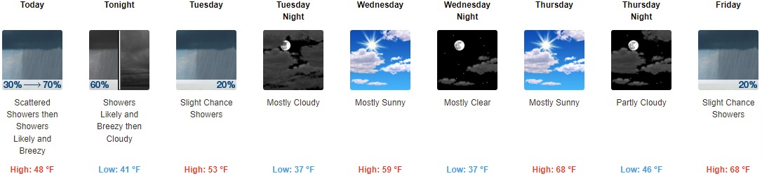
Today: Showers likely, mainly after 2pm. Cloudy, with a high near 48. Breezy, with a west wind 16 to 22 mph, with gusts as high as 38 mph. Chance of precipitation is 70%. New precipitation amounts of less than a tenth of an inch possible.
Tonight: Showers likely, mainly before 10pm. Cloudy, with a low around 41. Breezy, with a west northwest wind 16 to 21 mph, with gusts as high as 34 mph. Chance of precipitation is 60%. New precipitation amounts of less than a tenth of an inch possible.
Tuesday: A 20 percent chance of showers. Mostly cloudy, with a high near 53. West northwest wind around 18 mph, with gusts as high as 28 mph.
Tuesday Night: Mostly cloudy, with a low around 37. Northwest wind around 14 mph, with gusts as high as 22 mph.
Wednesday: Mostly sunny, with a high near 59. Northwest wind around 14 mph, with gusts as high as 22 mph.
Wednesday Night: Mostly clear, with a low around 37.
Thursday: Mostly sunny, with a high near 68.
Thursday Night: Partly cloudy, with a low around 46.
Friday: A 20 percent chance of showers. Partly sunny, with a high near 68.
Friday Night: A 20 percent chance of showers before 2am. Mostly cloudy, with a low around 49.
Saturday: Mostly sunny, with a high near 73.
Saturday Night: Mostly clear, with a low around 50.
Sunday: Mostly sunny, with a high near 77.
THE UNITED STATES OF AMERICA 3-DAY OUTLOOK


SOURCE: NWS Indianapolis.
Follow NWS Indianapolis on Twitter @NWSIndianapolis for the latest Indianapolis area weather news.