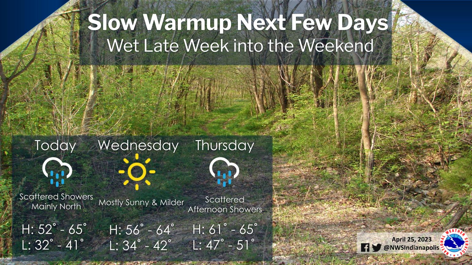
Scattered light showers are possible mainly through midday across the northern half of central Indiana as a weak frontal boundary passes.
Dry and chilly conditions will settle in tonight with the potential for patchy frost north of I-70.
Sunny and milder conditions are expected for Wednesday before an unsettled pattern develops with periodic chances for rain beginning Thursday and extending into this weekend.
INDIANAPOLIS 7-DAY EXTENDED FORECAST
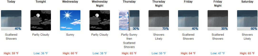
Today: Scattered showers, mainly before 2pm. Cloudy, with a high near 59. South wind 7 to 13 mph becoming west southwest in the afternoon. Winds could gust as high as 18 mph. Chance of precipitation is 40%.
Tonight: Partly cloudy, with a low around 36. North northeast wind 8 to 10 mph.
Wednesday: Sunny, with a high near 60. North northeast wind around 7 mph.
Wednesday Night: Partly cloudy, with a low around 38. Northeast wind around 6 mph.
Thursday: Scattered showers after 2pm. Partly sunny, with a high near 65. East southeast wind 7 to 10 mph. Chance of precipitation is 30%.
Thursday Night: Showers likely, with thunderstorms also possible after 5am. Mostly cloudy, with a low around 50. Chance of precipitation is 70%. New rainfall amounts between a tenth and quarter of an inch, except higher amounts possible in thunderstorms.
Friday: Scattered showers and thunderstorms. Mostly cloudy, with a high near 64. Chance of precipitation is 40%.
Friday Night: Scattered showers. Mostly cloudy, with a low around 47. Chance of precipitation is 30%.
Saturday: Showers likely, mainly after 2pm. Mostly cloudy, with a high near 65. Chance of precipitation is 60%.
Saturday Night: Showers likely, mainly before 2am. Mostly cloudy, with a low around 44. Chance of precipitation is 60%.
Sunday: Showers likely. Mostly cloudy, with a high near 56. Chance of precipitation is 60%.
Sunday Night: Scattered showers. Mostly cloudy, with a low around 41. Chance of precipitation is 40%.
Monday: Scattered showers. Partly sunny, with a high near 55. Chance of precipitation is 50%.
THE UNITED STATES OF AMERICA 3-DAY OUTLOOK


SOURCE: NWS Indianapolis.
Follow NWS Indianapolis on Twitter @NWSIndianapolis for the latest Indianapolis area weather news.