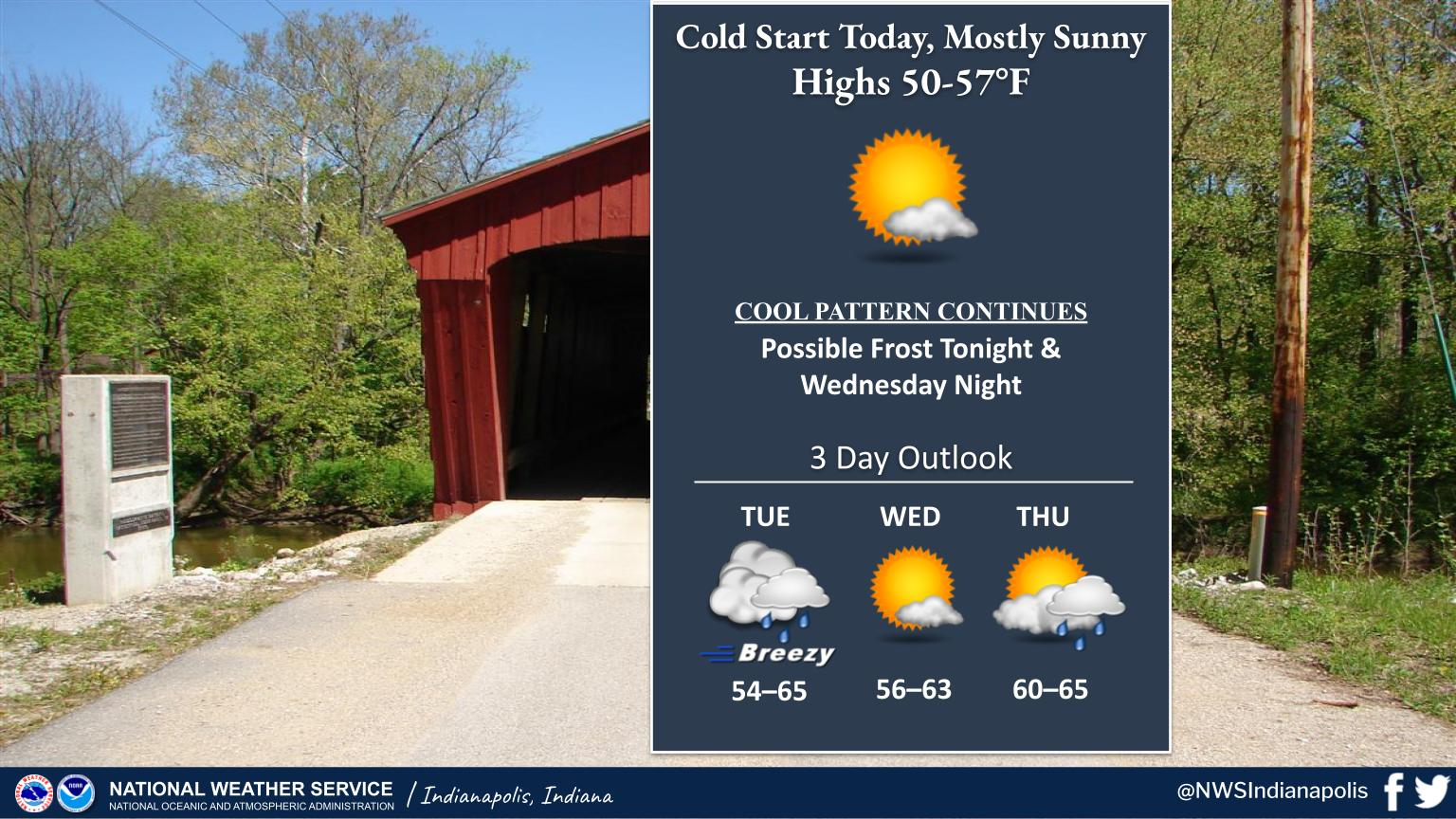
Freeze Warning in effect through 9:00am this morning for temperatures as low as 28F before strong sun rebounds temps into the 50s.
A weak cold front will make for a breezy Tuesday with a few showers.
Continued cool this week.
INDIANAPOLIS 7-DAY EXTENDED FORECAST
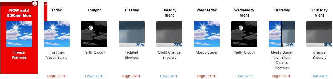
Today: Widespread frost before 8am. Otherwise, increasing clouds, with a high near 55. Light west wind becoming west northwest 5 to 9 mph in the morning.
Tonight: Partly cloudy, with a low around 38. West northwest wind around 5 mph becoming calm.
Tuesday: Isolated showers. Mostly cloudy, with a high near 59. South wind 7 to 14 mph becoming west southwest in the afternoon. Winds could gust as high as 21 mph. Chance of precipitation is 20%.
Tuesday Night: A 20 percent chance of showers before 2am. Mostly cloudy, with a low around 39. North northeast wind 7 to 9 mph.
Wednesday: Mostly sunny, with a high near 61. North northeast wind around 9 mph.
Wednesday Night: Partly cloudy, with a low around 37.
Thursday: A 20 percent chance of showers after 2pm. Mostly sunny, with a high near 63.
Thursday Night: A 30 percent chance of showers, mainly after 8pm. Mostly cloudy, with a low around 46.
Friday: A 30 percent chance of showers, mainly after 2pm. Mostly cloudy, with a high near 64.
Friday Night: A 40 percent chance of showers. Mostly cloudy, with a low around 47.
Saturday: Showers likely. Mostly cloudy, with a high near 62. Chance of precipitation is 60%.
Saturday Night: Showers likely. Mostly cloudy, with a low around 45. Chance of precipitation is 60%.
Sunday: A 50 percent chance of showers. Mostly cloudy, with a high near 56.
THE UNITED STATES OF AMERICA 3-DAY OUTLOOK


SOURCE: NWS Indianapolis.
Follow NWS Indianapolis on Twitter @NWSIndianapolis for the latest Indianapolis area weather news.