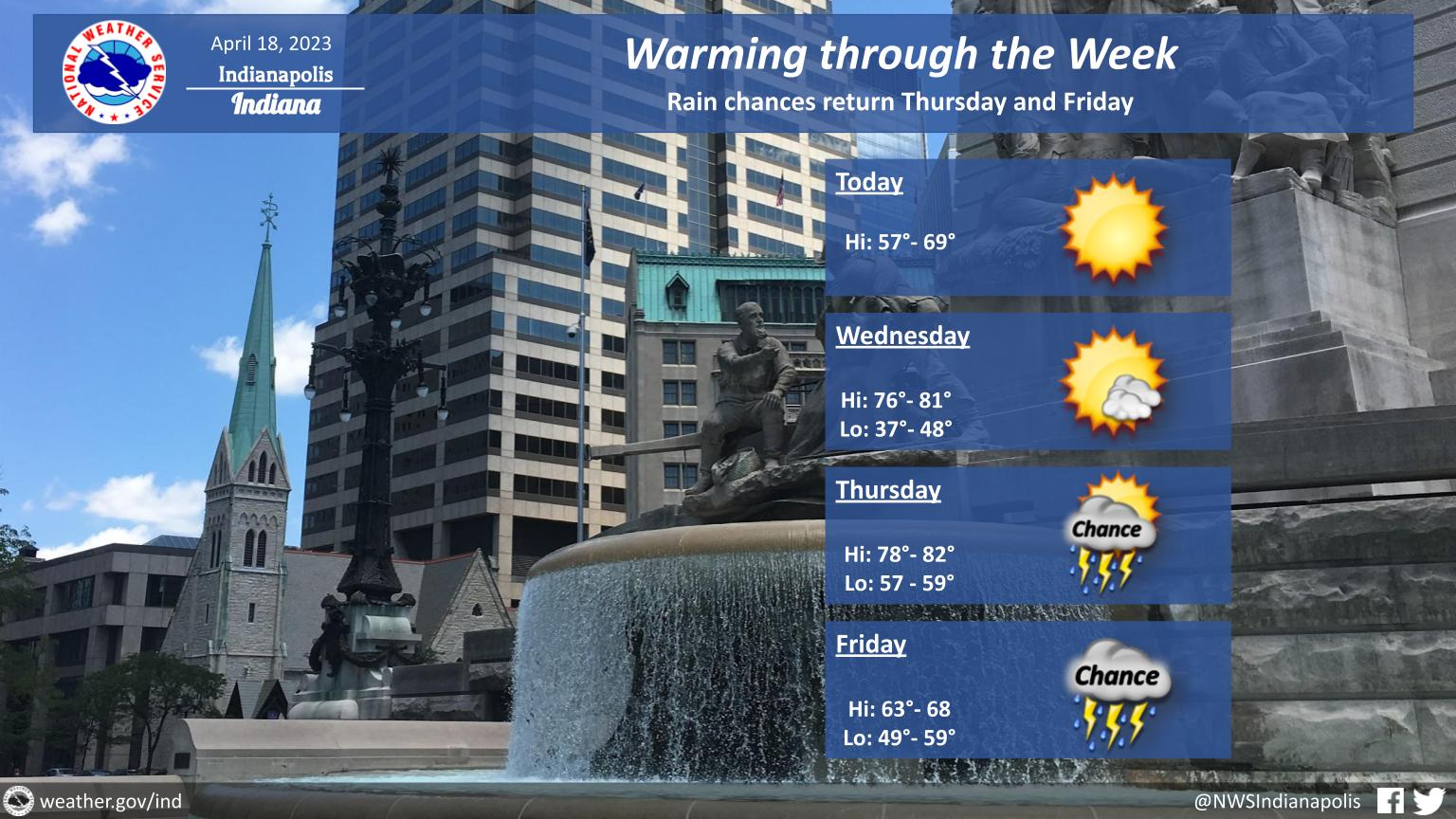
Look for sunny skies this afternoon with temperatures warming back to the upper 50s and 60s.
Temperatures will then soar back up to the upper 70s on Wednesday and Thursday.
Rain chances return Thursday and Friday.
INDIANAPOLIS 7-DAY EXTENDED FORECAST
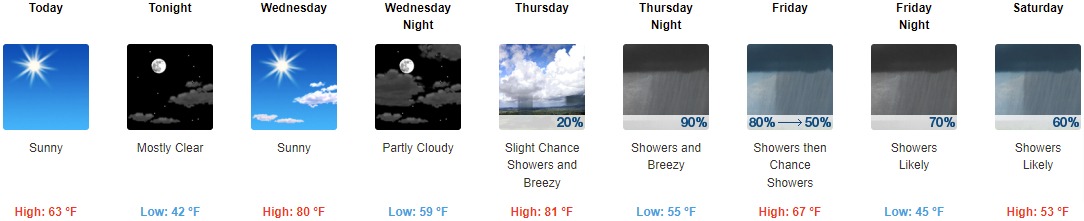
Today: Sunny, with a high near 63. West wind around 10 mph.
Tonight: Mostly clear, with a low around 42. West northwest wind 5 to 7 mph becoming east after midnight.
Wednesday: Sunny, with a high near 80. Southeast wind 10 to 16 mph becoming south southwest in the afternoon. Winds could gust as high as 24 mph.
Wednesday Night: Partly cloudy, with a low around 59. South wind around 14 mph, with gusts as high as 22 mph.
Thursday: A 20 percent chance of showers. Mostly sunny, with a high near 81. Breezy, with a south southwest wind 15 to 24 mph, with gusts as high as 37 mph.
Thursday Night: Showers and possibly a thunderstorm. Low around 55. Breezy. Chance of precipitation is 90%. New rainfall amounts between a half and three quarters of an inch possible.
Friday: Showers, mainly before 8am. High near 67. Chance of precipitation is 80%.
Friday Night: Showers likely. Mostly cloudy, with a low around 45. Chance of precipitation is 70%.
Saturday: Showers likely, mainly after 2pm. Mostly cloudy, with a high near 53. Chance of precipitation is 60%.
Saturday Night: Showers likely, mainly before 8pm. Mostly cloudy, with a low around 35. Chance of precipitation is 60%.
Sunday: A 20 percent chance of showers. Partly sunny, with a high near 50.
Sunday Night: Partly cloudy, with a low around 34.
Monday: Mostly sunny, with a high near 57.
THE UNITED STATES OF AMERICA 3-DAY OUTLOOK


SOURCE: NWS Indianapolis.
Follow NWS Indianapolis on Twitter @NWSIndianapolis for the latest Indianapolis area weather news.