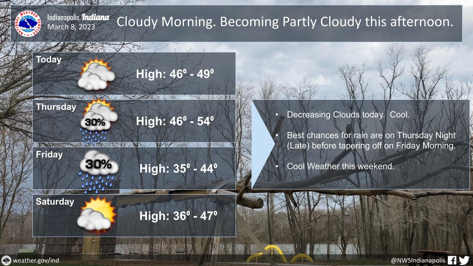
Look for cloudy skies this morning, but some clearing this afternoon.
Highs will reach the middle to upper 40s.
Rain is expected to arrive Thursday afternoon into Thursday night, tapering off Friday.
INDIANAPOLIS 7-DAY EXTENDED FORECAST
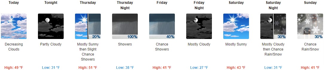
Today: Cloudy, then gradually becoming mostly sunny, with a high near 49. East wind 10 to 13 mph, with gusts as high as 20 mph.
Tonight: Partly cloudy, with a low around 31. East wind 9 to 13 mph, with gusts as high as 21 mph.
Thursday: A 20 percent chance of showers after 1pm. Partly sunny, with a high near 51. East wind 10 to 13 mph, with gusts as high as 18 mph.
Thursday Night: Showers. Low around 38. East southeast wind 13 to 17 mph, with gusts as high as 28 mph. Chance of precipitation is 100%. New precipitation amounts between a tenth and quarter of an inch possible.
Friday: A 40 percent chance of showers, mainly before 1pm. Cloudy, with a high near 41. West wind 14 to 18 mph, with gusts as high as 29 mph.
Friday Night: Mostly cloudy, with a low around 27.
Saturday: Mostly sunny, with a high near 43.
Saturday Night: A chance of rain and snow showers after 1am. Mostly cloudy, with a low around 31. Chance of precipitation is 30%.
Sunday: A chance of rain and snow showers before 1pm, then a chance of rain showers. Mostly cloudy, with a high near 41. Chance of precipitation is 30%.
Sunday Night: Mostly cloudy, with a low around 30.
Monday: Partly sunny, with a high near 43.
Monday Night: Mostly cloudy, with a low around 27.
Tuesday: Mostly sunny, with a high near 40.
THE UNITED STATES OF AMERICA 3-DAY OUTLOOK


SOURCE: NWS Indianapolis.
Follow NWS Indianapolis on Twitter @NWSIndianapolis for the latest Indianapolis area weather news.