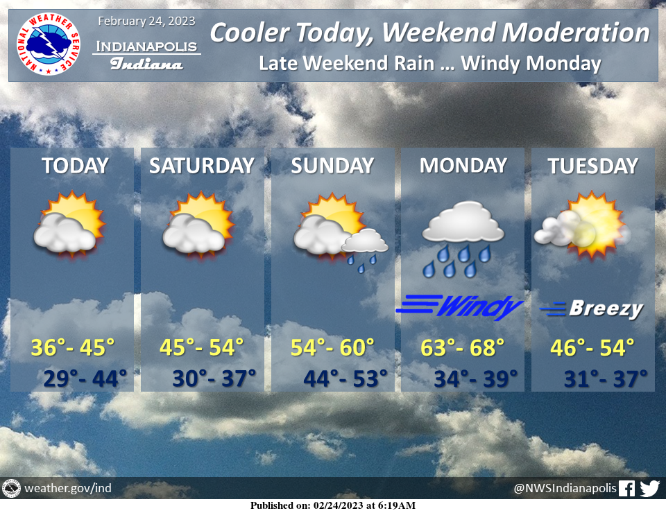
Below normal temperatures today under partly cloudy skies as Canadian high pressure builds into the Midwest.
Fair weather this weekend with 50s returning by Sunday…before a warm, windy and rainy day Monday.
INDIANAPOLIS 7-DAY EXTENDED FORECAST
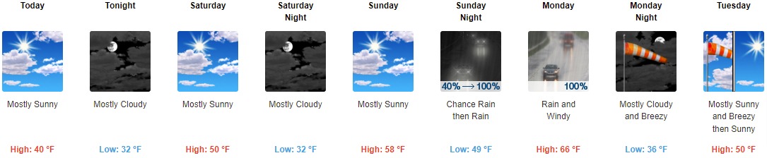
Today: Mostly sunny, with a high near 40. East northeast wind 7 to 9 mph.
Tonight: Mostly cloudy, with a low around 32. East northeast wind 7 to 11 mph becoming southeast after midnight.
Saturday: Mostly sunny, with a high near 50. South wind 6 to 8 mph becoming west northwest in the afternoon.
Saturday Night: Mostly cloudy, with a low around 32. Southwest wind 6 to 8 mph.
Sunday: Mostly sunny, with a high near 58. West southwest wind around 9 mph.
Sunday Night: Rain, mainly after 1am. Low around 49. Chance of precipitation is 100%. New precipitation amounts between a tenth and quarter of an inch possible.
Monday: Rain, mainly before 1pm. High near 66. Windy. Chance of precipitation is 100%.
Monday Night: Mostly cloudy, with a low around 36. Breezy.
Tuesday: Mostly sunny, with a high near 50. Breezy.
Tuesday Night: Mostly clear, with a low around 34.
Wednesday: Mostly sunny, with a high near 62.
Wednesday Night: A 30 percent chance of rain. Mostly cloudy, with a low around 44.
Thursday: A 40 percent chance of rain. Mostly cloudy, with a high near 56.
THE UNITED STATES OF AMERICA 3-DAY OUTLOOK


SOURCE: NWS Indianapolis.
Follow NWS Indianapolis on Twitter @NWSIndianapolis for the latest Indianapolis area weather news.