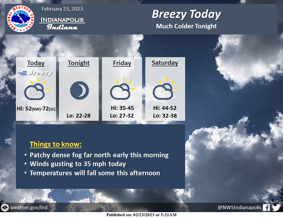
Patchy dense fog will continue across far northern sections early this morning.
Otherwise today will be breezy and partly cloudy.
A wide temperature range will be across central Indiana, with northwest areas having highs around 50 and southeast areas around 70.
Temperatures will fall some this afternoon.
Much colder air moves in tonight with lows in the 20s.
INDIANAPOLIS 7-DAY EXTENDED FORECAST
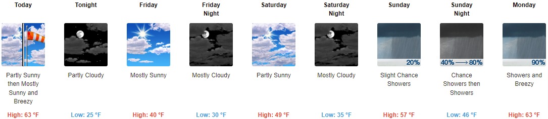
Today: Mostly sunny, with a high near 63. Breezy, with a west southwest wind 15 to 20 mph, with gusts as high as 31 mph.
Tonight: Partly cloudy, with a low around 25. West northwest wind 11 to 16 mph, with gusts as high as 25 mph.
Friday: Mostly sunny, with a high near 40. North northwest wind 6 to 10 mph becoming northeast in the afternoon.
Friday Night: Mostly cloudy, with a low around 30. East wind 7 to 10 mph.
Saturday: Partly sunny, with a high near 49. East wind around 7 mph becoming west in the afternoon.
Saturday Night: Mostly cloudy, with a low around 35.
Sunday: A 20 percent chance of showers. Partly sunny, with a high near 57.
Sunday Night: Showers, mainly after 1am. Low around 46. Chance of precipitation is 80%.
Monday: Showers. High near 63. Breezy. Chance of precipitation is 90%.
Monday Night: A 30 percent chance of showers before 1am. Mostly cloudy, with a low around 37. Breezy.
Tuesday: Sunny, with a high near 51. Breezy.
Tuesday Night: Mostly clear, with a low around 34.
Wednesday: Partly sunny, with a high near 58.
THE UNITED STATES OF AMERICA 3-DAY OUTLOOK


SOURCE: NWS Indianapolis.
Follow NWS Indianapolis on Twitter @NWSIndianapolis for the latest Indianapolis area weather news.