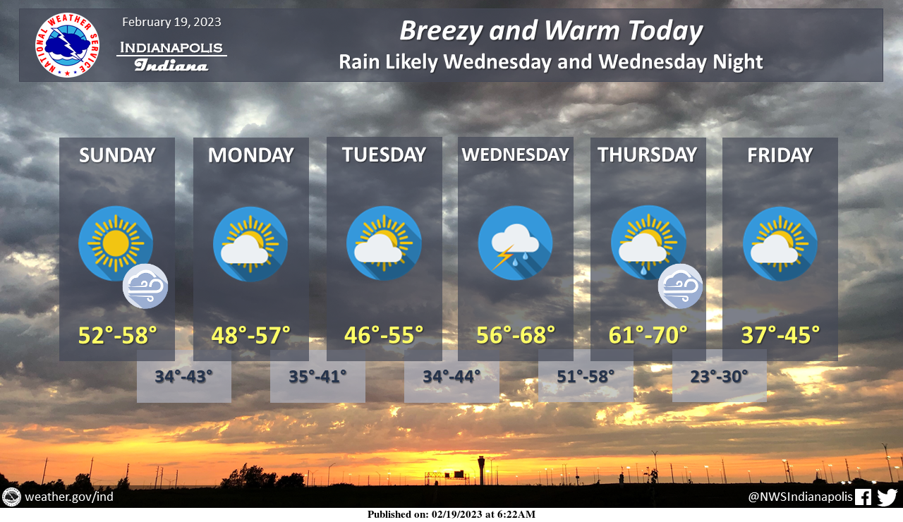
Well above seasonal temperatures are expected over the next several days, with highs in the 60s by the middle of next week.
Today, winds will increase throughout the day, including gusts up to 35 MPH at times this afternoon.
Rain and thunderstorm chances return Wednesday and continue into Wednesday night.
INDIANAPOLIS 7-DAY EXTENDED FORECAST
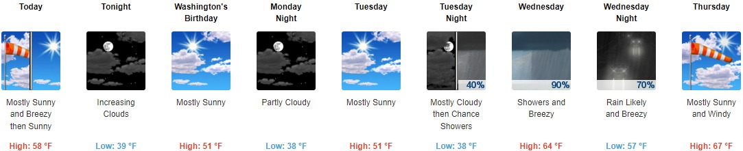
Today: Partly sunny, then gradually becoming sunny, with a high near 58. Breezy, with a southwest wind 18 to 21 mph, with gusts as high as 31 mph.
Tonight: Increasing clouds, with a low around 39. Southwest wind 7 to 11 mph, with gusts as high as 23 mph.
Washington’s Birthday: Mostly sunny, with a high near 51. West southwest wind 6 to 10 mph.
Monday Night: Partly cloudy, with a low around 38. Southwest wind 8 to 16 mph, with gusts as high as 23 mph.
Tuesday: Mostly sunny, with a high near 51. West northwest wind 10 to 14 mph, with gusts as high as 22 mph.
Tuesday Night: A chance of rain between 1am and 4am, then a chance of showers and thunderstorms after 4am. Mostly cloudy, with a low around 38. Chance of precipitation is 40%.
Wednesday: A chance of showers and thunderstorms, then showers and possibly a thunderstorm after 7am. High near 64. Breezy. Chance of precipitation is 90%.
Wednesday Night: Rain likely, mainly before 1am. Mostly cloudy, with a low around 57. Breezy. Chance of precipitation is 70%.
Thursday: Mostly sunny, with a high near 67. Windy.
Thursday Night: Mostly clear, with a low around 27. Breezy.
Friday: Mostly sunny, with a high near 41.
Friday Night: Rain and snow likely. Mostly cloudy, with a low around 34. Chance of precipitation is 60%.
Saturday: A 50 percent chance of rain. Mostly cloudy, with a high near 51.
THE UNITED STATES OF AMERICA 3-DAY OUTLOOK


SOURCE: NWS Indianapolis.
Follow NWS Indianapolis on Twitter @NWSIndianapolis for the latest Indianapolis area weather news.