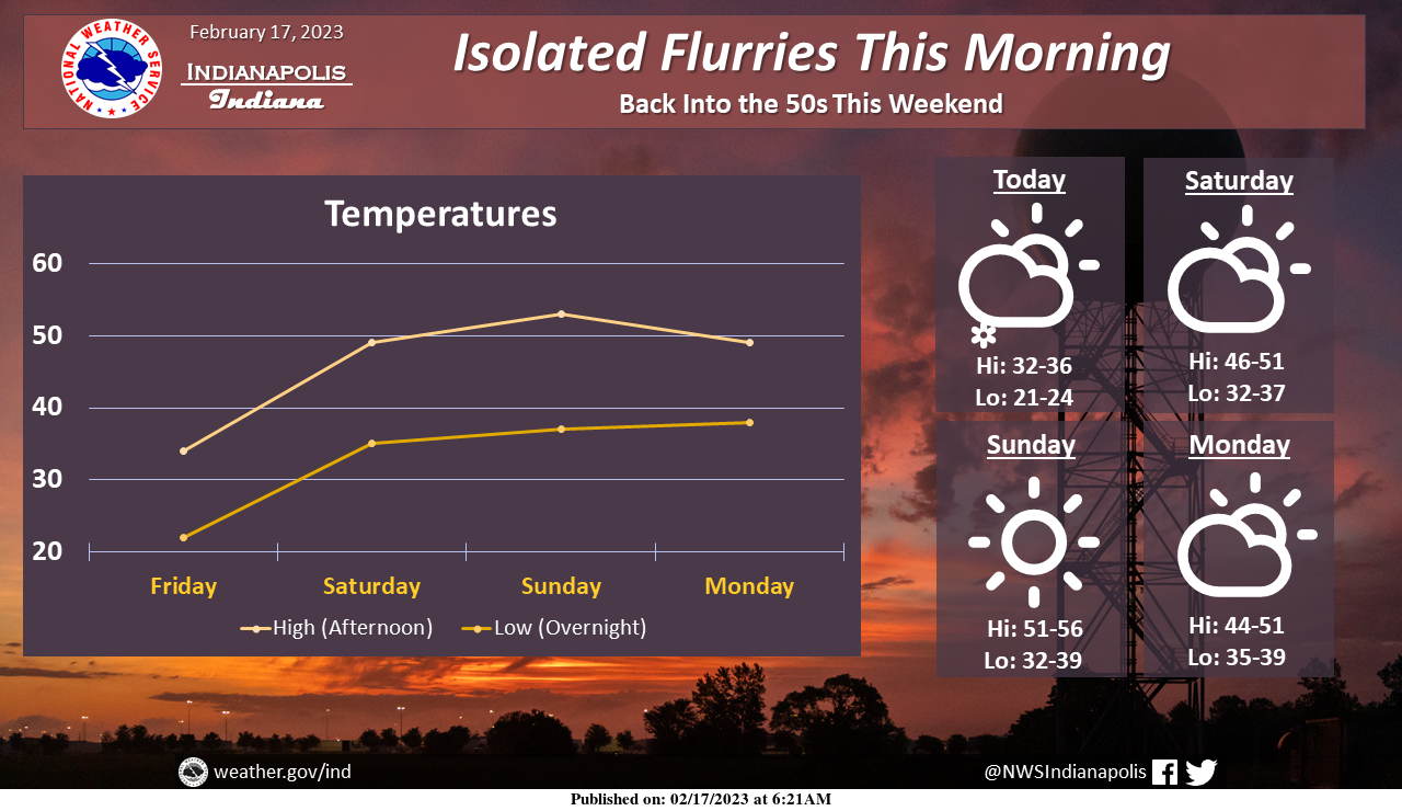
Isolated flurries are possible this morning, but no impacts are expected. Otherwise, dry weather should remain over the next 4 days.
Temperatures will warm again this weekend, with highs near to above 50.
INDIANAPOLIS 7-DAY EXTENDED FORECAST
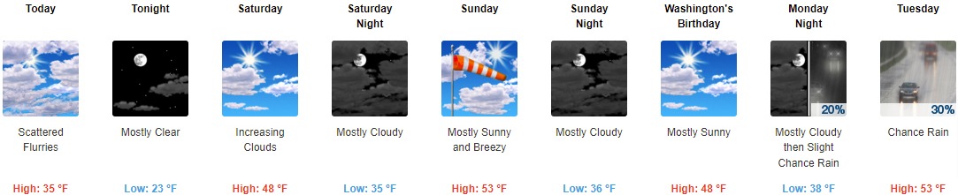
Today: Scattered flurries before 1pm. Mostly cloudy, with a high near 35. North northwest wind 13 to 15 mph, with gusts as high as 23 mph.
Tonight: Mostly clear, with a low around 23. West northwest wind 6 to 10 mph becoming southwest after midnight.
Saturday: Increasing clouds, with a high near 48. South southwest wind 13 to 16 mph, with gusts as high as 24 mph.
Saturday Night: Mostly cloudy, with a low around 35. South southwest wind 13 to 15 mph, with gusts as high as 22 mph.
Sunday: Mostly sunny, with a high near 53. Breezy, with a south southwest wind 15 to 21 mph, with gusts as high as 30 mph.
Sunday Night: Mostly cloudy, with a low around 36.
Washington’s Birthday: Mostly sunny, with a high near 48.
Monday Night: A 20 percent chance of rain after 1am. Mostly cloudy, with a low around 38.
Tuesday: A 30 percent chance of rain, mainly after 1pm. Mostly cloudy, with a high near 53.
Tuesday Night: A 30 percent chance of rain. Mostly cloudy, with a low around 38.
Wednesday: A 50 percent chance of rain. Mostly cloudy, with a high near 59.
Wednesday Night: Rain likely. Mostly cloudy, with a low around 48. Breezy. Chance of precipitation is 60%.
Thursday: A 30 percent chance of rain. Mostly sunny, with a high near 63. Breezy.
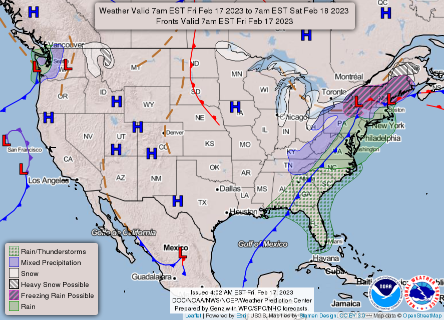
THE UNITED STATES OF AMERICA 3-DAY OUTLOOK


SOURCE: NWS Indianapolis.
Follow NWS Indianapolis on Twitter @NWSIndianapolis for the latest Indianapolis area weather news.