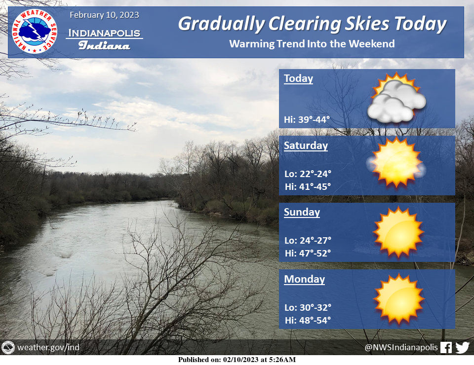
Skies will gradually begin to clear this afternoon and evening.
Plenty of sun is then expected for the weekend with a gradual warming trend.
INDIANAPOLIS 7-DAY EXTENDED FORECAST
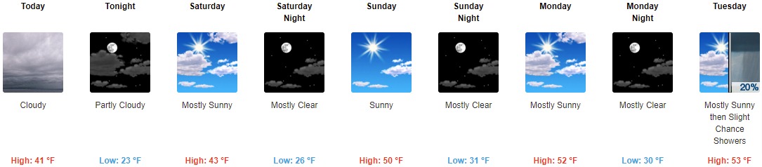
Today: Cloudy, with a high near 41. West wind around 10 mph.
Tonight: Partly cloudy, with a low around 23. North wind 3 to 8 mph.
Saturday: Mostly sunny, with a high near 43. North northeast wind around 5 mph becoming calm in the morning.
Saturday Night: Mostly clear, with a low around 26. Light and variable wind.
Sunday: Sunny, with a high near 50. North wind around 6 mph becoming west in the afternoon.
Sunday Night: Mostly clear, with a low around 31.
Monday: Mostly sunny, with a high near 52.
Monday Night: Mostly clear, with a low around 30.
Tuesday: A 20 percent chance of showers after 2pm. Partly sunny, with a high near 53.
Tuesday Night: Showers likely, mainly between 8pm and 2am. Mostly cloudy, with a low around 46. Breezy. Chance of precipitation is 70%.
Wednesday: A 50 percent chance of showers. Partly sunny, with a high near 64. Breezy.
Wednesday Night: A 50 percent chance of showers. Partly cloudy, with a low around 50.
Thursday: Showers likely and possibly a thunderstorm. Partly sunny, with a high near 60. Breezy. Chance of precipitation is 70%.
THE UNITED STATES OF AMERICA 3-DAY OUTLOOK


SOURCE: NWS Indianapolis.
Follow NWS Indianapolis on Twitter @NWSIndianapolis for the latest Indianapolis area weather news.