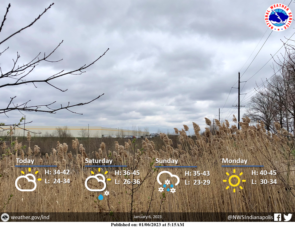
After a few morning flurries, clouds gradually begin to break up with some late-day sun.
A few light rain and snow showers are possible across far southern portions of central Indiana Saturday with calm conditions elsewhere.
The best chance for more widespread light wintry precipitation will impact the area Saturday night and Sunday.
Temperatures will remain seasonable through the weekend.
INDIANAPOLIS 7-DAY EXTENDED FORECAST
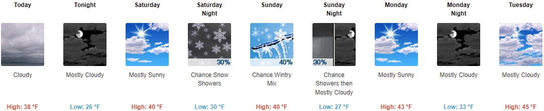
Today: Cloudy, with a high near 38. West wind around 9 mph.
Tonight: Mostly cloudy, with a low of around 26. West-southwest wind around 6 mph becoming calm in the evening.
Saturday: Mostly sunny, with a high near 40. Light east-northeast wind.
Saturday Night: A 30 percent chance of snow showers, mainly after 2am. Partly cloudy, with a low of around 30. East wind around 6 mph.
Sunday: A chance of rain showers, snow showers, and freezing rain before 11am, then a chance of rain and snow showers between 11am and 2pm, then a chance of rain showers after 2pm. Mostly cloudy, with a high near 40. East wind around 5 mph becoming calm in the afternoon. The chance of precipitation is 40%.
Sunday Night: A 30 percent chance of showers before 8pm. Mostly cloudy, with a low of around 27.
Monday: Mostly sunny, with a high near 43.
Monday Night: Mostly cloudy, with a low of around 33.
Tuesday: Mostly cloudy, with a high near 45.
Tuesday Night: Mostly cloudy, with a low of around 32.
Wednesday: Mostly cloudy, with a high near 45.
Wednesday Night: Mostly cloudy, with a low of around 32.
Thursday: A chance of rain and snow showers. Mostly cloudy, with a high near 45. The chance of precipitation is 30%.
THE UNITED STATES OF AMERICA 3-DAY OUTLOOK


SOURCE: NWS Indianapolis.
Follow NWS Indianapolis on Twitter @NWSIndianapolis for the latest Indianapolis area weather news.