
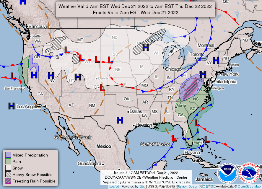
The cold front is now expected to arrive slightly earlier.
Behind this front, temperatures will drop 30+ degrees, freezing prior to rain/drizzle, immediately leading to travel difficulties.
Snow will also begin shortly after the frontal passage.

The onset of impacts is now expected to begin earlier.
A flash freeze of prior day drizzle and a quick change to heavy snowfall will create a sudden drop in travel conditions Thursday evening.
High winds, extreme cold, and light snowfall along with blowing and drifting snow will make travel difficult as well on Friday.
WINTER STORM WATCH
National Weather Service Indianapolis, Indiana
328 AM EST Wed Dec 21 2022
Indiana: Carroll County, Warren County, Tippecanoe County, Clinton County, Howard County, Fountain County, Montgomery County, Boone County, Tipton County, Hamilton County, Madison County, Delaware County, Randolph County, Vermillion County, Parke County, Putnam County, Hendricks County, Marion County, Hancock County, Henry County, Vigo County, and Clay County
Including the cities of Delphi, Flora, Williamsport, West Lebanon, Lafayette, West Lafayette, Frankfort, Kokomo, Attica, Covington, Veedersburg, Crawfordsville, Lebanon, Zionsville, Tipton, Fishers, Carmel, Noblesville, Anderson, Muncie, Winchester, Union City, Farmland, Parker City, Clinton, Fairview Park, Rockville, Montezuma, Rosedale, Greencastle, Plainfield, Brownsburg, Danville, Indianapolis, Greenfield, New Castle, Terre Haute, and Brazil.
WINTER STORM WATCH REMAINS IN EFFECT FROM THURSDAY AFTERNOON THROUGH SATURDAY MORNING
* WHAT…Heavy snow is possible. Total snow accumulations of 3 to 6 inches are possible. Winds could gust as high as 55 mph. Blowing snow. Wind chills as low as 30 below zero.
* WHERE…Portions of central, east central, north central, and west central Indiana.
* WHEN…From Thursday afternoon through Saturday morning.
* IMPACTS…Plan on slippery road conditions. Widespread blowing snow could significantly reduce visibility. The hazardous conditions could impact the morning or evening commute. Strong
winds could cause tree damage. The cold wind chills as low as 35 below zero could cause frostbite on exposed skin in as little as 15 minutes.
* ADDITIONAL DETAILS…A flash freeze is likely Thursday night with temperatures dropping more than 30 degrees in a matter of hours during the transition from rain to snow. Heaviest snow is
expected shortly after frontal passage Thursday evening into Thursday night
PRECAUTIONARY/PREPAREDNESS ACTIONS…
Monitor the latest forecasts for updates on this situation.
INDIANAPOLIS 7-DAY EXTENDED FORECAST

Today: Cloudy, with a high near 42. East wind 3 to 6 mph.
Tonight: A chance of drizzle after 3am. Cloudy, with a low of around 32. South southeast wind around 6 mph.
Thursday: A chance of drizzle before 7am, then rain between 7am and 4pm, then rain and snow, possibly mixed with sleet after 4pm. High near 40. South wind around 8 mph. The chance of precipitation is 100%. New snow and sleet accumulation of less than a half inch possible.
Thursday Night: Snow, possibly mixed with sleet, becoming all snow after 7pm. The snow could be heavy at times. Widespread blowing snow after 10pm. Low around -3. Wind chill values as low as -23. Breezy, with a west-northwest wind 15 to 23 mph, with gusts as high as 40 mph. The chance of precipitation is 100%. New precipitation amounts between a quarter and half of an inch possible.
Friday: A 20 percent chance of snow. Areas of blowing snow. Mostly cloudy and cold, with a high near 3. Breezy, with a west wind 22 to 25 mph, with gusts as high as 46 mph.
Friday Night: Widespread blowing snow, mainly between 7pm and 1am. Mostly cloudy, with a low around -2. Breezy.
Saturday: Areas of blowing snow. Partly sunny and cold, with a high near 10.
Saturday Night: Partly cloudy, with a low around 2.
Christmas Day: Sunny, with a high near 17.
Sunday Night: A 20 percent chance of snow after 1am. Mostly cloudy, with a low of around 10.
Monday: A 20 percent chance of snow. Mostly cloudy, with a high near 21.
Monday Night: Mostly cloudy, with a low around 16.
Tuesday: Partly sunny, with a high near 25.
THE UNITED STATES OF AMERICA 3-DAY OUTLOOK


SOURCE: NWS Indianapolis.
Follow NWS Indianapolis on Twitter @NWSIndianapolis for the latest Indianapolis area weather news.