
Light rain showers across central Indiana will diminish over the next few hours with clouds beginning to break by mid-morning.
Make sure to get outside this afternoon as highs will be in the 70s with much lower humidity.
Dry and cooler weather is expected through Saturday.
INDIANAPOLIS 7-DAY EXTENDED FORECAST

Today: A 30 percent chance of showers and thunderstorms before 10am. Mostly cloudy, then gradually becoming sunny, with a high near 76. Northwest wind 5 to 8 mph.
Tonight: Mostly clear, with a low around 54. Northwest wind 5 to 7 mph becoming calm in the evening.
Friday: Sunny, with a high near 79. Light west wind becoming west northwest 5 to 10 mph in the morning. Winds could gust as high as 21 mph.
Friday Night: Mostly clear, with a low around 55. Northwest wind around 6 mph becoming calm in the evening.
Saturday: Sunny, with a high near 80. Calm wind becoming south southeast around 5 mph in the afternoon.
Saturday Night: Partly cloudy, with a low around 58.
Sunday: A 20 percent chance of showers and thunderstorms after 2pm. Partly sunny, with a high near 82.
Sunday Night: A 40 percent chance of showers and thunderstorms, mainly after 8pm. Mostly cloudy, with a low around 63.
Monday: A 50 percent chance of showers and thunderstorms. Mostly cloudy, with a high near 78.
Monday Night: A chance of showers and thunderstorms. Mostly cloudy, with a low around 62. The chance of precipitation is 50%.
Tuesday: A 40 percent chance of showers. Partly sunny, with a high near 78.
Tuesday Night: A 50 percent chance of showers. Mostly cloudy, with a low around 61.
Wednesday: Showers likely and possibly a thunderstorm. Mostly cloudy, with a high near 77. The chance of precipitation is 60%.
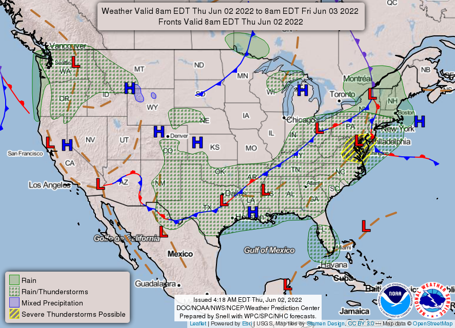
THE UNITED STATES OF AMERICA 3-DAY OUTLOOK


SOURCE: NWS Indianapolis.
Follow NWS Indianapolis on Twitter @NWSIndianapolis for the latest Indianapolis area weather news.