
Dry conditions are expected outside of a slight chance for flurries this morning.
Warmer weather returns tomorrow into Wednesday with the next chance for precipitation on Friday where a rain or snow mix is possible.
INDIANAPOLIS 7-DAY EXTENDED FORECAST

Today: Increasing clouds, with a high near 24. West northwest wind 6 to 9 mph.
Tonight: Cloudy, then gradually becoming partly cloudy, with a low around 8. West wind around 5 mph becoming calm in the evening.
Tuesday: Mostly sunny, with a high near 38. Light south southeast wind becoming south 5 to 9 mph in the morning.
Tuesday Night: Mostly cloudy, with a low around 31. South southwest wind 8 to 10 mph, with gusts as high as 20 mph.
Wednesday: Partly sunny, with a high near 40. Southwest wind 6 to 10 mph.
Wednesday Night: Mostly cloudy, with a low around 25.
Thursday: Partly sunny, with a high near 33.
Thursday Night: Mostly cloudy, with a low around 24.
Friday: A chance of snow before 9am, then a chance of rain and snow between 9am and noon, then a chance of rain after noon. Mostly cloudy, with a high near 42. The chance of precipitation is 30%.
Friday Night: Mostly cloudy, with a low around 23.
Saturday: Partly sunny, with a high near 30.
Saturday Night: Mostly cloudy, with a low around 9.
Sunday: Mostly sunny, with a high near 27
THE UNITED STATES OF AMERICA 3-DAY OUTLOOK
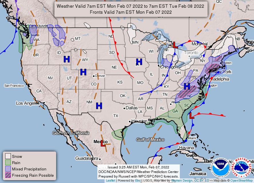
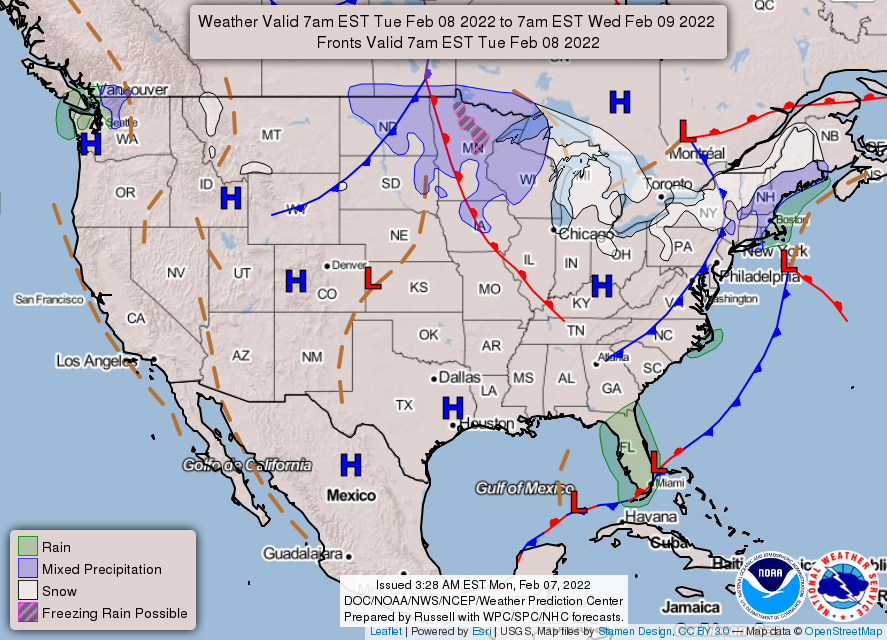
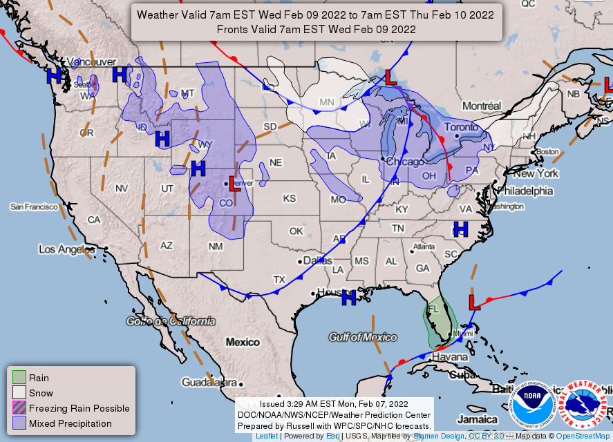
SOURCE: NWS Indianapolis.
Follow NWS Indianapolis on Twitter @NWSIndianapolis for the latest Indianapolis area weather news.