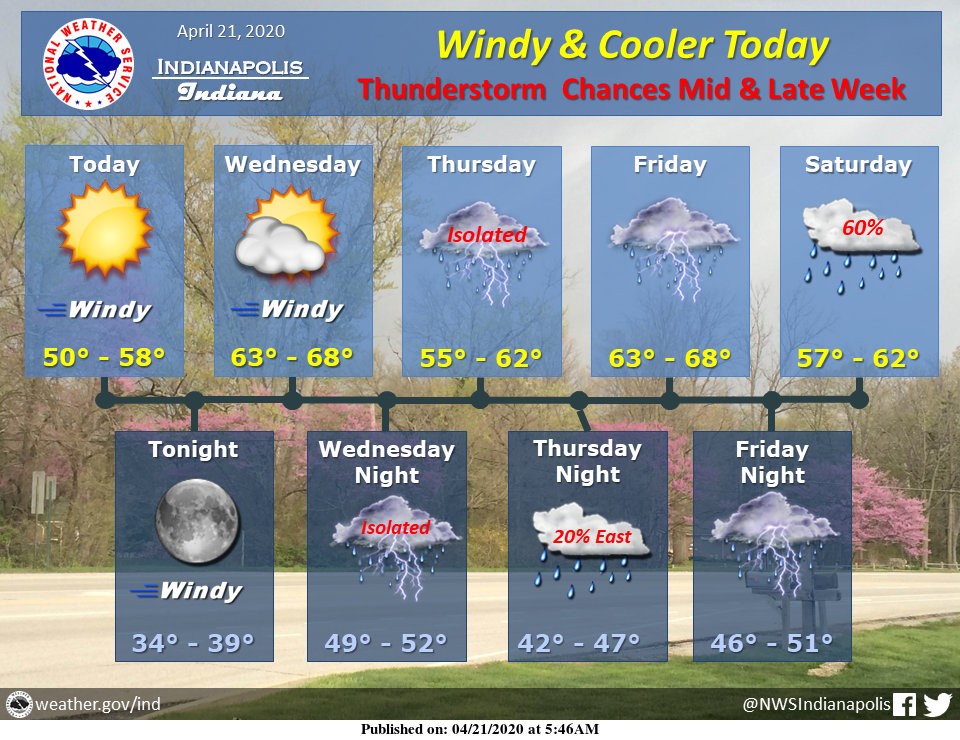
Windy and cooler today, and dry through Wednesday. However, a more active pattern will bring rain and thunderstorm chances to central Indiana starting Wednesday night.
Via NWS Indianapolis. Follow them on Twitter @NWSIndianapolis for the latest Indianapolis area weather news.
AROUND TWITTER
Our Tuesday is just getting started. I wanted to share the forecast as you get your day going. #INwx pic.twitter.com/iNp8j5YyH7
— Kyle Mounce (@kylemounce) April 21, 2020
A cold front ushered in a gustier, cooler day than yesterday, but it will still be sunny! https://t.co/GwgfLwKxhG #INwx #FOX59Morning
— FOX59 News (@FOX59) April 21, 2020
https://twitter.com/StarDerryWX/status/1252527957584883713
A breezy and cooler Tuesday with highs in the lower to mid 50s! Still lots of sunshine though! @WISH_TV #INwx #Indy pic.twitter.com/ivcSGkZlsN
— Stephanie Mead (@stephmeadwx) April 21, 2020
Amber’s #Doodlecast >> Another bright day, but it will be cooler this afternoon!!! 🎾 🐕 🐾 Enjoy the sunshine this Tuesday! High: 54°☀️@FOX59 #FOX59morning #sketchforecast @thewxauthority #INwx pic.twitter.com/NrXf8NmPMm
— Amber Hardwick (@AHardwickWx) April 21, 2020